Maps of Tarakan

Blad IX Soekadana, blad d, uit: Residentie Wester-Afdeeling van Borneo : weg- en rivierkaart / Topographisch Bureau
1 : 50000 Annotatie: Voor aanwezige bladen zie overzichtsblad Topographisch Bureau, Batavia Batavia : Topographisch Bureau
Oost Borneo / samengesteld en gedrukt bij den Topografischen Dienst
Topografische Dienst Batavia Batavia : Topografische Dienst
Bladwijzer van Zuider- en ooster Afd[eling] v[an] Borneo
[S.l. : s.n.]
Blad XXV Boengan, blad i, uit: Residentie Wester-Afdeeling van Borneo : weg- en rivierkaart / Topographisch Bureau
1 : 50000 Annotatie: Voor aanwezige bladen zie overzichtsblad Topographisch Bureau, Batavia Batavia : Topographisch Bureau
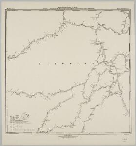
Blad VII Siding, blad g, uit: Residentie Wester-Afdeeling van Borneo : weg- en rivierkaart / Topographisch Bureau
1 : 50000 Annotatie: Voor aanwezige bladen zie overzichtsblad Topographisch Bureau, Batavia Batavia : Topographisch Bureau
Tarakan / Survey of India
Survey of India [S.l.] : Survey of India
[Peta Kalimantan (Indonesian Borneo)

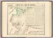
Kaart van het oostelijk gedeelte van Borneo : vanaf Mangka Liat tot de Koeran of Berouwrivier
Aardrijkskundig Genootschap Amsterdam : Stemler
Sangkoelirang / Survey of India
Survey of India [S.l.] : Survey of India
Nawan / Survey of India
Survey of India [S.l.] : Survey of India
Dondo-Baai / samengesteld door den Topografischen Dienst (kartogr. afd.) naar diverse gegevens in 1939
Topografische Dienst Batavia Batavia : Reproductiebedrijf Topografische Dienst
Tarakan / prepared under the direction of the Chief of Engineers by the Army Map Service, US Army
US Army Washington D.C. . Army Map Service Washington D.C. : Army Map Service, US Army
Eiland Tarakan : Opgenomen door den Topografische Dienst (Luchtfotogrammetrische Sectie) in 1935
Topografische Dienst Batavia Batavia : Reproductiebedrijf Topografische Dienst
T[angoen]g Simaja / published by Survey Directorate H.Q. SEALF ; prepared under the direction of the Chief of Engineers
Survey Directorate H.Q. SEALF Washington D.C. : Army Map Service
T[angoen]g Batoe / published by Survey Directorate H.Q. SEALF ; prepared under the direction of the Chief of Engineers
Survey Directorate H.Q. SEALF Washington D.C. : Army Map Service
Boeang / published by Survey Directorate H.Q. SEALF ; prepared under the direction of the Chief of Engineers
Survey Directorate H.Q. SEALF Washington D.C. : Army Map Service
Bakatan / published by Survey Directorate H.Q. SEALF ; prepared under the direction of the Chief of Engineers
Survey Directorate H.Q. SEALF Washington D.C. : Army Map Service
P[oelau] Fanny / published by Survey Directorate H.Q. SEALF ; prepared under the direction of the Chief of Engineers
Survey Directorate H.Q. SEALF Washington D.C. : Army Map Service
T[angoen]g Batoe Pasoe / published by Survey Directorate H.Q. SEALF ; prepared under the direction of the Chief of Engineers
Survey Directorate H.Q. SEALF Washington D.C. : Army Map Service
P[oelau] Boeka / published by Survey Directorate H.Q. SEALF ; prepared under the direction of the Chief of Engineers
Survey Directorate H.Q. SEALF Washington D.C. : Army Map Service
Djoewata / published by Survey Directorate H.Q. SEALF ; prepared under the direction of the Chief of Engineers
Survey Directorate H.Q. SEALF Washington D.C. : Army Map Service
S[oengai] Tenau / published by Survey Directorate H.Q. SEALF ; prepared under the direction of the Chief of Engineers
Survey Directorate H.Q. SEALF Washington D.C. : Army Map Service
Tarakan / published by Survey Directorate H.Q. SEALF ; prepared under the direction of the Chief of Engineers
Army Map Service US Army WAshington D.C. Washington D.C. : Army Map Service
[Peta Kalimantan (Indonesian Borneo)

K[on]g Djoewata / [Topografische Dienst]
Topografische Dienst Weltevreden (Batavia) [Weltevreden (Batavia) : Reproductiebedrijf Topografische Dienst]
Zuid-Tarakan : kuststrook van de S. Karoengan tot Tg. Batoe / Topografische Dienst
Topografische Dienst Weltevreden (Batavia) Weltevreden (Batavia) : Reproductiebedrijf Topografische Dienst
Zuid-Tarakan : Peningki-Karoengan complex / Topografische Dienst
Topografische Dienst Weltevreden (Batavia) Weltevreden (Batavia) : Reproductiebedrijf Topografische Dienst
Tolitoli / samengesteld door den Topografischen Dienst (kartogr. afd.) naar diverse gegevens in 1939
Topografische Dienst Batavia Batavia : Reproductiebedrijf Topografische Dienst
Kaart van een gedeelte van Borneo : met aanwijzing van de grens tusschen het Nederlandsche gebied en dat van het Britsche protectoraat / Top. Inrichting
Topographische Inrichting Batavia [Batavia] : Top[ographische] Inrichting