Maps of Bontang

Sangkoelirang / Survey of India
Survey of India [S.l.] : Survey of India
Kaart van het oostelijk gedeelte van Borneo : vanaf Mangka Liat tot de Koeran of Berouwrivier
Aardrijkskundig Genootschap Amsterdam : Stemler
Ranau Dampelas / samengesteld door den Topografischen Dienst (kartogr. afd.) naar diverse gegevens in 1939
Topografische Dienst Batavia Batavia : Reproductiebedrijf Topografische Dienst
Dondo-Baai / samengesteld door den Topografischen Dienst (kartogr. afd.) naar diverse gegevens in 1939
Topografische Dienst Batavia Batavia : Reproductiebedrijf Topografische Dienst
Oost Borneo / samengesteld en gedrukt bij den Topografischen Dienst
Topografische Dienst Batavia Batavia : Topografische Dienst
Kaart van het Landschap Koetai
[S.l. : s.n.]
Blad XIV Bija, uit: Residentie Wester-Afdeeling van Borneo / Topographisch Bureau
1 : 200000 titelvariant: Residentie Westerafdeeling van Borneo; Annotatie: Titelvariant: Residentie Westerafdeeling van Borneo; Voor aanwezige bladen zie overzichtsblad; Annotatie geografische gegevens: Opname: 1886-1895 Topographisch Bureau, Batavia Batavia : Topographisch Bureau
[Sheet] B, uit: Topographical and geological sketch-map of the Samba-river / comp. from croquis, made by the author [G.A.F. Molengraaff] during his flying survey in October 1894
1 : 40000 Annotatie: "Sketch-map" in de titel foutief gespeld als "scetch-map; Proefdruk; Later verschenen als kaart X a-c in: Geologische verkenningstochten in Centraal-Borneo (1893-94) / G.A.F. Molengraaff. - Leiden : Brill ; [etc.], 1900; Met aanvullingen en verbeteringen in rode inkt en potlood Molengraaff, G. A. F. [S.l. : s.n.]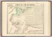
Partie, Borneo. Oceanique no. 14.
1 : 1641836 Vandermaelen, Philippe, 1795-1869
Blad XV Kajoeng, uit: Residentie Wester-Afdeeling van Borneo / Topographisch Bureau
1 : 200000 titelvariant: Residentie Westerafdeeling van Borneo; Annotatie: Titelvariant: Residentie Westerafdeeling van Borneo; Voor aanwezige bladen zie overzichtsblad; Annotatie geografische gegevens: Opname: 1886-1895 Topographisch Bureau, Batavia Batavia : Topographisch Bureau
Blad IX Soekadana, blad d, uit: Residentie Wester-Afdeeling van Borneo : weg- en rivierkaart / Topographisch Bureau
1 : 50000 Annotatie: Voor aanwezige bladen zie overzichtsblad Topographisch Bureau, Batavia Batavia : Topographisch Bureau
Sulawesi
[S.l. : s.n.]
Bladwijzer van Zuider- en ooster Afd[eling] v[an] Borneo
[S.l. : s.n.]
Schetskaart van Midden-Borneo en het landschap Koetei
Topographisch Bureau Batavia Batavia : Topographisch Bureau
Schetskaart van de Zelfbesturende Landschappen der Residentie Menado gelegen op den vasten wal van Celebes / samengesteld bij het Encyclopaedisch Bureau, Afdeeling Bestuurszaken der Buitenbezittingen van het Departement van Binnenlandsch Bestuur
Encyclopaedisch Bureau Batavia ['s-Gravenhage : N.V. Electrische Drukkerij 'Luctor et Emergo']
Celebes / Koninklijke Nederlandsch Indische Motorclub
Koninklijke Nederlandsch Indische Motorclub Semarang Semarang : Koninklijke Nederlandsch Indische Motorclub
Automobielkaart van Noord Celebes / samengesteld en uitgegeven door de Koninklijke Vereeniging Java Motor Club
Koninklijke Vereeniging Java Motor Club Semarang Semarang : Koninklijke Vereeniging Java Motor Club
Kaart van een gedeelte van Borneo : met aanwijzing van de grens tusschen het Nederlandsche gebied en dat van het Britsche protectoraat / Top. Inrichting
Topographische Inrichting Batavia [Batavia] : Top[ographische] Inrichting
Blad XXV Boengan, blad i, uit: Residentie Wester-Afdeeling van Borneo : weg- en rivierkaart / Topographisch Bureau
1 : 50000 Annotatie: Voor aanwezige bladen zie overzichtsblad Topographisch Bureau, Batavia Batavia : Topographisch Bureau
Schetstaalkaart van Celebes / Top[ografische Inr[ichting]
Topografische Inrichting Batavia Batavia : Top[ografische] Inr[ichting]
Kaart van de Onderafdeeling Koetei de Afdeeling Koetei en N[oord] O[ost] Kust van Borneo
Den Haag : Smulders & Co
Blad VII Siding, blad g, uit: Residentie Wester-Afdeeling van Borneo : weg- en rivierkaart / Topographisch Bureau
1 : 50000 Annotatie: Voor aanwezige bladen zie overzichtsblad Topographisch Bureau, Batavia Batavia : Topographisch Bureau
[Peta Kalimantan (Indonesian Borneo)

Blad XII Ketoengau, blad o, uit: Residentie Wester-Afdeeling van Borneo : weg- en rivierkaart / Topographisch Bureau
1 : 50000 Annotatie: Voor aanwezige bladen zie overzichtsblad Topographisch Bureau, Batavia Batavia : Topographisch Bureau
Tarakan / Survey of India
Survey of India [S.l.] : Survey of India
Samarinda / Survey of India
Survey of India [S.l.] : Survey of India
Nawan / Survey of India
Survey of India [S.l.] : Survey of India
Tilamoeta / Survey of India
Survey of India [S.l.] : Survey of India
De Goudkust van Noord Celebes van 120ÿê tot 123ÿê40' O.L. v. Greenwich naar de laatste gegevens samengesteld
Kolff, G. & Co. Batavia Batavia : G. Kolff & Co. ; 's-Gravenhage : W.P. van Stockum & Zoon


