Cataloged map
Nawan / Survey of India

Full title:Nawan / Survey of India
Depicted:1945
Publisher:[S.l.] : Survey of India
Physical Size:20 x 30 cm
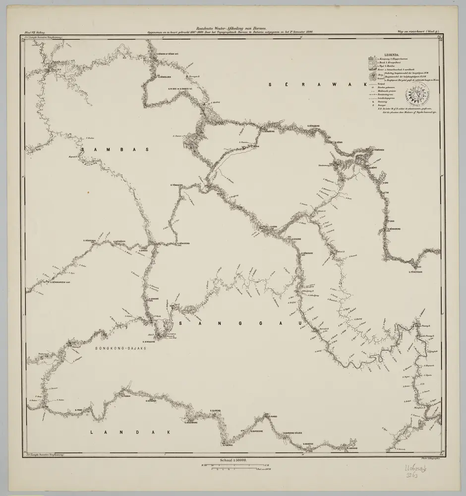
Blad VII Siding, blad g, uit: Residentie Wester-Afdeeling van Borneo : weg- en rivierkaart / Topographisch Bureau
1889
Topographisch Bureau, Batavia
1:50k
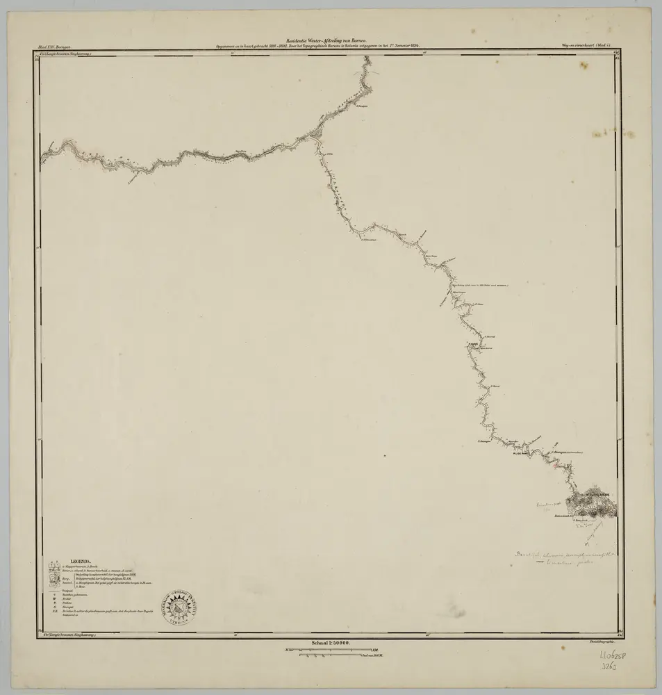
Blad XXV Boengan, blad i, uit: Residentie Wester-Afdeeling van Borneo : weg- en rivierkaart / Topographisch Bureau
1889
Topographisch Bureau, Batavia
1:50k
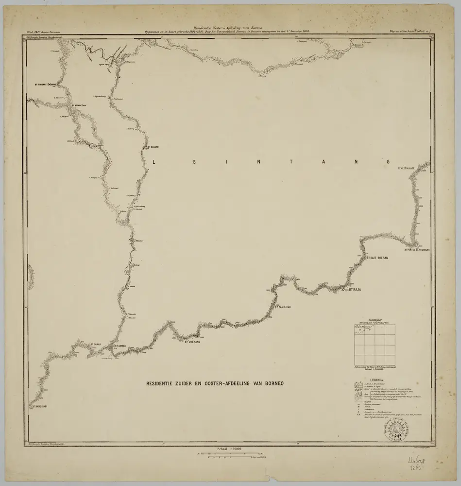
Blad XXIV Boven Serawai, blad a, uit: Residentie Wester-Afdeeling van Borneo : weg- en rivierkaart / Topographisch Bureau
1889
Topographisch Bureau, Batavia
1:50k
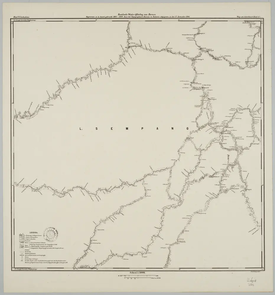
Blad IX Soekadana, blad d, uit: Residentie Wester-Afdeeling van Borneo : weg- en rivierkaart / Topographisch Bureau
1889
Topographisch Bureau, Batavia
1:50k
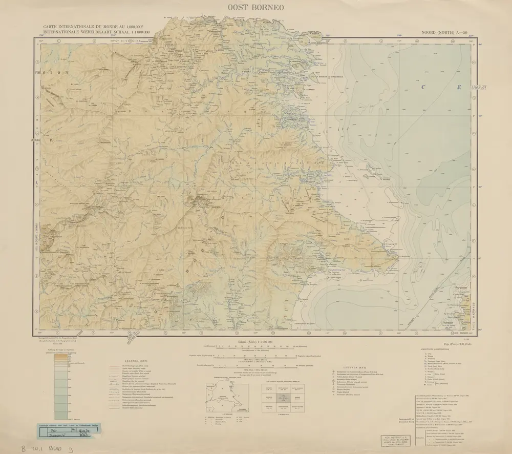
Oost Borneo / samengesteld en gedrukt bij den Topografischen Dienst
1935
Topografische Dienst Batavia
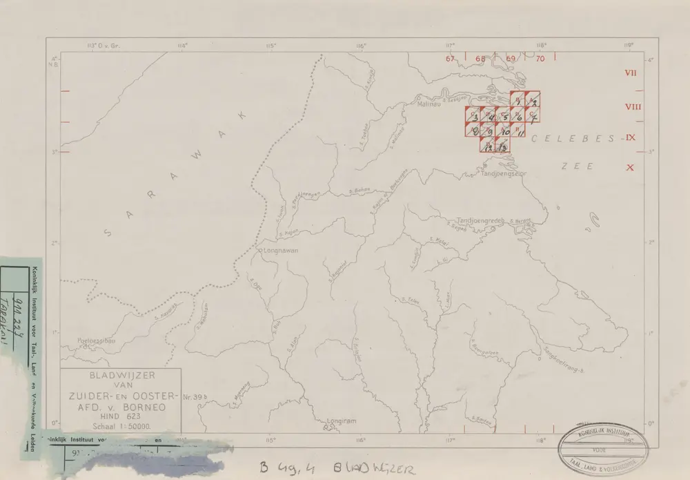
Bladwijzer van Zuider- en ooster Afd[eling] v[an] Borneo
1947
[S.l. : s.n.]
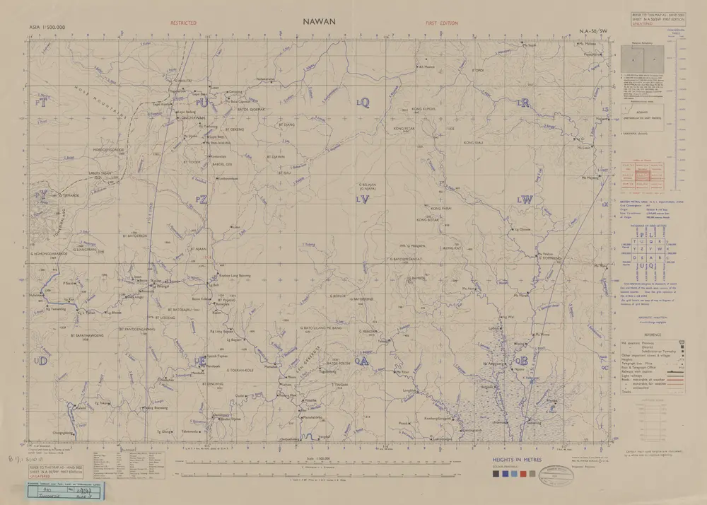
Nawan / Survey of India
1945
Survey of India
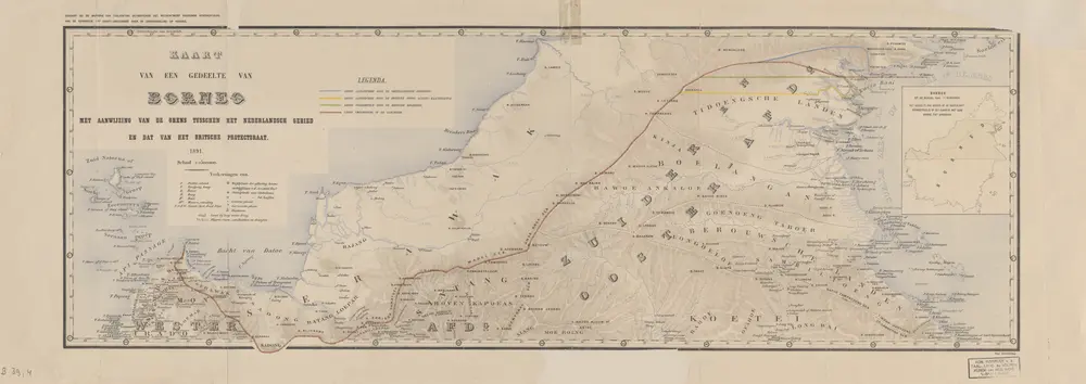
Kaart van een gedeelte van Borneo : met aanwijzing van de grens tusschen het Nederlandsche gebied en dat van het Britsche protectoraat / Top. Inrichting
1891
Topographische Inrichting Batavia
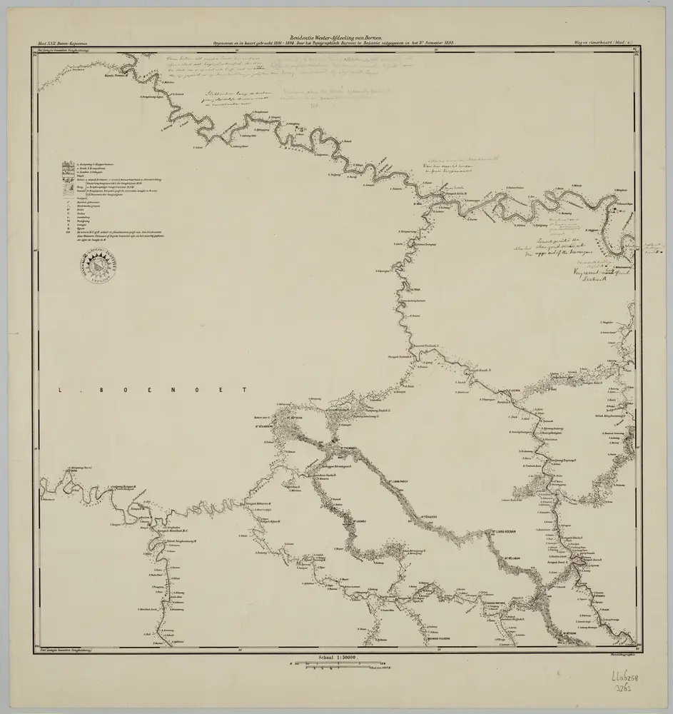
Blad XXII Boven-Kapoewas, blad o, uit: Residentie Wester-Afdeeling van Borneo : weg- en rivierkaart / Topographisch Bureau
1889
Topographisch Bureau, Batavia
1:50k
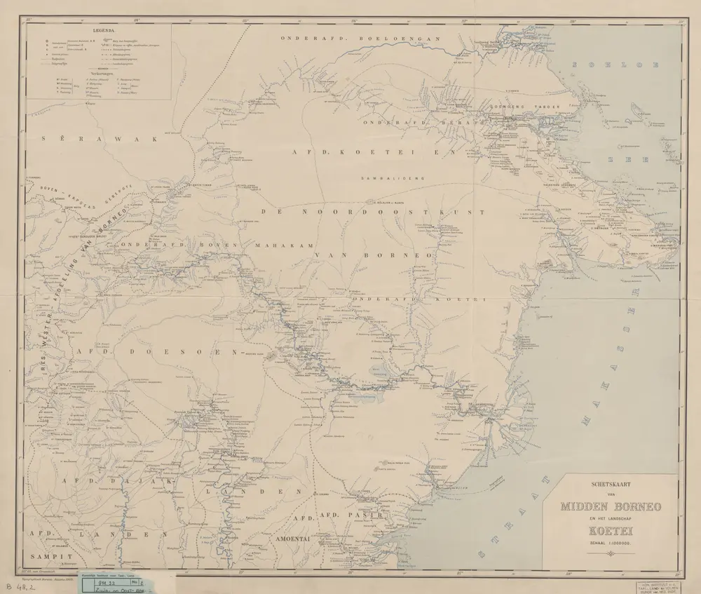
Schetskaart van Midden-Borneo en het landschap Koetei
1905
Topographisch Bureau Batavia