Maps of Ural Mountains

[V], uit: Geognostische Karte des Oesterreichischen Kaiserstaates mit einem grossen Theile Deutschland's u. Italien / hauptsachlich nach ... Haidinger's geognostischer Karte dieses Staates bearb. von Josef Scheda
1 : 3000000 titelvariant: General-Karte von Europa in 25 Blättern; Annotatie: Bijlage bij: General-Karte von Europa in 25 Blättern. - 1:2.592.000. - 1845-1847 Scheda, Joseph Wien : K.K. Militär. Geografisch. Institut
Map showing the country traversed by Yermak
Russland Sibirien Eroberung Ermak, Timofeevič
Feuille 13 (F II), uit: Carte géologique internationale de l'Europe : la carte, votée au congrès géologique international de Bologne en 1881, est exécutée conformément aux décisions d'une commission internationale, avec le concours des gouvernements, sous le dir. de M.M. Beyrich et Hauchecorne
Annotatie: Blad 48 gamme des couleurs; blad 49: bladwijzer en titelblad Heinrich Ernst Beyrich 1815-1896; Wi. Hauchecorne Berlin : Reimer / (Berlin: Institut lithographique)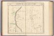
Partie, Russie d'Asie. Asie 12.
1 : 1641836 Vandermaelen, Philippe, 1795-1869
24. Urals. The World Atlas.
1 : 3000000 USSR (Union of Soviet Socialist Republics).
Partie, Russie d'Asie. Asie 21.
1 : 1641836 Vandermaelen, Philippe, 1795-1869
Karte der stroganowschen Erbländer
1 : 850000 Leipzig : Wilhelmi
Geologische Karte des Hüttenbezirks Katharinenburg
1 : 210000 Hofmann, E. Kartographische Anstalt A. Ilgin
Geologische Karte des Hüttenbezirks Goroblagodatsk
1 : 210000 Hofmann, E. Kartographische Anstalt A. Ilgin
Geologische Karte des Hüttenbezirks Wotkinsk |i Geologische Karte des Hüttenbzirks Perm
1 : 210000 Hofmann, E. Kartographische Anstalt A. Ilgin
Geologische Karte des Hüttenbezirks Bogoslowsk
1 : 210000 Hofmann, E. Kartographische Anstalt A. Ilgin
Geologische Karte des Hüttenbezirks Slatoust
1 : 210000 Hofmann, E. Kartographische Anstalt A. Ilgin
(Europaischen Russland II).
1 : 5000000 Berghaus, Heinrich; Flemming, Carl; Handtke, Friedrich H.; Sohr, Karl
Russian Dominions
A new general atlas of modern geography, consisting of a complete collection of maps of the four quarters of the globe Wyld, James James Wyld
Carte generale de toute l'Europe, 3
1 Blatt : 57 x 48 cm J.M. Will
[Ost-Europa in 6 Blättern, Blatt 2]
Handatlas über alle Theile der Erde und über das Weltgebäude Stieler, Adolf Justus Perthes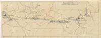
Schema historických momentů československ. vojenských operací na Sibiři 1918-1919

Russia in Europe. Part II.
1 : 4500000 Society for the Diffusion of Useful Knowledge (Great Britain)
Russie d'Europe / par J.B. Poirson Ingénieur Géog.e
1 : 10000000 1 Karte : Kupferdruck ; 18 x 24 cm Poirson, Jean-Baptiste [Verlag nicht ermittelbar]
Carte de la Russie d'Europe / par J.B. Poirson ; gravé par Tardieu
1 : 9000000 1 Karte auf 2 Blatt : Kupferdruck ; 39 x 27 cm Poirson, Jean-Baptiste [Mentelle]
Geologičeskaja karta Evropejskoj Rossii
1 : 2500000 Nordost-Blatt Karpinskij, A.P. (Aleksandr Petrovič) Kartografičeskoe zavedenie A.Il'ina
Feuille 6 (F I), uit: Carte géologique internationale de l'Europe : la carte, votée au congrès géologique international de Bologne en 1881, est exécutée conformément aux décisions d'une commission internationale, avec le concours des gouvernements, sous le dir. de M.M. Beyrich et Hauchecorne
Annotatie: Blad 48 gamme des couleurs; blad 49: bladwijzer en titelblad Heinrich Ernst Beyrich 1815-1896; Wi. Hauchecorne Berlin : Reimer / (Berlin: Institut lithographique)
Ost-Europa, Bl. 2: Nordost-Russland.
1 : 3700000 Petermann, A.
Russia 2.
1 : 4435200 Letts, Son & Co.
Karta Pomorskago kraja v 17 věkě
Russland Russland (Nord)
[Ost-Europa in 6 Blättern, Enthaltend: Norwegen, Schweden, Russland, Kaukasien und die Türkei, Blatt 2]
Hand-Atlas über alle Theile der Erde und über das Weltgebäude Stieler, Adolf Justus Perthes
[Ost-Europa, Blatt 2]
Adolf Stieler's Handatlas über alle Theile der Erde und über das Weltgebäude Stieler, Adolf Justus Perthes
Geognostisch-geographische Übersicht des Petschora Landes
Pečora, řeka (Rusko) Keyserling, Alexander Krusenstern, Paul von
Geognostisch-geographische Übersicht des Petschora Landes
Pečora, řeka (Rusko) Keyserling, Alexander Krusenstern, Paul von
![[V], uit: Geognostische Karte des Oesterreichischen Kaiserstaates mit einem grossen Theile Deutschland's u. Italien / hauptsachlich nach ... Haidinger's geognostischer Karte dieses Staates bearb. von Josef Scheda](https://images-2.georeferencer.com/images/iiif/559049503149/full/,300/0/native.jpg)

