Maps of Mediterranean Sea

Oorlogskaart van Europa : met vermelding der voornaamste gebeurtenissen van af 28 juni 1914 tot 29 januari 1916 / samengest. en get. door Ph.L. Battefeld
1 : 2600000 Annotatie: Met lijst van: Datums en feiten; Annotatie geografische gegevens: Met schaalstok Ph.L. Battefeld Delft : Hillen's Sigaren en Tabaksfabriek / (Amsterdam : drukkerij Senefelder)
4. Friedensschlüsse nach dem span. Erbfolgekriege 1713/1714. nach d. Nord. Kriege 1719/21. Passarowitz 1718
1 : 30000000 Europa Nystad / Friede, Požarevac / Friede
Evropa
1 : 5000000 Evropa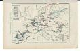
Kriegszusammenhänge V (1788 - 1815)
1 : 20000000 Europa Napoleonische Kriege, Koalitionskriege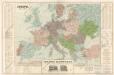
Evropa

Kriegszusammenhänge III (1700 - 1721)
1 : 20000000 Europa Nordischer Krieg <1700-1721>, Türkenkriege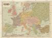
Evropa
1 : 5000000 Evropa V. Neubert
Carte genérale et itineraire de l'Europe
1 : 2300000 Evropa Traux, Maximilian de Schwarzenberg, Karel Filip Artaria
Europa Saeculo XVIII. Usque ad Annum 1789 (1795)
Europa
Cestovní spoje v Evropě
Evropa
Nová mapa vysílacích stanic Evropy
Evropa Hlaváček, Josef Orbis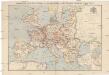
Compagnie Internationale des Wagons-lits et des Grands Express européens
1 : 4500000 Evropa L. Hermann
Europa im Zeitalter Napoleons
1 : 15000000 Europa Napoleon I., Frankreich, Kaiser
Europa im Zeitalter Wilhelms I.
1 : 15000000 Europa Wilhelm I., Deutsches Reich, Kaiser
Mitteleuropa zur Napoleonischen Zeit
Mittel-Europa
Europa
Carte Routiere et Postale de la France

Europe Historique.
Andriveau-Goujon, J.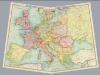
Composite: Europe - communications.
1 : 5300000 John Bartholomew and Son
Carte d'Europe indiquant le canal maritime de l'océan à la Méditerranée
1 : 16000000 Perrin, Maurice [Paris] : [éditeur inconnu]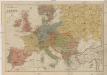
Neueste Geschäfts u. Reisekarte von Europa
1 : 5000000 Evropa Brandes, H. Moritz Perles
The Mountain Systems of Europe
The physical atlas Johnston, Alexander Keith William Blackwood & Sons
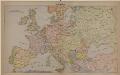
Europe
1 : 4000000 Evropa Andriveau-Goujon, E. E. Andriveau-Goujon
Europa temporibus expeditionum sacrarum
Evropa Kunst u geogr. Anstalt von Serz & C.ie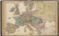
Map of Europe.
1 : 6300000 Walling, H. F.
Europa Temporibus Expeditionum Sacrarum
Europa Kreuzzüge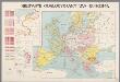
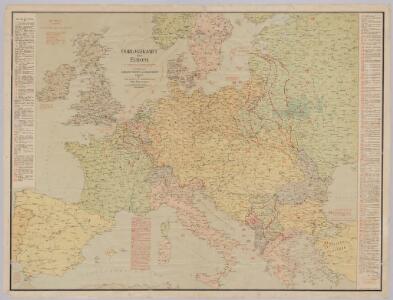
Nieuwste oorlogskaart van Europa
1 : 6000000 A[mster]dam : Meulenhoff
[Personifizierte Europa als Königin mit Reichsapfel und Zepter, Hispania bildet den Kopf]
1 Karte : Holzschnitt ; 16 x 26 cm Münster, Sebastian [Sebastian Münster]
[Personifizierte Europa als Königin mit Reichsapfel und Zepter, Hispania bildet den Kopf]
1 Karte : Holzschnitt ; 16 x 26 cm Münster, Sebastian [Sebastian Münster]