Maps of Créteil
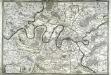
Flle. 9. Sceaux, uit: Carte topographique des environs de Versailles dite "Carte des chasses du Roi"
1 : 28800 titelvariant: Carte des chasses du Roi; Annotatie: Herdruk van originele koperplaten; Oorspr. uitg.: 1764-1807; Voor aanwezige bladen zie overzichtsblad; Annotatie geografische gegevens: Opname: 1764-1773 [Paris : IGN]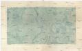
Sceaux
1 : 29236 Francie Doudau
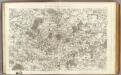
Sud-Est: Paris Et Ses Environs.
1 : 40000 Service Geologique Des Mines (France)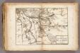
La Marne.
1 : 54000 Vincent
Sud-Ouest: Paris Et Ses Environs.
1 : 40000 Service Geologique Des Mines (France)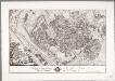
Tableau topographique de la Fôret de Sénart / ... G. Coutans
1 : 14400 Annotatie: Herdruk van originele koperplaat; Oorspr. uitg.: 1786 Coutans, G. [Paris : IGN]
Département de Paris
1 Karte : Kupferdruck ; 35 x 41 cm Capitaine s.n.
Environs de Paris
1 Karte : Kupferdruck ; 51 x 65 cm Le Rouge; Roussel; Delavigne chez le Rouge ing. geogr. rue des g.ds Augustins
Environs de Paris
1 Karte : Kupferdruck ; 51 x 65 cm Le Rouge; Roussel; Delavigne chez le Rouge ing. geogr. rue des g.ds Augustins
Topographische Karte von Paris und Gegend
1 : 103000 Paříž (Francie : oblast) Fr. R. Reiss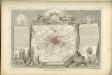
Dept. De La Siene.
1 : 194000 Levasseur, Victor.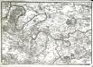
Environs de Paris
1 Karte : Kupferdruck ; 24 x 34 cm Fer; Starckman s.n.
Nieuwe kaart van de buitenstreeken van Parys : meetkundig opgenomen in 1792 en 1793 met alle de nieuwe sterkten, verschansingen en versperringen tusschen de rivieren de Seine en de Marne
1 : 80000 Allart, J. (Johannes), 1754-1816 by Johannes Allart
Carte des environs de Paris, Versailles, St. Germain, et de Poissy
1 Karte : Kupferdruck ; 22 x 33 cm Crépy; Crépy chez Crepy rue S. Jacques à S. Pierre près la rue de la parcheminerie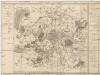
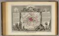
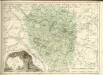
Département de la Seine
1 : 70500 Paříž-oblast (Francie) Chanlaire, P. G. P.G. Chanlaire
Paris.
1 : 95000 Colton, G.W.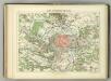
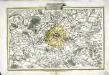
Camp Retranche de Paris.
1 : 100000 Jouvet et Cie.
Plan de Paris
Li contorni di Parigi
1 Karte : Kupferdruck ; 26 x 41 cm Zatta presso Antonio Zatta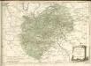

Nordost Frankreich, Belgien und Luxemburg Deutsche Rheinländer

Environs de Paris dans un rayon de 30 kilomètres
1 : 66670 Antoine E. Andriveau-Goujon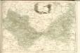
1 Paris.
1 : 86400 Cassini family; Cassini, Cesar-Francois, 1714-1784
66. Paris, Lorraine, and Saar. The World Atlas.
1 : 250000 USSR (Union of Soviet Socialist Republics).
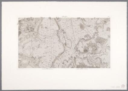
Plan de Paris XII.
[Paris]
1 Blatt : 60 x 91 cm Bourgoin s.n.