Maps of Val-de-Marne

Sud-Est: Paris Et Ses Environs.
1 : 40000 Service Geologique Des Mines (France)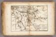
La Marne.
1 : 54000 Vincent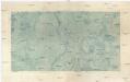
Sceaux
1 : 29236 Francie Doudau
Flle. 9. Sceaux, uit: Carte topographique des environs de Versailles dite "Carte des chasses du Roi"
1 : 28800 titelvariant: Carte des chasses du Roi; Annotatie: Herdruk van originele koperplaten; Oorspr. uitg.: 1764-1807; Voor aanwezige bladen zie overzichtsblad; Annotatie geografische gegevens: Opname: 1764-1773 [Paris : IGN]
Paris au XVIII siécle 3

La Topographie de Paris ou Plan détaillé de la Ville de Paris 19-20

La Topographie de Paris ou Plan détaillé de la Ville de Paris 18

Grand Plan de Paris et de ses Evirons VI.

Plan des verschanzten Lagers von Paris

Département de Paris
1 Karte : Kupferdruck ; 35 x 41 cm Capitaine s.n.

[Paříž]
1 : 40800 Paříž-oblast (Francie) Fer, Nicolas de N. de Fer
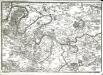
Der Gegend um Paris
1 : 73000 Paříž (Francie)
Typus choro-topographicus regiæ et totius orbis celeberrimæ urbis Lutetiæ parisiorum
1 Karte : Kupferdruck ; 49 x 57 cm Seutter Matthäus Seutter
Sud-Ouest: Paris Et Ses Environs.
1 : 40000 Service Geologique Des Mines (France)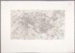
Flle. 6. Paris, uit: Carte topographique des environs de Versailles dite "Carte des chasses du Roi"
1 : 28800 titelvariant: Carte des chasses du Roi; Annotatie: Herdruk van originele koperplaten; Oorspr. uitg.: 1764-1807; Voor aanwezige bladen zie overzichtsblad; Annotatie geografische gegevens: Opname: 1764-1773 [Paris : IGN]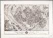
Tableau topographique de la Fôret de Sénart / ... G. Coutans
1 : 14400 Annotatie: Herdruk van originele koperplaat; Oorspr. uitg.: 1786 Coutans, G. [Paris : IGN]
Redbank, Clarion County, Pennsylvania.
1 : 31680 Caldwell, Joseph A.
La Topographie de Paris ou Plan détaillé de la Ville de Paris 20

Plan de la ville de Paris

Östliche Hälfte von Paris
Grosser Hand-Atlas über alle Theile der Erde in 170 Karten Meyer, J. Verlag des Bibliographischen Instituts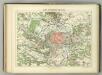
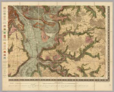
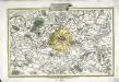
Camp Retranche de Paris.
1 : 100000 Jouvet et Cie.
Nieuwe kaart van de buitenstreeken van Parys : meetkundig opgenomen in 1792 en 1793 met alle de nieuwe sterkten, verschansingen en versperringen tusschen de rivieren de Seine en de Marne
1 : 80000 Allart, J. (Johannes), 1754-1816 by Johannes Allart
Plan de Paris
Li contorni di Parigi
1 Karte : Kupferdruck ; 26 x 41 cm Zatta presso Antonio Zatta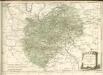

Nordost Frankreich, Belgien und Luxemburg Deutsche Rheinländer

Environs de Paris dans un rayon de 30 kilomètres
1 : 66670 Antoine E. Andriveau-Goujon