Maps of powiat szczycieński

[Recto], uit: Archangel Port : revised plan of saw mills and loading places
1 : 90000 Annotatie geografische gegevens: Met legenda, 1-45 Archangel : A.J. Anderson & Son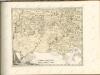

Regni Borussiae Episcopatus Warmiensis Palatinatus Mariaeburgensis et Culmensis cum Territorio Dantiscano et Ichnographia Urbis Regiomontis].
Mollova mapová sbírka
Östlicher Kriegsschauplatz II: Schlacht bei Tannenberg
1 : 750000 Tannenberg Schlacht bei Tannenberg <1914>
Regni Borussiae Episcopatus Warmiensis Palatinatus Mariaeburgensis et Culmensis cum Territorio Dantiscano et Ichnographia Urbis Regiomontis].
Mollova mapová sbírka

Bromberg 38, uit: Special-Karte von Mittel-Europa / nach amtlichen Quellen bearbeitet von W. Liebenow
1 : 300000 titelvariant: W. Liebenow's Mittel-Europa; Annotatie: Titel boven de bladen: W. Liebenow's Mittel-Europa Johannes Wilhelm Liebenow 1822-1897 Frankfurt a. M. : Ludwig Ravenstein
29 Augustowo, uit: Special-Karte von Mittel-Europa / nach amtlichen Quellen bearbeitet von W. Liebenow
1 : 300000 titelvariant: W. Liebenow's Mittel-Europa; Annotatie: Titel boven de bladen: W. Liebenow's Mittel-Europa Johannes Wilhelm Liebenow 1822-1897 Frankfurt a. M. : Ludwig Ravenstein
Iwje, Ljubtscha, Nowogródek, Korelitschi, Zdzienciol, Gorodischtsche
1 : 100000 Dzjatlava (Bělorusko)
Nowogródek

Grodno-Ost, Ostryna, Bielica, Indura, Mosty, Wenzowiec, Swislocz, Wolkowyßk, Slonim
1 : 100000 Bělorusko

170.1. Bialla (202. Gehsen). (Germany)
1 : 100000 Reichsamt fur Landesaufnahme
199.1. Neidenburg. 230.1 Bialutten. (Germany)
1 : 100000 Reichsamt fur Landesaufnahme
202.1. (170. Bialla). Gehsen. (Germany)
1 : 100000 Reichsamt fur Landesaufnahme
Composite: 170.1. Bialla (202. Gehsen) (Germany)
1 : 100000 Reichsamt fur Landesaufnahme
Composite: 202.1. (170. Bialla). Gehsen. (Germany)
1 : 100000 Reichsamt fur Landesaufnahme
Composite: 161. Konitz. (Germany)
1 : 100000 Reichsamt fur Landesaufnahme
168. Ortelsburg. (Germany)
1 : 100000 Reichsamt fur Landesaufnahme
162. Tuchel. (Germany)
1 : 100000 Reichsamt fur Landesaufnahme
Composite: 168. Ortelsburg. (Germany)
1 : 100000 Reichsamt fur Landesaufnahme
193. Zempelburg. (Germany)
1 : 100000 Reichsamt fur Landesaufnahme
Composite: 195. Kulm. (Germany)
1 : 100000 Reichsamt fur Landesaufnahme
Composite: 169. Johannisburg. (Germany)
1 : 100000 Reichsamt fur Landesaufnahme
165. Deutsch-Eylau. (Germany)
1 : 100000 Reichsamt fur Landesaufnahme
169. Johannisburg. (Germany)
1 : 100000 Reichsamt fur Landesaufnahme
Composite: 194. Crone a. d. Brahe. (Germany)
1 : 100000 Reichsamt fur Landesaufnahme
171. Ostrokollen. (Germany)
1 : 100000 Reichsamt fur Landesaufnahme
170. Bialla (202. Gehsen). (Germany)
1 : 100000 Reichsamt fur Landesaufnahme
![[Recto], uit: Archangel Port : revised plan of saw mills and loading places](https://images-2.georeferencer.com/images/iiif/531884426009/full/,300/0/native.jpg)

