Maps of Czech Republic

Strassen- und Eisenbahnkarte des oesterreichischen Kaiserthumes
1 : 864000 Blatt 2 Schaller, G. K.K. Militärisch-Geografisches Institut, Karten-Evidenthaltungs-Abteilung
Mappa Geographica Totius Regni BOHEMIAE in XII. Provincias divisae, adjunctis Comitatu Glacensi Regione Egrana et Limitibus finitimarum Provinciarum
1 : 665000 Čechy (Česko) Bernardi, Augustin Augustin Bernardi
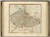
Mappa Geographica Totius Regni Bohemiae in XII. Provincias divisae adjunctis Comitatu Glacensi Regione Egrana et Limitibus finitimarum Provinciarum
1 : 650000 Čechy (Česko) Erber, Bernardinus Gütl, Philipp
Bohemia, Moravia, Austrian Silesia.
1 : 1950000 Bowen, Frances
Charte der Böhmischen Laender oder des Königreichs Böhmen der Markgrafschaft Maehren und des Herzogthums Schlesien Österreichischen Antheils
1 : 1350000 Mollova mapová sbírka Hard, Martin Withalm, Andreas
Charte der Böhmischen Laender oder des Königreichs Böhmen der Markgrafschaft Maehren und des Herzogthums Schlesien Österreichischen Antheils
1 : 1350000 Mollova mapová sbírka Hard, Martin Withalm, Andreas
La Royaume de Boheme...

Mappa Geographica summo labore, accurate et novissime exarata, exhibens Circulos aliquot Germaniae, praesertim illos ubi Bellum nunc Geritur
1 : 1300000 Mollova mapová sbírka Lotter, Tobias Conrad Lotter, Tobias Conrad
Bohemia et Provinciae huic Regno unitae

Le Royaume de Boheme Carte Reduite Sur celle de 25 Feuilles Faite á Prague
1 : 725000 Mollova mapová sbírka Le Rouge, Georges-Louis Le Rouge, Georges-Louis
Carte de Boheme
Česko Salač, Klement Müller, Johann Christoph chez Hugnin
A new map of Bohemia and Moravia
1 : 930000 Česko Cary, John J. Cary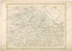
Strassen und Eisenbahnkarte des oesterreichischen Kaiserthumes

CoLLegIa et ResIDentIae BoheMIae
Mollova mapová sbírka Sartorius, Johann Christoph
Čechové, Moravané
Česko Müller, Jos. D. Jungmann, C.
České království
1 : 720000
Königreich Böhmen nach der neusten Beobachtungen
1 : 680000 Čechy (Česko) Reiffer, F. T. Mollo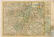
Das Königreich Böhmen


Tabula conventuum Almae et Magnae Provinciae Bohemiae S. Wenceslai...
Bohemia, Moravia.
1 : 915000 Cary, John, ca. 1754-1835
Le Royaume de Boheme divisée en ses douze cercles : carte reduite sur celle de 25 feuilles
I.C. Muller capit. et ingen. à Amsterdam : chez Pierre Schenk, l'Entrée du Ness, dans le Atlas de N. Visscher
Le Royaume de Boheme divisée en ses douze cercles : carte reduite sur celle de 25 feuilles
I.C. Muller capit. et ingen. à Amsterdam : chez Pierre Schenk, l'Entrée du Ness, dans le Atlas de N. Visscher
Charta Cursum Publicorum per Bohemiam, Silesiam, Moraviam, Lusatiam et Glacium
1 : 1300000 Kladsko-oblast (Polsko) Reilly, Franz Johann Josef von Müller, Franz Franz Johann Josef von Reilly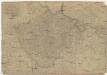
Königreich Böhmen
1 : 670000 Čechy (Česko) Mollo, Tranquillo T. Mollo
Podrobné mapy zemí Koruny české v měřítku 1:75.000 a mapa vzdáleností všech míst při silnici ležících - Přeštice - Švihov - Klatovy. Průvodce statisticko-historický po všech místech na těchto mapách uvedených a rejstřík věcný názvů hor, potoků, řek, rybníků atd. Sešit 41. List 22,
1 : 75000
Position des Toute les deux Armée en Bohéme del ́Anne 1778

Le Royaume de Boheme divisée en ses douze cercles. Carte Reduite Sur celle de 25 feuilles
1 : 700000 Mollova mapová sbírka Müller, Johann Christoph Schenk, Peter II
Regni Bohemiae, Ducatus Silesiae, Marchionatus Moraviae et Lusatiae Tabula Generalis
1 : 980000 Mollova mapová sbírka Homann, Johann Baptist Homann, Johann Baptista - dědici


