Maps of Brandenburg

Postkarte von dem Obersaechsischen und Niedersaechsischen Kreise
Polsko severozápadní Kühn, Ignaz im von Reilly'schen Landkarten und Kunstwerke Verschleiss Komptoir
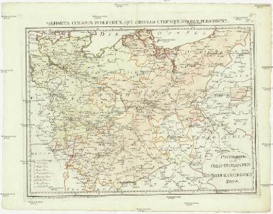
General Karte von denen Ober- und Niedersaechsischen Kreisen nach des D. Büsching Erdbeschreibung u. den besten Hülfsmitteln entworffen
1 : 1150000 [Augsburg] : bey Joh. Walch
[Nord-Östliches Deutschland]
Hand-Atlas über alle Theile der Erde nach dem neuesten Zustande und über das Weltgebäude Stieler, Adolf bei Justus Perthes
[Nordoestliches Deutschland]
Stieler's Hand-Atlas Stieler, Adolf bei Justus Perthes
[Nord-Östliches Deutschland]
Hand-Atlas über alle Theile der Erde nach dem neuesten Zustande und über das Weltgebäude Stieler, Adolf bei Justus Perthes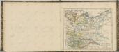

Nord-östliches Deutschland
1 : 1850000 Braniborsko (Německo) Ausfeld, Johann Carl Justus Perthes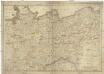
Die Königreiche Sachsen und Westphalen nach der neuesten astronomischen Beobachtungen und den besten Hülfsmitteln verfasst
1 : 1060000 Sasko (Německo) Mollo, Tranquillo T. Mollo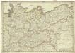
Die Königreiche Sachsen und Westphalen nach der neuesten astronomischen Beobachtungen und den besten Hülfsmitteln verfasst
1 : 1060000 Sasko (Německo) Mollo, Tranquillo T. Mollo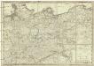
Die Königreiche Sachsen und Westphalen
1 : 1060000 Sasko (Německo) Mollo, Tranquillo T. Mollo
Nord-Östliches Deutschland
Hand-Atlas über alle Theile der Erde und über das Weltgebäude Stieler, Adolf Justus Perthes
Nord-Östliches Deutschland
Handatlas über alle Theile der Erde und über das Weltgebäude Stieler, Adolf Justus Perthes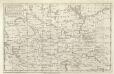
A Map of the Seat of War in Germany &c.
Mollova mapová sbírka Bennett Dilly, Charles
Nordöstliches Deutschland
Preußen
[Nordöstliches Deutschland]
Schul-Atlas über alle Theile der Erde nach dem neuesten Zustande, und über das Weltgebäude Stieler, Adolf bei Justus Perthes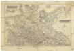
Nordwestliche deutsche Bundesstaaten, Nordoestliche deutsche Bundesstaaten
Německo severní
Nord-Ostliches Deutschland bearbeitet von C. Vogel.
1 : 1850000 Vogel, C.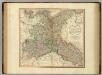
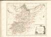
Upper Saxony, Silesia, Lusatia.
1 : 1340000 Cary, John, ca. 1754-1835
NO Deutschland.
1 : 5500000 Brudin, J. L.; Stieler, Adolf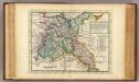
The N.E. part of Germany.
1 : 3500000 Moll, Herman, d. 1732
Die Königl. Preussischen Provinzen Brandenburg Pommern Sachsen und Schlesien nebst Mecklenburg
Mitteleuropa
Upper Saxony.
1 : 2900000 Bowen, Frances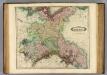
Upper Saxony.
1 : 1500000 Lizars, Daniel
[Die Provinzen Brandenburg, Pommern und Sachsen, nebst Anhalt und Mecklenburg]
Schul-Atlas in 36 Karten Völter, Daniel Verlag der J.M. Dannheimer'schen Buchhandlung
Prehľadná automapa NDR

The N. E. Part of Germany
1 : 3400000 Mollova mapová sbírka Moll, Herman Moll, Hermann
Mitteldeutschland
Volksschul-Atlas über alle Teile der Erde Lange, Henry Druck und Verlag von Georg Westermann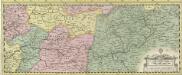
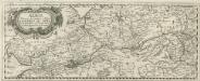
Albis Fluvius Germaniae celebris A Fontibus ad Ostia
1 : 880000 Mollova mapová sbírka Ottens, Joachim Ottens, Joachim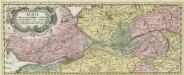
Albis Fluvius Germaniae celebris A Fontibus ad Ostia
1 : 880000 Mollova mapová sbírka Ottens, Joachim Ottens, Joachim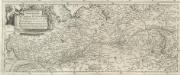
Eigentliche Vorstellung dess grossen Elb-Stroms in Deutschland, vom Ursprung biss zu seinen Ausfluss, mit seinen beyderseits einfliessenden Wassern und Flüssen
1 : 880000 Mollova mapová sbírka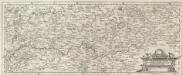
Eigentliche Vorstellung dess grossen Elb-Stroms in Deutschland, vom Ursprung biss zu seinen Ausfluss, mit seinen beyderseits einfliessenden Wassern und Flüssen
1 : 880000 Mollova mapová sbírka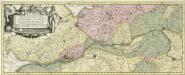
Albis Fluvius Germaniae celebris A Fontibus ad Ostia
1 : 860000 Mollova mapová sbírka Aveele, Johannes van den Schenk, Peter I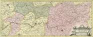
Albis Fluvius Germaniae celebris A Fontibus ad Ostia
1 : 860000 Mollova mapová sbírka Aveele, Johannes van den Schenk, Peter I