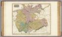
Maps of Brandenburg
Albis Fluvius Germaniae celebris A Fontibus ad Ostia
1 : 880000 Mollova mapová sbírka Ottens, Joachim Ottens, Joachim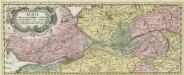
Albis Fluvius Germaniae celebris A Fontibus ad Ostia
1 : 880000 Mollova mapová sbírka Ottens, Joachim Ottens, Joachim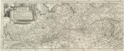
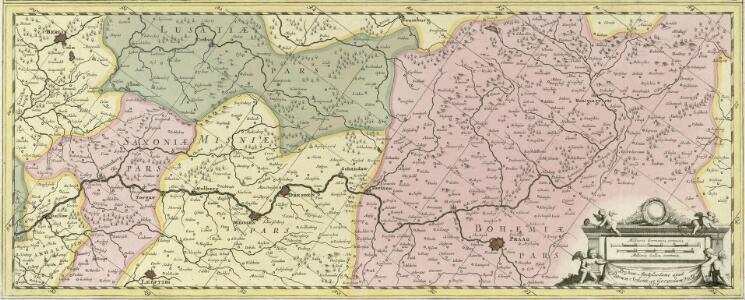
Eigentliche Vorstellung dess grossen Elb-Stroms in Deutschland, vom Ursprung biss zu seinen Ausfluss, mit seinen beyderseits einfliessenden Wassern und Flüssen
1 : 880000 Mollova mapová sbírka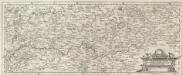
Eigentliche Vorstellung dess grossen Elb-Stroms in Deutschland, vom Ursprung biss zu seinen Ausfluss, mit seinen beyderseits einfliessenden Wassern und Flüssen
1 : 880000 Mollova mapová sbírka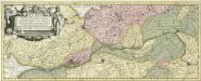
Albis Fluvius Germaniae celebris A Fontibus ad Ostia
1 : 860000 Mollova mapová sbírka Aveele, Johannes van den Schenk, Peter I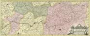
Albis Fluvius Germaniae celebris A Fontibus ad Ostia
1 : 860000 Mollova mapová sbírka Aveele, Johannes van den Schenk, Peter I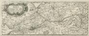
Albis Fluvius Germaniae celebris A Fontibus ad Ostia
1 : 880000 Mollova mapová sbírka Danckertsz, Cornelis Danckerts, Cornelis
Prehľadná automapa NDR

Postkarte von dem Obersaechsischen und Niedersaechsischen Kreise
Polsko severozápadní Kühn, Ignaz im von Reilly'schen Landkarten und Kunstwerke Verschleiss Komptoir
[Nord-Östliches Deutschland]
Hand-Atlas über alle Theile der Erde nach dem neuesten Zustande und über das Weltgebäude Stieler, Adolf bei Justus Perthes
General Karte von denen Ober- und Niedersaechsischen Kreisen nach des D. Büsching Erdbeschreibung u. den besten Hülfsmitteln entworffen
1 : 1150000 [Augsburg] : bey Joh. Walch
[Nordoestliches Deutschland]
Stieler's Hand-Atlas Stieler, Adolf bei Justus Perthes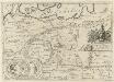
Vanniani Regni et Veteris Silesiae Amplitudo Fines et Gentes conterminae
1 : 5000000 Mollova mapová sbírka Winckler, Christian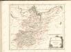

[Nord-Östliches Deutschland]
Hand-Atlas über alle Theile der Erde nach dem neuesten Zustande und über das Weltgebäude Stieler, Adolf bei Justus Perthes
Sachsen
Allgemeiner Atlas [Walch, Johannes] im Verlag bei Johannes Walch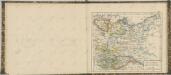
Germany north of the Mayn.
1 : 1180000 Pinkerton, John, 1758-1826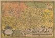
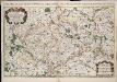
Saxoniae, Misniae, Thuringiae, Nova Exactissimaque Descriptio. [Karte], in: Theatrum orbis terrarum, S. 61.
1 Karte aus Atlas Ortelius, Abraham
Mitteldeutschland
Volksschul-Atlas über alle Teile der Erde Lange, Henry Druck und Verlag von Georg Westermann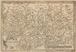
Saxoniae, Misniae, Thuringiae, Nova Exactissimaque Descriptio. [Karte], in: Theatrum orbis terrarum, S. 219.
1 Karte aus Atlas Ortelius, Abraham Vrients, Jan Baptista
Länder der DDR 1949
Deutschland, DDR Kunz, Andreas ; Moeschl, Joachim Robert

Bezirke der DDR 1952
Deutschland, DDR Kunz, Andreas ; Moeschl, Joachim Robert
Länder der DDR 3.10.1990
Deutschland, DDR Kunz, Andreas ; Moeschl, Joachim Robert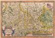
Saxoniae, Misniae, Thuringiae, Nova Exactissimaque Descriptio. [Karte], in: Theatrum orbis terrarum, S. 127.
1 Karte aus Atlas Ortelius, Abraham
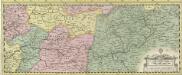
Le Cercle De La Haute Saxe [...] [Karte], in: Atlas nouveau, contenant toutes les parties du monde [...], Bd. 1, S. 312.
1 Karte aus Atlas Sanson, Nicolas Jaillot, Alexis Hubert und Mortier, Pieter
Soubor map

Upper Saxony.
1 : 2900000 Bowen, Frances