Maps of Český Brod

Český Brod, berní okres Český Brod, Čechy
1 : 1000 Český Brod (Česko : oblast) Litografický ústav Ministerstva financí
Plán královského města Českého Brodu

Böhmischbrod (Český Brod) - c0981-1-002 - Kaiserpflichtexemplar der Landkarten des stabilen Katasters
1 : 2880
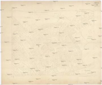
Böhmischbrod (Český Brod) - c0981-1-001 - Kaiserpflichtexemplar der Landkarten des stabilen Katasters
1 : 2880
Böhmischbrod (Český Brod) - c0981-1-003 - Kaiserpflichtexemplar der Landkarten des stabilen Katasters
1 : 2880
Böhmischbrod (Český Brod) - c0981-1-005 - Kaiserpflichtexemplar der Landkarten des stabilen Katasters
1 : 2880
Böhmischbrod (Český Brod) - c0981-1-004 - Kaiserpflichtexemplar der Landkarten des stabilen Katasters
1 : 2880
Böhmischbrod (Český Brod) - c0981-1-006 - Kaiserpflichtexemplar der Landkarten des stabilen Katasters
1 : 2880
Lieblitz (Lieblice) - c4024-1-003 - Kaiserpflichtexemplar der Landkarten des stabilen Katasters
1 : 2880
Lieblitz (Lieblice) - c4024-1-001 - Kaiserpflichtexemplar der Landkarten des stabilen Katasters
1 : 2880
Lieblitz (Lieblice) - c4024-1-002 - Kaiserpflichtexemplar der Landkarten des stabilen Katasters
1 : 2880
Lieblitz (Lieblice) - c4024-1-004 - Kaiserpflichtexemplar der Landkarten des stabilen Katasters
1 : 2880
Stollmirz (Stollmir) - c7804-1-001 - Kaiserpflichtexemplar der Landkarten des stabilen Katasters
1 : 2880
Stollmirz (Stollmir) - c7804-1-002 - Kaiserpflichtexemplar der Landkarten des stabilen Katasters
1 : 2880
Stollmirz (Stollmir) - c7804-1-004 - Kaiserpflichtexemplar der Landkarten des stabilen Katasters
1 : 2880
Stollmirz (Stollmir) - c7804-1-003 - Kaiserpflichtexemplar der Landkarten des stabilen Katasters
1 : 2880
Przistaupin (Přistaupin) - c6251-1-004 - Kaiserpflichtexemplar der Landkarten des stabilen Katasters
1 : 2880
Przistaupin (Přistaupin) - c6251-1-003 - Kaiserpflichtexemplar der Landkarten des stabilen Katasters
1 : 2880
Przistaupin (Přistaupin) - c6251-1-002 - Kaiserpflichtexemplar der Landkarten des stabilen Katasters
1 : 2880
Przistaupin (Přistaupin) - c6251-1-001 - Kaiserpflichtexemplar der Landkarten des stabilen Katasters
1 : 2880
Gradkartenblatt
1 : 25000 Čechy (Česko) Czechák, Carl
III. vojenské mapování 3954/3
1 : 25000
[Gradkartenblatt]
1 : 25000 Čechy (Česko) Vojenský zeměpisný ústav
III. vojenské mapování 3954/3
1 : 25000

Česko Brodský vikariát
Český Brod-oblast (Česko)
Eisenbahn Karte Wien-Dresden, Ollmütz-Trübau
1 : 72000 Blatt 12 Minarzik, Anselm J. Rauh
Podrobné mapy zemí Koruny české v měřítku 1:75.000 a mapa vzdáleností všech míst při silnici ležících - Český Brod – Kouřim. Průvodce statisticko-historický po všech místech na těchto mapách uvedených a rejstřík věcný názvů hor, potoků, řek, rybníků atd. Sešit 14. List 68,
1 : 75000
Plan der Gegend zwischen Nehwizd und Sadska in welcher das Feldlager und Manoeuvre vom 11ten bis 14ten September 1837 statt hat
Sadská-oblast (Česko) Hennig, C. C. Hennig