Maps of Český Brod

Stollmirz (Stollmir) - c7804-1-001 - Kaiserpflichtexemplar der Landkarten des stabilen Katasters
1 : 2880
Stollmirz (Stollmir) - c7804-1-002 - Kaiserpflichtexemplar der Landkarten des stabilen Katasters
1 : 2880
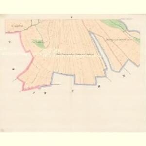
Stollmirz (Stollmir) - c7804-1-004 - Kaiserpflichtexemplar der Landkarten des stabilen Katasters
1 : 2880
Stollmirz (Stollmir) - c7804-1-003 - Kaiserpflichtexemplar der Landkarten des stabilen Katasters
1 : 2880
Böhmischbrod (Český Brod) - c0981-1-002 - Kaiserpflichtexemplar der Landkarten des stabilen Katasters
1 : 2880
Böhmischbrod (Český Brod) - c0981-1-001 - Kaiserpflichtexemplar der Landkarten des stabilen Katasters
1 : 2880
Böhmischbrod (Český Brod) - c0981-1-003 - Kaiserpflichtexemplar der Landkarten des stabilen Katasters
1 : 2880
Böhmischbrod (Český Brod) - c0981-1-005 - Kaiserpflichtexemplar der Landkarten des stabilen Katasters
1 : 2880
Böhmischbrod (Český Brod) - c0981-1-004 - Kaiserpflichtexemplar der Landkarten des stabilen Katasters
1 : 2880
Böhmischbrod (Český Brod) - c0981-1-006 - Kaiserpflichtexemplar der Landkarten des stabilen Katasters
1 : 2880
Český Brod, berní okres Český Brod, Čechy
1 : 1000 Český Brod (Česko : oblast) Litografický ústav Ministerstva financí
Plán královského města Českého Brodu

Neudorf (Nowawes) - c5212-1-001 - Kaiserpflichtexemplar der Landkarten des stabilen Katasters
1 : 2880
Neudorf (Nowawes) - c5212-1-002 - Kaiserpflichtexemplar der Landkarten des stabilen Katasters
1 : 2880
Neudorf (Nowawes) - c5212-1-003 - Kaiserpflichtexemplar der Landkarten des stabilen Katasters
1 : 2880
Czernik (Černik) - c0896-1-001 - Kaiserpflichtexemplar der Landkarten des stabilen Katasters
1 : 2880
Czernik (Černik) - c0896-1-003 - Kaiserpflichtexemplar der Landkarten des stabilen Katasters
1 : 2880
Czernik (Černik) - c0896-1-002 - Kaiserpflichtexemplar der Landkarten des stabilen Katasters
1 : 2880
Kaunitz (Kaunice) - c3423-1-008 - Kaiserpflichtexemplar der Landkarten des stabilen Katasters
1 : 2880
Kaunitz (Kaunice) - c3423-1-005 - Kaiserpflichtexemplar der Landkarten des stabilen Katasters
1 : 2880
Kaunitz (Kaunice) - c3423-1-007 - Kaiserpflichtexemplar der Landkarten des stabilen Katasters
1 : 2880
Kaunitz (Kaunice) - c3423-1-003 - Kaiserpflichtexemplar der Landkarten des stabilen Katasters
1 : 2880
Kaunitz (Kaunice) - c3423-1-001 - Kaiserpflichtexemplar der Landkarten des stabilen Katasters
1 : 2880
Kaunitz (Kaunice) - c3423-1-002 - Kaiserpflichtexemplar der Landkarten des stabilen Katasters
1 : 2880
Kaunitz (Kaunice) - c3423-1-004 - Kaiserpflichtexemplar der Landkarten des stabilen Katasters
1 : 2880
Kaunitz (Kaunice) - c3423-1-006 - Kaiserpflichtexemplar der Landkarten des stabilen Katasters
1 : 2880

Česko Brodský vikariát
Český Brod-oblast (Česko)
Eisenbahn Karte Wien-Dresden, Ollmütz-Trübau
1 : 72000 Blatt 12 Minarzik, Anselm J. Rauh