Maps of Czech Republic

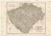
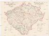
[Čechy]
1 : 600000 Česko
Nejnovější podrobná mapa Čech
1 : 400000 Praha (Česko) Štumper, Karel Šolc a Šimáček
Neueste Reisekarte von Böhmen
1 : 600000 Česko Wagner, Jan Eduard F. Kytka
Statistisch topographische Karte des Kronlandes Boehmen
1 : 800000 Německo Steingruber, Konrad Riedl, Johann Baptist Joh. Stiasny
Politická a místopisná mapa Království českého
1 : 418000 Česko Erben, Josef nákladem kněhkupectví K. Janského
Politická a místopisná mapa Království českého
1 : 418000 Česko Erben, Josef Smolík, Ott. nákladem kněhkupectví K. Janského
Politická a místopisná mapa Království českého
1 : 418000 Česko Erben, Josef Smolík, Ott. nákladem kněhkupectví K. Janského
General-Uibersichts-Karte des Königreiches Böhmen
1 : 575000 Česko Windisch-Graetz, Alfred Kandidus C. Hennig u. F. Tempsky
General-Uibersichts-Karte des Königreiches Böhmen
1 : 575000 Česko Windisch-Graetz, Alfred Kandidus C. Hennig u. F. Tempsky
Strassen-Uebersichtskarte von Böhmen
1 : 665000 Česko
Strassen-Uebersichtskarte von Böhmen
1 : 665000 Česko
Geologická mapa Království Českého

Böhmen

Karten zur Statistik des Königreiches Böhmen...

Nejnovější příruční mapa Království Českého
Das chartografische Netz der ombrometrischen Stationen Böhmens
1 : 600000 Čechy (Česko) Purkyně, Emanuel Hickmann, Anton L. böhm. Forstverein
Karten zur Statistik des Königreiches Böhmen...
Fischerei-Karte des Königreiches Böhmen
České království Frič, Antonín Subvention des Landtages und des Comités für Landesdurchforschung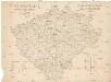
Fischerei-Karte des Königreiches Böhmen
Česko Frič, Antonín vydána pomocí sl. sněmu a komitétu pro výzkum Čech
Království české
Česko Šrámek, Ferdinand
Království české
Česko Šrámek, Ferdinand
Království české
Čechy (Česko) Klub národní strany svobodomyslné
Království české
Česko Klub národní strany svobodomyslné
Bez titulu: Statistické mapky Čech

Cestovní mapa království Českého

Böhmen

Karten zur Statistik des Königreiches Böhmen

Mapa školství Království českého
1 : 460000 Čechy (Česko) Mařatka, František Zemský ústřední spolek jednot učitelských v Král. českém
Historická mapa Čech
1 : 525000 Česko Palacký, František Kalausek, Josef nákladem Kr. č. učené společnosti
![[Čechy]](https://images-2.georeferencer.com/images/iiif/415119859812/full/,300/0/native.jpg)

