Maps of Karelia

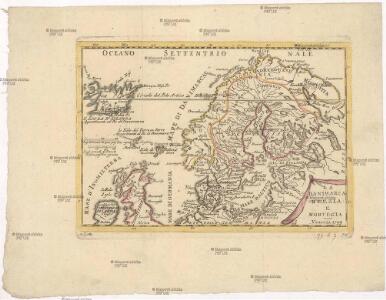
La Danimarca Svezia e Norvegia.
Dánsko Seutter, Matthäus Zatta, Antonio Zatta
Europaischen Russland I.
1 : 5000000 Handtke, Friedrich H.
Carte de la partie européene de l'empire de Russie avec l'indication des chemins de poste
1 : 2300000 Finsko Artaria
Plemena ozernoj oblasti
Russland Russland (Nord) Ethnische Gruppe Stavrovskij, Ja.
Geologičeskoe stroenīe ozernoj oblasti
Russland Russland (Nord) Geologie Geol. Komitet
Počvy ozernoj oblasti
Russland Russland (Nord) Geografie Sibircev, K.
Ukazanije slavjanskago gorodstva v sevěro-zapadnoj časti Rossii
Finsko
Suomi ja Itä-Karjala
1 : 2000000 Finsko Tilgmannin kivipaino
Europäisches Russland
Stieler's Hand-Atlas Stieler, Adolf bei Justus Perthes
Übersichtskarte Karelien-Kola
1 : 1000000 Karélie (Rusko) Generalstab des Heeres, Abteilung für Kriegskarten und Vermessungswesen
Europäisches Russland
Hand-Atlas über alle Theile der Erde nach dem neuesten Zustande und über das Weltgebäude Stieler, Adolf bei Justus Perthes
[IX], uit: Geognostische Karte des Oesterreichischen Kaiserstaates mit einem grossen Theile Deutschland's u. Italien / hauptsachlich nach ... Haidinger's geognostischer Karte dieses Staates bearb. von Josef Scheda
1 : 3000000 titelvariant: General-Karte von Europa in 25 Blättern; Annotatie: Bijlage bij: General-Karte von Europa in 25 Blättern. - 1:2.592.000. - 1845-1847 Scheda, Joseph Wien : K.K. Militär. Geografisch. Institut
Plotnost' naselenīja ozernoj oblasti
Russland Russland (Nord) Bevölkerungsdichte Moračevskij, V.
Raspredělenie lěsov i preděly rasprostranenīja někotorych porod derev'ev v ozernoj oblasti
Russland Russland (Nord) Geografie Bewaldung Il'in', N.
Raspredělenie škol v ozernoj oblasti
Russland Russland (Nord) Schule Stavrovskij, Ja.
[Nordrussland ; Vieh]
Russland Russland (Nord) Landwirtschaft
Rel'ef ozernoj oblasti
Russland Russland (Nord) Geografie Tillo, A. ; Šokal'skij, Ju.
Nedostajuščee količestvo prodovol'stvennago chlěba na dušu sel'skago naselenīja
Russland Russland (Nord) Ernährung Moračevskij, V.
[Nordrussland ; Vieh]
Russland Russland (Nord) Landwirtschaft
No.20. Karta Evropeyskaia Rossiia. Sheet 6
1 : 2000000 Shokalskago,Iu. M.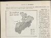
[Nordrussland ; Pferd]
Russland Russland (Nord) Landwirtschaft
[Nordrussland ; Pferd]
Russland Russland (Nord) Landwirtschaft
Karta ozernoj oblasti
Russland Russland (Nord) Il'in', N.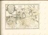

Die Königreiche Schweden und Norwegen
Švédsko Seutter, Matthäus Zatta, Antonio im Verlage des Kunst u. Industrie Comptoirs
Prozentualer Anteil der Geldeinkünfte aus Saisonarbeit in St. Petersburg am Einkommen der Bauern in den 30er Jahren des 19. Jahrhunderts nach C.C. Böcker
Finnland Einkommen, Saisonarbeiter
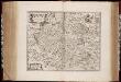
RVSSIÆ, | Vulgo MOSCOVIA dictæ, | Pars Occidentalis
Auctore Isaaco Maßa. [Amsterdam : Joan Blaeu]
No.16. Karta Evropeyskaia Rossiia. Sheet 2
1 : 2000000 Shokalskago,Iu. M.
Partie, Russie d'Europe. Europe 5.
1 : 1641836 Vandermaelen, Philippe, 1795-1869