Mapa catalogado
Karta ozernoj oblasti

Título completo:Karta ozernoj oblasti
Año de ilustración:1900
Fecha de publicación:1900
Tamaño físico:20 x 30 cm
Nowgorod, Str. Russa, Ostaszkow
1918
K. u. k. Militärgeographisches Institut
1:750k
Moscovia
1626
Mercator, Gerhard
1:5m
Moscovia
1607
Hondius, Jodocus
1:5m

Atlas minor, mapa ze strany: 139
1610
Mercator Gerhard
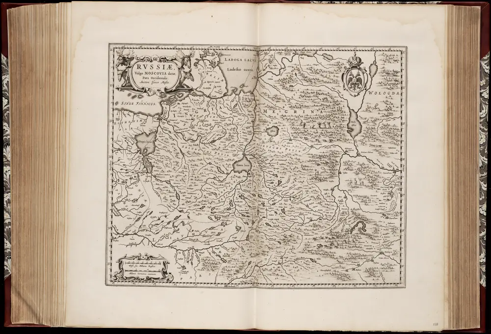
Rvssiæ, vulgo Moscovia dictæ, pars occidentalis / auctore Isaaco Maßa
1662
Isaac Abrahamszoon Massa 1586-1643
1:2m
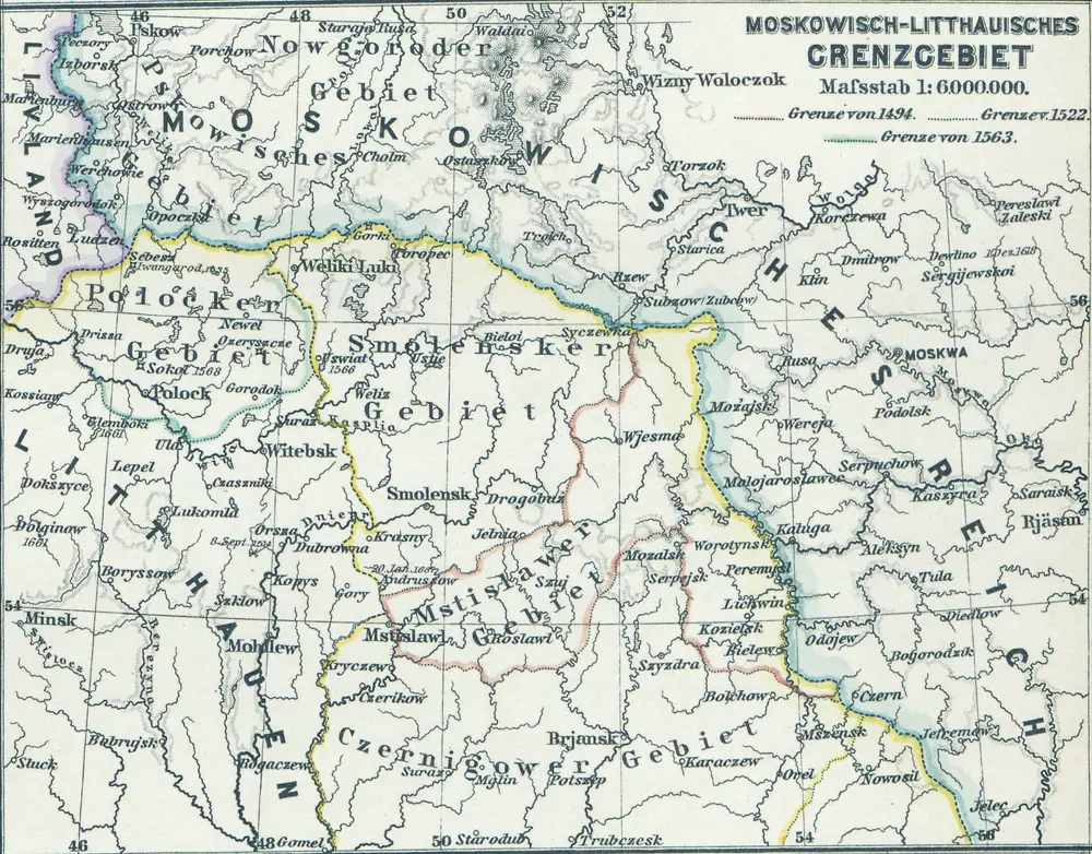
Moskowisch-Litthauisches Grenzgebiet
1880
1:6m

Anfänge des Moskauer Reiches
1923
1:8m
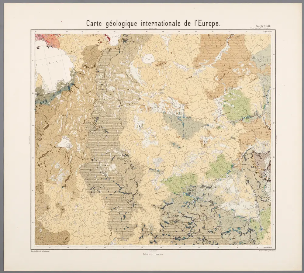
Feuille 19 (E III), uit: Carte géologique internationale de l'Europe : la carte, votée au congrès géologique international de Bologne en 1881, est exécutée conformément aux décisions d'une commission internationale, avec le concours des gouvernements, sous le dir. de M.M. Beyrich et Hauchecorne
1881
Heinrich Ernst Beyrich 1815-1896; Wi. Hauchecorne
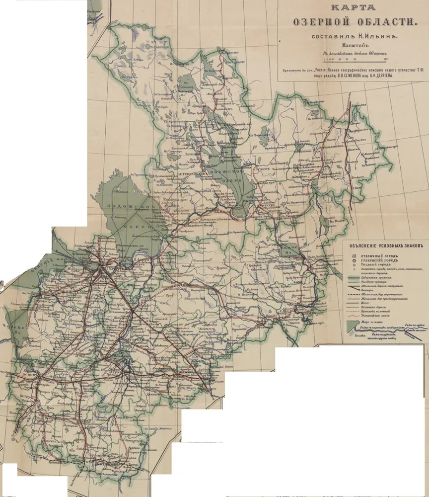
Karta ozernoj oblasti
1900
Il'in', N.
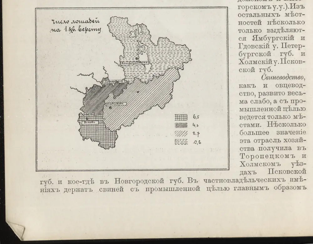
[Nordrussland ; Pferd]
1900