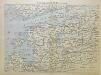
Maps of Baltic Plains

Geologičeskoe stroenīe ozernoj oblasti
Russland Russland (Nord) Geologie Geol. Komitet
Počvy ozernoj oblasti
Russland Russland (Nord) Geografie Sibircev, K.
Raspredělenie lěsov i preděly rasprostranenīja někotorych porod derev'ev v ozernoj oblasti
Russland Russland (Nord) Geografie Bewaldung Il'in', N.
Rel'ef ozernoj oblasti
Russland Russland (Nord) Geografie Tillo, A. ; Šokal'skij, Ju.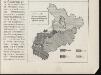
[Nordrussland ; Vieh]
Russland Russland (Nord) Landwirtschaft
Raspredělenie škol v ozernoj oblasti
Russland Russland (Nord) Schule Stavrovskij, Ja.
[Nordrussland ; Vieh]
Russland Russland (Nord) Landwirtschaft
Nedostajuščee količestvo prodovol'stvennago chlěba na dušu sel'skago naselenīja
Russland Russland (Nord) Ernährung Moračevskij, V.
Plemena ozernoj oblasti
Russland Russland (Nord) Ethnische Gruppe Stavrovskij, Ja.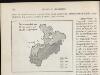
[Nordrussland ; Pferd]
Russland Russland (Nord) Landwirtschaft
Plotnost' naselenīja ozernoj oblasti
Russland Russland (Nord) Bevölkerungsdichte Moračevskij, V.
[Nordrussland ; Pferd]
Russland Russland (Nord) Landwirtschaft
Europäisches Russland
Stieler's Hand-Atlas Stieler, Adolf bei Justus Perthes
Europäisches Russland
Hand-Atlas über alle Theile der Erde nach dem neuesten Zustande und über das Weltgebäude Stieler, Adolf bei Justus Perthes
Karta ozernoj oblasti
Russland Russland (Nord) Il'in', N.
No.20. Karta Evropeyskaia Rossiia. Sheet 6
1 : 2000000 Shokalskago,Iu. M.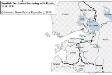
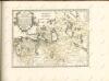
Swedish Territories Bordering with Russia, 1617–1721
Russland, Schweden, Grenze Beyer-Thoma, Hermann
Trigonometrisk grunnlag, vedlegg 65, 1b: Grunnlagspunkter for Struves meridianbue fra Jyväskylä til Hrodna
1 : 1440000
Schema kʺ pochodamʺ Sv. V. Knjazja Aleksandra Nevskago.
Russland Feldzug Aleksandr Nevskij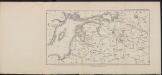
[Nordwestrussland [12.-15. Jh.]]
Russland Russland (Nord)
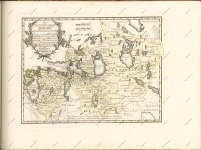
RVSSIÆ, | Vulgo MOSCOVIA dictæ, | Pars Occidentalis
Auctore Isaaco Maßa. [Amsterdam : Joan Blaeu]
Russland
1 : 3360000 Estonsko Renner Kleinknecht
Russia 3.
1 : 1900800 Letts, Son & Co.
Partie, Russie d'Europe. Europe 5.
1 : 1641836 Vandermaelen, Philippe, 1795-1869
Magnus Ducatus Finlandiae Nova et accurata delineatio. [Karte], in: Novus atlas absolutissimus, Bd. 1, S. 48.
1 Karte aus Atlas Janssonius Offizin
MAGNVS DVCATVS | FINLANDIÆ
Auct. Andrea Buræo Sueco. [Amsterdam : Joan Blaeu]
Eisenbahnkarte von Finnland
Finnland Eisenbahnnetz
Magni Ducatus Finlandiae Russiae partim, partim Sueciae subjecti, sinus item Bothnici ac Finnici nova et accurata delineatio
1 : 1500000 [Augustae Vindelicorum] : calamo et sumptibus Matthaei Seutteri