Maps of Saint-Jean-sur-Richelieu

PLAN and SECTIONS of the NEW WORKS proposed at ST. JOHNS
Plan of work proposed at the site of St John’s fort in Quebec. The site was first fortified by English settlers in c.1666 and was known as St John’s Fort. In 1748 military engineer Gaspard-Joseph Chaussegros de Lery rebuilt the fort to protect against English invaders. It became known as Fort St Jean however this fort was destroyed and burned down in August 1760. In 1775 it was rebuilt but much of it was damaged during the fighting of the American War for Independence. After this time it was converted into a ship building yard. This plan is interesting because the fort itself is drawn on an overlay attached to the main plan. Underneath this overlay is another drawing of the fort from a more distant perspective. Mann, Captain Gother
A Survey of Lake Champlain, including Lake George, Crown Point and St. John.
1 : 400000 Robert Sayer and John Bennett (Firm)
A survey of Lake Champlain, including Lake George, Crown Point, and St. John
1 : 400000 Brasier, William Robert Sayer & John Bennett (Firm)
(This Topographical map of the Province of Lower Canada. Sheet) E.
1 : 174240 Faden, William, 1750?-1836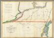
Map of the River St Lawrence and Adjacent Country.
1 : 291456 Melish, John
A SURVEY OF LAKE CHAMPLAIN
1 : 2700000 Brasier, William Amherst, Jeffery
Vermont, N.H.
1 : 600000 Mitchell, Samuel Augustus
Vermont, N.H.
1 : 600000 Mitchell, Samuel Augustus
Vermont, N.H.
1 : 600000 Mitchell, Samuel Augustus Jr.
N.H., Vermont.
1 : 665000 Mitchell, Samuel Augustus
Vermont and New Hampshire.
1 : 1050000 Rand McNally and Company
N.H., Vermont.
1 : 1000000 Mitchell, Samuel Augustus
New Hampshire And Vermont.
1 : 570240 Johnson, A.J.
Vermont And New Hampshire.
1 : 1040000 Greenleaf, Jeremiah
N.H., Vermont.
1 : 900000 Meyer, Joseph, 1796-1856
New Hampshire & Vermont.
1 : 900000 Mitchell, Samuel Augustus
New Hampshire & Vermont.
1 : 887040 Tanner, Henry S.
Vermont, N.H.
1 : 887040 Morse, Sidney E. (Sidney Edwards), 1794-1871
Vermont And New Hampshire.
1 : 1077120 Greenleaf, Jeremiah
N.H., Vermont.
1 : 1220000 Huntington, Nathaniel G. (Nathaniel Gilbert), 1785-1848
New Hampshire & Vermont.
1 : 887040 Tanner, Henry S.
Vermont And New Hampshire.
1 : 1140480 Burr, David H., 1803-1875
Vermont and New Hampshire.
1 : 878000 Hammond, C.S.
Vermont and New Hampshire.
1 : 1073000 Schonberg & Co.
N.H., Vt.
1 : 890000 Mitchell, Samuel Augustus
New Hampshire & Vermont.
1 : 885000 Mitchell, Samuel Augustus
New Hampshire & Vermont.
1 : 885000 Mitchell, Samuel Augustus
New Hampshire & Vermont.
1 : 890000 Tanner, Henry S.
Vermont & New Hampshire.
1 : 450000 Robinson, Lewis


