Maps of Les Jardins-de-Napierville

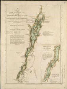
A survey of Lake Champlain, including Lake George, Crown Point, and St. John
1 : 400000 Brasier, William Robert Sayer & John Bennett (Firm)
A Survey of Lake Champlain, including Lake George, Crown Point and St. John.
1 : 400000 Robert Sayer and John Bennett (Firm)
A SURVEY OF LAKE CHAMPLAIN
1 : 2700000 Brasier, William Amherst, Jeffery
"Plan of Clinton Co., N.Y."
from Atlas of Clinton Co., New York : from actual surveys / by and under the direction of F.W. Beers, assisted by Geo. P. Sanford & others.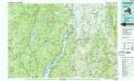
Ticonderoga
1 : 100000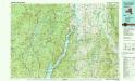
Ticonderoga
1 : 100000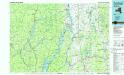
Ticonderoga
1 : 100000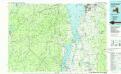
Lake Champlain South
1 : 100000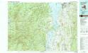
Lake Champlain South
1 : 100000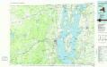
Lake Champlain North
1 : 100000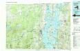
Lake Champlain North
1 : 100000
Map of Lake George
1 : 63360 Stoddard, Seneca Ray, 1844-1917 S. R. Stoddard
Clinton County.
1 : 158400 Bien, Joseph Rudolf
Clinton County.
1 : 151000 Burr, David H., 1803-1875
Map of Lake George & vicinity : from recent and careful surveys
1 : 79200 Beers, F. W. (Frederick W.) J.B. Beers & Co.
Addison County, Vermont.
1 : 190080 H.W. Burgett and Company
Chittenden County, Vermont.
1 : 174240 H.W. Burgett and Company
Bolton Landing
1 : 62500
Bolton Landing
1 : 62500
Bolton Landing
1 : 62500
Bolton Landing
1 : 62500
Whitehall
1 : 62500
Whitehall
1 : 62500
Whitehall
1 : 62500
Whitehall
1 : 62500
Whitehall
1 : 62500
Whitehall
1 : 62500
Whitehall
1 : 62500
Whitehall
1 : 62500
Whitehall
1 : 62500
Whitehall
1 : 62500
Whitehall
1 : 62500
Whitehall
1 : 62500
Bolton
1 : 62500
Bolton
1 : 62500
Bolton
1 : 62500
Bolton
1 : 62500
Bolton
1 : 62500
Bolton
1 : 62500
Bolton
1 : 62500
Bolton
1 : 62500
Bolton
1 : 62500
Bolton
1 : 62500
Bolton
1 : 62500
Bolton
1 : 62500
Bolton
1 : 62500
Whitehall
1 : 62500
Whitehall
1 : 62500
Bolton
1 : 62500
Castleton
1 : 62500
Castleton
1 : 62500
Castleton
1 : 62500
Castleton
1 : 62500
Castleton
1 : 62500
Castleton
1 : 62500
Castleton
1 : 62500
Castleton
1 : 62500
Whitehall
1 : 62500
Castleton
1 : 62500