Maps of Addison County

A SURVEY OF LAKE CHAMPLAIN
1 : 2700000 Brasier, William Amherst, Jeffery
(This Topographical map of the Province of Lower Canada. Sheet) E.
1 : 174240 Faden, William, 1750?-1836
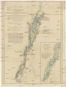
A survey of Lake Champlain, including Lake George, Crown Point, and St. John
1 : 400000 Brasier, William Robert Sayer & John Bennett (Firm)
A Survey of Lake Champlain, including Lake George, Crown Point and St. John.
1 : 400000 Robert Sayer and John Bennett (Firm)
Lake Champlain
1 : 250000
Lake Champlain
1 : 250000
Lake Champlain
1 : 250000
Lake Champlain
1 : 250000
Lake Champlain
1 : 250000
Lake Champlain
1 : 250000
Lake Champlain
1 : 250000
"Plan of Clinton Co., N.Y."
from Atlas of Clinton Co., New York : from actual surveys / by and under the direction of F.W. Beers, assisted by Geo. P. Sanford & others.
Outline map of Essex County, New York.
from New topographical atlas of Essex County, New York : from official records, unpublished maps and plans, and special explorations and surveys; with a supplement comprising a map of the state of New York, and general maps of the United States and the world, with descriptions / O. W. Gray and Son.
Ticonderoga
1 : 100000
Ticonderoga
1 : 100000
Ticonderoga
1 : 100000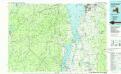
Lake Champlain South
1 : 100000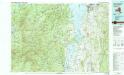
Lake Champlain South
1 : 100000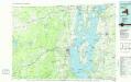
Lake Champlain North
1 : 100000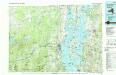
Lake Champlain North
1 : 100000
Addison County, Vermont.
1 : 190080 H.W. Burgett and Company
Chittenden County, Vermont.
1 : 174240 H.W. Burgett and Company
Clinton County.
1 : 158400 Bien, Joseph Rudolf
Plan of Grand Isle and Franklin cos., Vermont.
1 : 190080 H.W. Burgett and Company
Clinton County.
1 : 151000 Burr, David H., 1803-1875
Map of Lake George
1 : 63360 Stoddard, Seneca Ray, 1844-1917 S. R. Stoddard
Essex County.
1 : 158400 Bien, Joseph Rudolf
New York, Mt. Marcy and vicinity : land classification map / Henry Gannett, chief topographer ; H.M. Wilson, geographer in charge ; triangulation by U.S. Coast and Geodetic Survey ; topography by E.C. Barnard ... [et al.]
1 : 62500 Annotatie geografische gegevens: Opname: 1891-1894 Gannett, Henry; Wilson, H. M.; Barnard, E. C.; US Coast and Geodetic Survey [Washington, D.C. : U.S. Geological Survey]
Land classificaton map, Mt. Marcy and vicinity, New York
1 : 62500 Barnard, E.C. U.S. Geological Survey