Maps of Vaudreuil-Soulanges
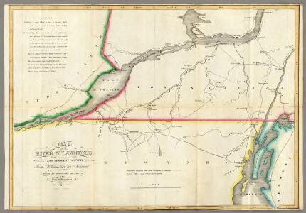
Map of the River St Lawrence and Adjacent Country.
1 : 291456 Melish, John
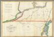
(This Topographical map of the Province of Lower Canada. Sheet) A.
1 : 174240 Faden, William, 1750?-1836
"Plan of Clinton Co., N.Y."
from Atlas of Clinton Co., New York : from actual surveys / by and under the direction of F.W. Beers, assisted by Geo. P. Sanford & others.
Massena
1 : 100000
Lake Champlain North
1 : 100000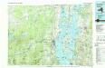
Lake Champlain North
1 : 100000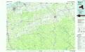
Massena
1 : 100000
Clinton County.
1 : 151000 Burr, David H., 1803-1875
Montreal.
Rand McNally and Company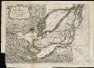
The Isles of Montreal as they have been survey'd by the French engineers
1 : 170000
Clinton County.
1 : 158400 Bien, Joseph Rudolf
Franklin County.
1 : 158400 Bien, Joseph Rudolf
Franklin County.
1 : 151000 Burr, David H., 1803-1875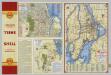
Downtown Montreal. Seeing Montreal. Shell Metropolitan District of Montreal.
Shell Oil Company
Malone [Township]
from Atlas of Franklin County, New York. : From actual surveys and official records.
Dannemora
1 : 62500
Dannemora
1 : 62500
Dannemora
1 : 62500
Plattsburgh
1 : 62500
Plattsburgh
1 : 62500
Plattsburgh
1 : 62500
Milton
1 : 62500
Milton
1 : 62500
Milton
1 : 62500
Milton
1 : 62500
Milton
1 : 62500
Plattsburg
1 : 62500
Plattsburg
1 : 62500
Plattsburg
1 : 62500
Plattsburg
1 : 62500
Plattsburg
1 : 62500
Plattsburg
1 : 62500
Lyon Mountain
1 : 62500
Santa Clara
1 : 62500
Santa Clara
1 : 62500
Santa Clara
1 : 62500
Santa Clara
1 : 62500
Nicholville
1 : 62500
Nicholville
1 : 62500
Nicholville
1 : 62500
Nicholville
1 : 62500
Santa Clara
1 : 62500
Nicholville
1 : 62500
Nicholville
1 : 62500
Milton
1 : 62500
Milton
1 : 62500
Milton
1 : 62500
Milton
1 : 62500
Milton
1 : 62500
Lyon Mountain
1 : 62500
Lyon Mountain
1 : 62500
Lyon Mountain
1 : 62500
Lyon Mountain
1 : 62500
Lyon Mountain
1 : 62500
Dannemora
1 : 62500
Dannemora
1 : 62500
Dannemora
1 : 62500
Dannemora
1 : 62500
Dannemora
1 : 62500
Milton
1 : 48000
Lyon Mountain
1 : 62500
Lyon Mountain
1 : 62500
Potsdam
1 : 62500
Potsdam
1 : 62500
Potsdam
1 : 62500
Potsdam
1 : 62500
Potsdam
1 : 62500
Potsdam
1 : 62500
Potsdam
1 : 62500
Loon Lake
1 : 62500
Loon Lake
1 : 62500
Loon Lake
1 : 62500
Loon Lake
1 : 62500
Loon Lake
1 : 62500
Loon Lake
1 : 62500
Loon Lake
1 : 62500
Loon Lake
1 : 62500
Plattsburg
1 : 62500
Plattsburg
1 : 62500
Plattsburg
1 : 62500
Plattsburg
1 : 62500
Plattsburg
1 : 62500
Plattsburg
1 : 62500
Plattsburg
1 : 62500
Plattsburg
1 : 62500