Maps of Switzerland

Atlas novus Reipublicae Helveticae
1 Atlas ([40] Bl., 97 S.) bey Orell, Gessner und Compagnie, Zürich
Potentissimae Helvetiorum reipublicae cantones tredecim
1 : 2900000 1 Karte Tobias Lobeck del. et exc. ; Tob. Conr. Lotter sc. [Lotter], Aug. Vind.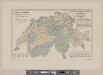
Karte der Schweiz mit Angabe der Kantons- und der Bezirksgrenzen
1 : 1050000 1 Karte vom eidg. statistischen Bureau ; Lith. Gebr. Kümmerly Eidg. statist. Bureau, [Bern]
[Schweiz]
1 : 520000 1 Karte [Keller?], [Zürich?]
Historisch-Geographischer Atlas der Schweiz in 15 Blättern
1 : 770000 Helvetien 450 - 879 Voegelin, Johann Conrad ; Meyer von Knonau, Gerold ; Wyss, Georg von ; Meyer von Knonau, Gerold Schulthess
Carte physique et politique de la Suisse
1 : 900000 1 Karte par E. Mentelle et P.G. Chanlaire an VI ; gravé par [Alexandre] Blondeau P.G. Chanlaire et E. Mentelle, Paris
<<Der>> Bauernkrieg 1653
1 : 1050000 1 Karte entworfen von J. Steiner Wurster, Randegger & Cie., Winterthur
<<Die>> Helvetische Republik in Cantone und Districte eingetheilt
1 : 630000 1 Karte gedruckt bey Wilhelm Haas dem Sohne, Basel
Johnson's Switzerland
1 : 970000 1 Karte by Johnson and Ward Johnson and Ward, New York
Johnson's Switzerland
1 : 970000 1 Karte by Johnson and Ward Johnson and Ward, New York
République helvétique divisée en ses 22 cantons
1 : 1000000 1 Karte par F.x Delamarche [chez Félix Delamarche, ingénieur-mécanicien pour les globes et sphères, rue du jardinet, no. 13], [Paris]
Charte von der Schweiz nach ihrer jezigen Eintheilung
1 : 880000 1 Karte [Joseph Dirwaldt] Mollo, Wien
Geological map of Switzerland
1 : 800000 1 Karte by R. Leuzinger Anglo-Swiss Tourists Equipment Company, A. Ramsauer, [Erscheinungsort nicht ermittelbar]
<<Die>> Helvetische Republik in Cantone und Districte eingetheilt
1 : 630000 1 Karte gedruckt bey Wilhelm Haas dem Sohne, Basel
<<Der>> Helvetischen Republik neue Cantons und Districts Eintheilung
1 : 630000 1 Karte dem Vollziehungs-Directorium gewiedmet von Wilhelm Haas dem Sohne im Augstmonat 1798 Haas, Basel
Helvetiae, Rhaetiae & Valesiae cum omnibus finitimis regionibus tabula nova & exacta
1 : 500000 1 Karte operâ & curâ Ioh. Conradi Gygeri Tigurini delineata et excusa, anno Christi MDCXXXV [Verlag nicht ermittelbar], [Zürich]
Nova totius Helvetiae cum suis subditis ac sociis tab. geogr
1 : 1400000 1 Karte studio manu ac sumtibus Matth. Seutter ; Tob. Conr. Lotter sc. anjezo im Verlag bey Tob Conr. Lotter, Augsburg
<<La>> Suisse
1 : 1500000 1 Karte [Verlag nicht ermittelbar], [Erscheinungsort nicht ermittelbar]
<<La>> Suisse divisée en ses treize cantons et ses alliés
1 : 850000 1 Karte projettée et assujettie aux observations astronomiques par [Rigobert] Bonne chez Lattré, rue S. Jacques, à la ville de Bordeaux, Paris
Schweizerische Eisenbahnen im Jahr 1875
1 : 1000000 1 Karte R. Leuzinger Orell Füssli & Co., Zürich
<<La>> Suisse
1 Karte par P. Du Val ; Somer sculp. et l'Alleman chez l'autheur en l'Isle du Palais sur le Quay de l'Horloge, Paris
Karte der Schweiz mit den in römischer Zeit erstellten Strassen
1 : 760000 1 Karte nach den Peutingerschen Tafeln bearbeitet Wurster, Winterthur
<<La>> Suisse divisée en ses treze cantons, ses alliéz & ses sujets
1 : 480000 1 Karte par le Sr. Sanson, géographe du roy chez H. Jaillot, Paris
<<Die>> Helvetische Republik
1 : 1150000 1 Karte im Verlage des Land. Industrie Compt., Weimar
Carte générale des trèze cantons de Suisse, Vallay, ligues Grise, Maison-Dieu & Valteline
1 : 725000 1 Karte A Paris au bout du pont neuf proche les Augustins
Historisch-Geographischer Atlas der Schweiz in 15 Blättern
1 : 770000 Eidgenossenschaft 1412 - 1481 Voegelin, Johann Conrad ; Meyer von Knonau, Gerold ; Wyss, Georg von ; Meyer von Knonau, Gerold Schulthess
<<Der>> Helvetischen Republik neue Cantons und Districts Eintheilung
1 : 630000 1 Karte dem Vollziehungs-Directorium gewiedmet von Wilhelm Haas dem Sohne im Augstmonat 1798 Haas, Basel
Potentissimae Helvetiorum reipublicae cantones tredecim
1 : 2900000 1 Karte Tobias Lobeck del. et exc. ; Tob. Conr. Lotter sc. [Lotter], Aug. Vind.
Schweizerische Zollkarte
1 : 500000 1 Karte Schweiz. Zolldepartement = Carte douanière de la Suisse / Département Fédéral des Douanes Commissions-Verlag von Schmid u. Francke, Bern


