Maps of Switzerland

Potentissimae Helvetiorum reipublicae cantones tredecim
1 : 2900000 1 Karte Tobias Lobeck del. et exc. ; Tob. Conr. Lotter sc. [Lotter], Aug. Vind.
Atlas novus Reipublicae Helveticae
1 Atlas ([40] Bl., 97 S.) bey Orell, Gessner und Compagnie, Zürich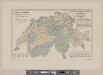
Karte der Schweiz mit Angabe der Kantons- und der Bezirksgrenzen
1 : 1050000 1 Karte vom eidg. statistischen Bureau ; Lith. Gebr. Kümmerly Eidg. statist. Bureau, [Bern]
[Schweiz]
1 : 520000 1 Karte [Keller?], [Zürich?]
Johnson's Switzerland
1 : 970000 1 Karte by Johnson and Ward Johnson and Ward, New York
Regenkarte vom 10.-12. Juni 1876
1 : 1400000 1 Karte [Verlag nicht ermittelbar], [Erscheinungsort nicht ermittelbar]
Johnson's Switzerland
1 : 970000 1 Karte by Johnson and Ward Johnson and Ward, New York
Charte von der Schweiz nach ihrer jezigen Eintheilung
1 : 880000 1 Karte [Joseph Dirwaldt] Mollo, Wien
République helvétique divisée en ses 22 cantons
1 : 1000000 1 Karte par F.x Delamarche [chez Félix Delamarche, ingénieur-mécanicien pour les globes et sphères, rue du jardinet, no. 13], [Paris]
Nouvelle carte illustrée de la Suisse indiquant les divisionis physiques et politiques, les routes de postes, les canaux et rivières navigables, les établissements d'eaux minérales ainsi que les endroits remarquables par des sites pittoresques ou des curiosités naturelles
1 : 490000 1 Karte dressée par A. Vuillemin d'après Keller et le Général Dufour Langlumé, Paris
<<La>> Suisse
1 : 1500000 1 Karte [Verlag nicht ermittelbar], [Erscheinungsort nicht ermittelbar]
<<Der>> Bauernkrieg 1653
1 : 1050000 1 Karte entworfen von J. Steiner Wurster, Randegger & Cie., Winterthur
<<La>> Suisse
1 Karte par P. Du Val ; Somer sculp. et l'Alleman chez l'autheur en l'Isle du Palais sur le Quay de l'Horloge, Paris
Nova totius Helvetiae cum suis subditis ac sociis tab. geogr
1 : 1400000 1 Karte studio manu ac sumtibus Matth. Seutter ; Tob. Conr. Lotter sc. anjezo im Verlag bey Tob Conr. Lotter, Augsburg
<<La>> Suisse divisée en ses treize cantons et ses alliés
1 : 850000 1 Karte projettée et assujettie aux observations astronomiques par [Rigobert] Bonne chez Lattré, rue S. Jacques, à la ville de Bordeaux, Paris
Schweiz, Liechtenstein.
1 : 2600000 Brudin, J. L.; Stieler, Adolf
Switzerland.
1 : 1700000 Seaman, James V.
(Schweitz, Italia, Danemarck, Schweden, Norwegen)
Hubner, Johann, 1688-1731
Helvetia tredecim statibus liberis quos cantones vocant, composita, una cum foederatis & subjectis provinciis
1 : 650000 1 Karte ex probatissimis subsidiis geographice delineata per Tobiam Mayerum luci publicae tradita ab Homannianis Heredibus, Norimbergae
Schweizerische Eisenbahnen im Jahr 1875
1 : 1000000 1 Karte R. Leuzinger Orell Füssli & Co., Zürich
Potentissimae Helvetiorum reipublicae cantones tredecim
1 : 2900000 1 Karte Tobias Lobeck del. et exc. ; Tob. Conr. Lotter sc. [Lotter], Aug. Vind.
Karte der Schweiz mit den in römischer Zeit erstellten Strassen
1 : 760000 1 Karte nach den Peutingerschen Tafeln bearbeitet Wurster, Winterthur
Schweiz
1 Karte [Schweizerische Bankgesellschaft], [Erscheinungsort nicht ermittelbar]
Carte généralle des cantons suisses et bailliages qui en despendent, du Valais, des Grisons, et autres pais leurs aliéz
1 Karte chez I. Boisseau en l'Isle du Palais, Paris
Carte générale de la Suisse
1 Karte dressée en 1787 d'apres les observations les plus récentes et les plus exactes, pour servir a la nouvelle édition très augmentée du dictionnaire de la Suisse chez BMC [i.e. Barde, Manget & Compagnie], Genève
<<Die>> Schweiz, oder, Helvetische Eidgenossenschaft
1 : 580000 1 Karte entworfen und gezeichnet von C. F. Weiland Im Verlag des Geograph. Instituts, Weimar
Atlas novus Reipublicae Helveticae
1 Atlas ([40] Bl., 97 S.) bey Orell, Gessner und Compagnie, Zürich
Nova Rhaetiae atque totius Helvetiae descriptio
1 Karte per Aegidium Tschudum Glaronensem [Hofer & Burger], [Zürich]
Carte physique et politique de la Suisse
1 : 900000 1 Karte par E. Mentelle et P.G. Chanlaire an VI ; gravé par [Alexandre] Blondeau P.G. Chanlaire et E. Mentelle, Paris


