Maps of North Atlantic Ocean

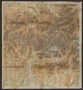
Karte der Schweizer Alpen : Oestliches Blatt
1 : 250000 Ravenstein, Hans 1866-1934 Frankfurt a. Main : L. Ravenstein
Partie, l'Espagne. Europe 18.
1 : 1641836 Vandermaelen, Philippe, 1795-1869
France, Belgium & Holland - political.
1 : 3000000 John Bartholomew and Son
Galliæ, Biscajæ et Gallissiæ sinus
1 Karte : Kupferdruck ; 48 x 55 cm Renard gedruckt bÿ L. Renard
[131][134] Galliae, Biscajae et Gallissiae Sinus ... De Bocht van Vranckryck ..., uit: Atlas sive Descriptio terrarum orbis
Annotatie: Gedigitaliseerde versie. Amsterdam. Heiloo : Picturae (vervaardiger), 2015. tiff-bestand. Gedigitaliseerd: 07-01-2015; Origineel: Universiteitsbibliotheek Vrije Universiteit (XL.05127.-) ; Netherlands; Titelpagina ontbreekt Wit, Frederik de Amsterdam : Frederick de Wit
A large chart of the BAY OF BISCAY
from The sea-atlas : containing an hydrographical description of most of the sea-coasts of the known parts of the world.
De Bocht van Vranckryck oock 't Canaal aen te doen, comende uyten Westen [Karte], in: De Nieuwe Groote Vermeerderde Zee-Atlas ofte Water-Werelt, S. 47.
1 Karte aus Atlas Doncker, Hendrick
United Kingdoms.
1 : 4500000 Arrowsmith, Aaron
United Kingdoms.
1 : 4500000 Arrowsmith, Aaron
Pas caert van 't in komen van de Canael
1 Karte : Kupferdruck ; 42 x 53 cm Doncker bÿ Hendrick Doncker boeckverkoper inde Nieuwbrugh steegh in 't Stuurmans gereetschap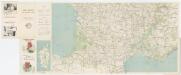
Carte Michelin 99: France - Sud, uit: Carte Michelin au 1:1.000.000e (1 cm = 10 km) : les grandes routes de France
1 : 1000000 Clermont-Ferrand : Michelin
Feuille 22 (A IV), uit: Carte géologique internationale de l'Europe : la carte, votée au congrès géologique international de Bologne en 1881, est exécutée conformément aux décisions d'une commission internationale, avec le concours des gouvernements, sous le dir. de M.M. Beyrich et Hauchecorne
Annotatie: Blad 48 gamme des couleurs; blad 49: bladwijzer en titelblad Heinrich Ernst Beyrich 1815-1896; Wi. Hauchecorne Berlin : Reimer / (Berlin: Institut lithographique)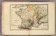
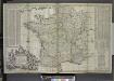
France physique.
1 : 4400000 Vincent
Pořežany o. České Budějovice 1
1 : 2880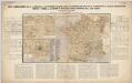
Nieuwe aardrijkskundige kaart van Frankrijk met geschiedkundig overzicht van den Duitsch-Franschen oorlog 1870-71 en aanteekening der Duitsche legerbewegingen, benevens de plannen der slagvelden om Weissenburg, Wörth, Saarbruggen, Metz, Sedan en Parijs / bewerkt door F.E.L.A. Abel ...
1 : 2400000 Annotatie: Met omringende tekst en tabellen; Annotatie geografische gegevens: Legenda F.E.L.A. Abel 's Hage : lithographie en uitgave van J. Smulders & Co ...
Pascaart Vande Custen Van Andaluzia, Portugal Gallißien, Biscajen, en een gedeelte van Vranckryck [...] [Karte], in: Novus atlas absolutissimus, Bd. 9, S. 232.
1 Karte aus Atlas Janssonius Offizin
Different Routes of Prince Edward in Great Britain
Maps are usually made by conquerors. This is an exception: it was made by the side that lost. The map was drawn by James Grant, a French officer of Scottish descent who fought alongside Bonnie Prince Charlie throughout his campaigns, including the Battle of Culloden, and accompanied him on his flight to France. The map bears the royal arms of the Stuart kings and records in detail the battles and sieges of the Jacobite campaign. Allegorical figures, such as Justice, dignify the conflict. The Prince’s escape route is watched over from the clouds by the gods of classical mythology: Venus, Zephyr, Apollo, Mercury and Neptune. In a rebuttal of the English propaganda that followed the defeat of the Jacobite Uprising, the map is pointedly Inscrib’d to all the Honest. Grant, James A.
British Channel, Bay of Biscay.
1 : 3100000 Faden, William, 1750?-1836
Pascaart Vande Custen Van Andaluzia, Portugal, Gallißien, Biscajen, en eengedeelt von Vranckryck [...] [Karte], in: Het vijfde Deel Des Grooten Atlas : Vervatende De Water-Weereld, S. 175.
1 Karte aus Atlas Jansson, Jan Jansson, Jan
Pas-caart van Hispangien
1 Karte : Kupferdruck ; 43 x 54 cm Doncker; Bree; Bree by Hendrick Doncker boekverkoper en graadbooghmaker in de Nieuwbrugh-steech in 't Stuurmans gereedschap
A new and accurate map of France with its aquisitions / composed from the latest surveys assited by the most approved maps & charts & regulated by astrol. Observations by Eman. Bowen
Bowen, Emmanuel
De Westkust van Europa van Texel tot Kaap Finisterre
Europe Gerard van Keulen
Geognostische Karte von Central-und West-Europa einschlieslich der Britischen Inseln, Frankreich, Deutschland und der Nachbarländer
Grosser Hand-Atlas über alle Theile der Erde in 170 Karten Meyer, J. Verlag des Bibliographischen Instituts
Een gedeelte van de Spaanse Zee van t Canaal tot t Naauw van de Straat
Portugal Gerard van Keulen
Carte de la France protestante / dressée sous la dir. de la Commission des Publications de la Fédération Protestante de France ; dressée par L. Hermann
1 : 1500000 Hermann, L.; Fédération Protestante de France. Commission des Publications Paris : Fischbacher
Paskaert, de Kusten van't Kanael, vertoonende alle, de Kusten van Engelandt, Schotlant, en Yerlandt, en een gedeelte van Vranckrijck.
from De zee-atlas ofte water-wereld : waer in vertoont werden alle de zee-kusten van het bekende des aerd-bodems : seer dienstigh voor alle heeren en kooplieden, als oock voor alle schippers en stuurlieden / by Pieter Goos.
The seat of war on the coast of France being a new chart of the coast of Holland, Flanders, France, Spain & Portugal, with the adjacent islands, part of Barbary, England and Ireland
Anglie Bowen, Emanuel T. Jefferys
Tabula Moderna Gallie [Karte], in: Claudii Ptolemei viri Alexandrini mathematice discipline philosophi doctissimi geographie opus [...], S. 242.
1 Karte aus Atlas Waldseemüller, Martin [und Ptolemaeus, Claudius] Übelin, Georg