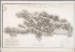
Maps of Dominican Republic
A Map of the British Empire in America. (Sheet 15).
1 : 2000000 Popple, Henry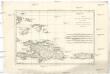
L'isle de St. Domingue, et celle de Porto-Rico
1 : 2930000 Hispaniola (ostrov) Bonne, Rigobert André
Porto Rico. Amer. Sep. 69.
1 : 1641836 Vandermaelen, Philippe, 1795-1869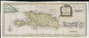
A new & accurate map of the islands of Hispaniola or St. Domingo, and Porto Rico
1 : 2750000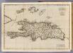
Hispaniola, St. Domingo.
1 : 1750000 Jefferys, Thomas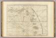
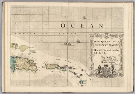
The Caribbee Islands, the Virgin Islands, and the Isle of Porto Rico.
1 : 1560000 Jefferys, Thomas
Karte von der durch den Frieden zu Basel den 22 July 1795 von Spanien und Frankreich abgetrettenen Insel St. Domingo oder Hispaniola
1 : 1900000 Francie Reilly, Franz Johann Josef von F.I.I. von Reilly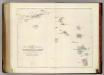
Map of The Leeward Islands.
1 : 950400 Arrowsmith, John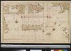
Afteekening van het eijland St. Juan de Porto Rico
Puerto Rico Gerard van Keulen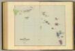
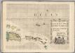
Leeward Islands.
1 : 887040 Stanford, Edward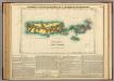
Map Of Porto Rico And The Virgin Islands.
1 : 950400 Lea, I.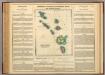
Leeward Islands.
1 : 1420000 Lea, I.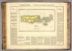
Porto Rico, Iles Vierges.
1 : 1100000 Buchon, J. A. C.; Carey, H. C.; Lea, I.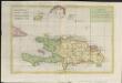
Carte de L'Isle de St. Domingue une des Grandes Antilles, Colonies Francoise et Espagnole
1 : 2400000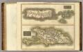
Porto Rico, Virgin Isles, Hispaniola.
1 : 700000 Thomson, John
Virgin Islands & c.
1 : 511753 Lucas, Fielding Jr.
Spagnvola
1 : 1
Spagnuola
1 : 4820000
Carte de l'isle de Saint Domingue : dressée en 1722 pour l'usage du Roy sur les mémoires de Mr. Frezier, Ingenieur de S.M. et autres
1 : 1280000 L'Isle, Guillaume de, 1675-1726 Chez l'Auteur sur le Quay de l'Horloge
Carte de l'Isle de Saint Domingue : dressée en 1722 pour l'usage du Roy sur les memoires de Mr. Frezier, ingenieur de S.M. et autres
1 : 310000 L'Isle, Guillaume de, 1675-1726 Chez Jean Cóvens et Corneille Mortier, geographes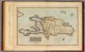
Hayti or Saint Domingo.
1 : 1520640 Lucas, Fielding Jr.
Hispaniola Insula [Karte], in: Gerardi Mercatoris Atlas, sive, Cosmographicae meditationes de fabrica mundi et fabricati figura, S. 556.
1 Karte aus Atlas Mercator, Gerhard Montanus, Petrus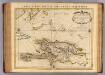
Saint Domingue.
1 : 1300000 L'Isle, Guillaume de, 1675-1726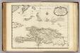
Saint Domingue.
1 : 1300000 L'Isle, Guillaume de, 1675-1726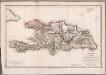
Carte de St. Domingue
1 : 1800000 Herbin de Halle, Etienne de.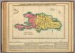
Map Of Hispaniola, Or St Domingo.
1 : 1500000 Lea, I.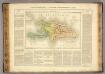
Hayti ou Ile St. Domingue.
1 : 1500000 Pierron, Jean Antoine
Hayti
Haiti im Verlage des Geographischen Instituts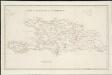
A map of the island of St. Domingo
1 : 950000