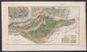
Maps of Anzoátegui
(Provincias de Margarita, Cumana, Barcelona, Guayana)
1 : 1300000 Codazzi, Agustin, 1793-1859
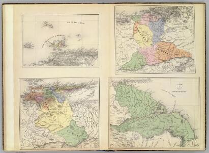
The coast of Caracas, Cumana, Parla and the mouths of Rio Orinoco.
1 : 1560000 Jefferys, Thomas
Partie, Colombie. Amer. Merid. 3.
1 : 1641836 Vandermaelen, Philippe, 1795-1869
Facsimile: Guiana by Blaeuw.
1 : 7100000 Blaeuw, William
Facsimile: Part of Chart of the Guiana Coast by Jefferys.
1 : 1510000 Jefferys, Thomas
Facsimile: Part of Northern Coast of South America by Jefferys.
1 : 1540000 Jefferys, Thomas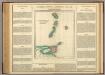
Windward Islands.
1 : 2100000 Lea, I.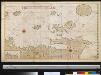
Een gedeelte van de kust van Venezuela en van de Caribesse Eijlanden van t eijland Granada tot t eijland Roca door d Engelse afgeteek(end)
Venezuela Gerard van Keulen
Map of the Windward Islands.
1 : 887040 Arrowsmith, John
Windward Islands.
1 : 887040 Stanford, Edward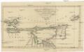
Charte von den Inseln TRINIDAD, TABAGO und MARGARETHA, dem Busen von PARIA, und einem Theile von CUMANA
1 : 1900000 Trinidad a Tobago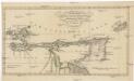
Charte von den Inseln Trinidad, Tabago und Margaretha, dem Busen von Paria, und einem Theile von Cumana
1 : 1900000 Trinidad a Tobago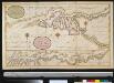
De rivier van Oronoque van Moco Moco tot St. Thome en een gedeelte van de Golf van Paria
Venezuela Gerard van Keulen
Tobago; Barbados.
1 : 338000 Peterson, Augusts
I. S. Margareta cum confiniis [Karte], in: Gerardi Mercatoris Atlas, sive, Cosmographicae meditationes de fabrica mundi et fabricati figura, S. 556.
1 Karte aus Atlas Mercator, Gerhard Montanus, Petrus
Tobago from actual surveys and observations
1 : 63360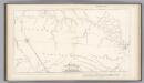
Boundary-line of Spanish and Dutch Guinana by Heneman.
1 : 1940000 Heneman, J.C. v.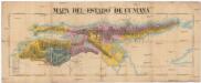
Mapa del Estado de Cumana
Venezuela Bessey, Henry
British Possessions on the North East Coast of South America.
Fullarton, A. & Co.
Trinidad.
1 : 823680 Lucas, Fielding Jr.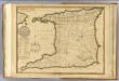
Trinidad.
1 : 180000 Robert Laurie & James Whittle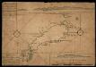
Map Of Tobago Showing Native Dwellings
Map of Tobago as it was in the year 1756. Rocks and other obstructions off the coast are marked with crosses and the depth of the water in the harbours is shown in fathoms. The names of the larger bays are given in both English and French. Along the upper edge of the map is a coastal view of the north east of the island and along the lower edge is the coast line of the south west. The map carries the annotations, ?On this Rock his Majesty's Ship Chesterfield Struck having XV Fathom the Cast Before. Anno 1749.? and ?The French Fort Burnt in 1749.?
Tobago.
1 : 164736 Lucas, Fielding Jr.
Grenada.
1 : 105600 Lucas, Fielding Jr.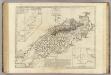
Tobago from actual surveys and observations.
1 : 63360 Ross, David
Carte de l'Isle de la Grenade cédée a la Grand Bretagne par le dernier traité de paix : Grenada divided into its parishes : surveyed by order of his excellency Governor Scott
1 : 70000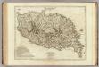
Carte de l'Isle de la Grenade. Grenada divided into its parishes.
1 : 70000 Jefferys, Thomas
Bequia or Becouya, the northernmost of the Granadilles.
1 : 23300 Jefferys, Thomas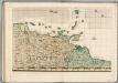
A Map of the British Empire in America. (Sheet 20).
1 : 2000000 Popple, Henry