Maps of Trinidad

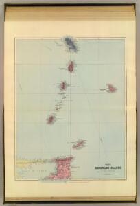
Windward Islands.
1 : 887040 Stanford, Edward
Map of the Windward Islands.
1 : 887040 Arrowsmith, John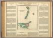
Windward Islands.
1 : 2100000 Lea, I.
Carte des Antilles francoises et des isles voisines
1 : 870000
Tabula novissima atque accuratissima Caraibicarum insularum sive Cannibalum, quae etiam Antillae Gallicae dicuntur, item insulae Supraventum, et in Archipelago Mexicano sitae sunt, ac detectae a Christ. Columbo Ao. MCCCCLXXXXIII
1 : 960000
Antilles Francoises, isles voisines.
1 : 890000 L'Isle, Guillaume de, 1675-1726
Antilles Francoises, isles voisines.
1 : 890000 L'Isle, Guillaume de, 1675-1726
A map of the islands of St. Lucia and Martinique, with part of Dominica and St. Vincents, shewing the two passages between Martinique and St. Lucia, and Martinique and Dominica, to Fort Royal Bay and harbour, the station of the French fleets ...
1 : 1
Tobago; Barbados.
1 : 338000 Peterson, Augusts
Tobago from actual surveys and observations
1 : 63360
British Possessions on the North East Coast of South America.
Fullarton, A. & Co.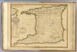
Trinidad.
1 : 180000 Robert Laurie & James Whittle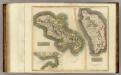
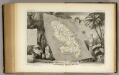
Martinico, Dominica.
1 : 200000 Thomson, John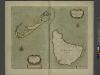
The Iland of BARBADOS
from The sea-atlas : containing an hydrographical description of most of the sea-coasts of the known parts of the world.
Trinidad.
1 : 823680 Lucas, Fielding Jr.

Martinico.
1 : 167366 Lucas, Fielding Jr.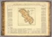
Martinique.
1 : 235000 Buchon, J. A. C.; Carey, H. C.; Lea, I.
Novissima et Acuratissima Barbados. Descriptio per Johannem Ogiluium Cosmographum Regium
from America: being the latest, and most accurate description of the Nevv vvorld; containing the original of the inhabitants, and the remarkable voyages thither. The conquest of the vast empires of Mexico and Peru, and other large provinces and territories, with the several European plantations in those parts. Also their cities, fortresses, towns, temples, mountains, and rivers. Their habits, customs, manners, and religions. Their plants, beasts, birds, and serpents. With an appendix, containing, besides several other considerable additions, a brief survey of what hath been discover'd of the vnknown south-land and the Arctick region. Collected from most authentick authors, augmented with later observations, and adorn'd with maps and sculptures, by John Ogilby ...
Insula Matanino Vulgo Martanico [Karte], in: Novus atlas absolutissimus, Bd. 9, S. 71.
1 Karte aus Atlas Janssonius Offizin
INSULA MATANINO Vulgo MARTANICO
1 : 130000 Martinik Visscher, Nicolaus in lucem edita per Nicolaum Visscher
Insula Matanino vulgo Martanico
1 : 125000 in lucem edita per Nicolaum Vischer [Amsterdam] : nunc apud P. Schenk Jun.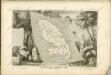
Colonies Francaises Martinique.
1 : 278000 Levasseur, Victor.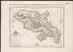
Carte de I'isle de la Martinique colonie Francoise de l'une des isles Antilles de l'Amérique
1 : 183333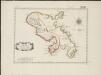
L'isle de la Martinique, scituée a 14 degrez 30 minutes de latitude septentrionale
1 : 216000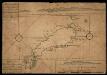
Map Of Tobago Showing Native Dwellings
Map of Tobago as it was in the year 1756. Rocks and other obstructions off the coast are marked with crosses and the depth of the water in the harbours is shown in fathoms. The names of the larger bays are given in both English and French. Along the upper edge of the map is a coastal view of the north east of the island and along the lower edge is the coast line of the south west. The map carries the annotations, ?On this Rock his Majesty's Ship Chesterfield Struck having XV Fathom the Cast Before. Anno 1749.? and ?The French Fort Burnt in 1749.?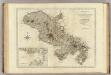
Martinico.
1 : 150000 Jefferys, Thomas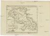
CHARTE von der Westindischen Insel MARTINIQUE
1 : 350000 Martinik Pluth, Fr.