Maps of Trinidad

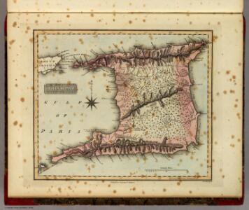
Trinidad.
1 : 823680 Lucas, Fielding Jr.
Trinidad.
1 : 180000 Robert Laurie & James Whittle
British Possessions on the North East Coast of South America.
Fullarton, A. & Co.
Tobago from actual surveys and observations
1 : 63360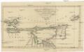
Charte von den Inseln TRINIDAD, TABAGO und MARGARETHA, dem Busen von PARIA, und einem Theile von CUMANA
1 : 1900000 Trinidad a Tobago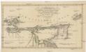
Charte von den Inseln Trinidad, Tabago und Margaretha, dem Busen von Paria, und einem Theile von Cumana
1 : 1900000 Trinidad a Tobago
Facsimile: Part of Northern Coast of South America by Jefferys.
1 : 1540000 Jefferys, Thomas
Facsimile: Part of Chart of the Guiana Coast by Jefferys.
1 : 1510000 Jefferys, Thomas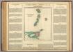
Windward Islands.
1 : 2100000 Lea, I.
Drainage Basins.
1 : 2027520 Venezuela-British Guiana Boundary Commission
European Occupation in 1597.
1 : 2027520 Venezuela-British Guiana Boundary Commission
Boundaries Claimed or Proposed.
1 : 2027520 Venezuela-British Guiana Boundary Commission
European Occupation in 1803 (1814).
1 : 2027520 Venezuela-British Guiana Boundary Commission
European Occupation in 1756.
1 : 2027520 Venezuela-British Guiana Boundary Commission
European Occupation in 1796.
1 : 2027520 Venezuela-British Guiana Boundary Commission
European Occupation in 1674.
1 : 2027520 Venezuela-British Guiana Boundary Commission
European Occupation in 1703.
1 : 2027520 Venezuela-British Guiana Boundary Commission
European Occupation in 1773.
1 : 2027520 Venezuela-British Guiana Boundary Commission
European Occupation in 1648.
1 : 2027520 Venezuela-British Guiana Boundary Commission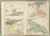
(Provincias de Margarita, Cumana, Barcelona, Guayana)
1 : 1300000 Codazzi, Agustin, 1793-1859
European Occupation in 1724.
1 : 2027520 Venezuela-British Guiana Boundary Commission
Grand View of European Occupation, 1597-1803 (1814).
1 : 2027520 Venezuela-British Guiana Boundary Commission
European Occupation in 1626.
1 : 2027520 Venezuela-British Guiana Boundary Commission
Facsimile: Guiana by Blaeuw.
1 : 7100000 Blaeuw, William
Partie, Colombie. Amer. Merid. 3.
1 : 1641836 Vandermaelen, Philippe, 1795-1869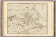
The coast of Caracas, Cumana, Parla and the mouths of Rio Orinoco.
1 : 1560000 Jefferys, Thomas
Facsimile: Surinam by Popple.
1 : 3787000 Popple, Henry
A CHART OF THE ANTILLES, or, CHARIBBE, or, CARIBS ISLANDS, WITH THE VIRGIN ISLES
This chart by cartographer L. S. de la Rochette (1731 ? 1802) was engraved by William Palmer and published by 'geographer to the King' William Faden in 1784. There is a compass rose at the centre of a network of rhumb lines (for sailing directions) and a smaller scale map of the region is inset at top right showing distances between the islands, sailing routes and a table recording latitude and longitude of each island. Down the right side of the map are represented the profiles of the headlands of the different islands- this is as they would appear to sailors from the sea. La Rochette. Cartographer.
CANIBALES | INSVLÆ.
[Amsterdam : Joan Blaeu]