Maps of Venezuela

Mapa de Venezuela ... guerra de independencia.
1 : 5300000 Codazzi, Agustin, 1793-1859
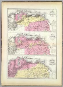
Mapa politico de Venezuela, antes 1810, 1840.
1 : 5300000 Codazzi, Agustin, 1793-1859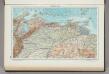
226. Venezuela, North. The World Atlas.
1 : 3750000 USSR (Union of Soviet Socialist Republics).
A Map of the British Empire in America. (Sheet 20).
1 : 2000000 Popple, Henry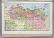
Venezuela.
1 : 3743000 Hammond, C.S.
Der Orenoco
Orinoko-oblast (Venezulea a Kolumbie) Löwenberg, J. J. Löwenberg
Venezuela, cum parte Australi Novae Andalusiae. [Karte], in: Gerardi Mercatoris et I. Hondii Newer Atlas, oder, Grosses Weltbuch, Bd. 2, S. 401.
1 Karte aus Atlas Mercator, Gerhard und Hondius, Jodocus Jansson, Jan
Venezuela, cum parte Australi Novae Andalusiae. [Karte], in: Novus Atlas, das ist, Weltbeschreibung, Bd. 2, S. 337.
1 Karte aus Atlas Blaeu, Joan Blaeu, Willem Janszoon

Venezuela, cum parte Australi Novae Andalusiae. [Karte], in: Theatrum orbis terrarum, sive, Atlas novus, Bd. 2, S. 343.
1 Karte aus Atlas Blaeu, Joan Blaeu, Willem Janszoon
Ecuador, Granada, Venezuela, Brazil, Guayana.
1 : 6900000 Society for the Diffusion of Useful Knowledge (Great Britain)
Venezuela, cum parte Australi Novae Andalusiae. [Karte], in: Novus atlas absolutissimus, Bd. 6, S. 237.
1 Karte aus Atlas Janssonius Offizin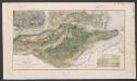
Venezuela, cum parte Australi Novae Andalusiae. [Karte], in: Le théâtre du monde, ou, Nouvel atlas contenant les chartes et descriptions de tous les païs de la terre, Bd. 2, S. 332.
1 Karte aus Atlas Blaeu, Willem Janszoon und Blaeu, Joan Blaeu, Willem Janszoon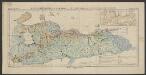
Nördliches Venezuela
1 : 3000000 Sievers, Wilhelm Justus Perthes
VENEZVELA, | cum parte Australi | NOVÆ ANDALVSIÆ
[Amsterdam : Joan Blaeu]
A Map of the British Empire in America. (Sheet 19).
1 : 2000000 Popple, Henry
Orinoco.
1 : 2650000 Restrepo, Jose Manuel, 1781-1863
Partie, Colombie. Amer. Merid. 2.
1 : 1641836 Vandermaelen, Philippe, 1795-1869
The coast of Caracas, Cumana, Parla and the mouths of Rio Orinoco.
1 : 1560000 Jefferys, Thomas
Partie, Colombie. Amer. Merid. 3.
1 : 1641836 Vandermaelen, Philippe, 1795-1869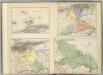
(Provincias de Margarita, Cumana, Barcelona, Guayana)
1 : 1300000 Codazzi, Agustin, 1793-1859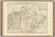
The coast of Tierra Firma from Cartagena to Golfo Triste.
1 : 1560000 Jefferys, Thomas
European Occupation in 1648.
1 : 2027520 Venezuela-British Guiana Boundary Commission
Facsimile: Guiana by Blaeuw.
1 : 7100000 Blaeuw, William
European Occupation in 1773.
1 : 2027520 Venezuela-British Guiana Boundary Commission
European Occupation in 1703.
1 : 2027520 Venezuela-British Guiana Boundary Commission
Grand View of European Occupation, 1597-1803 (1814).
1 : 2027520 Venezuela-British Guiana Boundary Commission
European Occupation in 1626.
1 : 2027520 Venezuela-British Guiana Boundary Commission
European Occupation in 1674.
1 : 2027520 Venezuela-British Guiana Boundary Commission