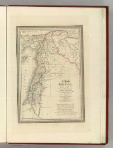
Maps of Syria

Syriae.
1 : 2400000 Vivien de St Martin, L.
Syria.
1 : 3801600 Tallis, J. & F.
Die sogenannten Missionen der Central-TürkeiDas Gebiet der Nestorianer

Ancient Syria to Sinai.
1 : 2200000 Society for the Diffusion of Useful Knowledge (Great Britain)
Syria.
1 : 6500000 Fenner, Rest.
Die Reiche der Kreuzfahrer um 1142
Kreuzfahrerstaaten
Syria to Sinai.
1 : 2200000 Society for the Diffusion of Useful Knowledge (Great Britain)
Ancient Syria
1 : 2200000 Blízký východ Hughes, William Chapman & Hall
Carte de la Syrie
Nouvel atlas physique politique et historique de l'Empire ottoman et des états limitrophes en Europe, en Asie et en Afrique, en quarante feuilles Hellert, J.J. Bellizard, Dufour et Cie
Die Reiche der Kreuzfahrer um 1142
Levante, Kreuzfahrerstaaten
Syria
1 : 2200000 Hughes, William, 1817-1876 George Cox
Syrie et de la Palestine, 624 ans apres J.C.
1 : 3300000 Houze, Antoine Philippe
Syrien und die angraenzenden Laender zur Zeit der Kreuzzuge.
1 : 3000000 Spruner von Merz, Karl
Syriæ, sive Soriæ : nova et accurata descriptio
1 : 1300000 Annotatie: Kaart vervaardigd in ca. 1658; Kaart uitg. tussen ca. 1658-ca. 1680; Origineel is Blad 182 in atlas factice; Annotatie geografische gegevens: Schaalstokken op kaart: 15 Milliaria Germanica Communia (=8,3 cm), en: 20 Milliaria Gallica Communia (=8,3 cm) Johannes Janssonius 1588-1664 Amstelodami : sumptibus Ioannis Ianssonii
Syrie et Palestine. Asie 63.
1 : 1641836 Vandermaelen, Philippe, 1795-1869
Feuille No. 9, uit: Carte de la Turquie d'Asie (moins l'Arabie) / dessiné et héliogravé au Service géographique de l'Armée
1 : 1000000 titelvariant: Turquie d'Asie; Annotatie: Titel boven de kaart: Turquie d'Asie; Bl. genummerd 1-4 en 7-10; Met lijst van de meest gebruikte woorden op de kaart vertaald uit het Turks, Arabisch en Perzisch; Annotatie geografische gegevens: Inzetkrt. op bl. 9: Plan de Jérusalem et de ses environs, Plan d'Alep, Plan de Damas et de ses faubourgs, Plan de Beyrout et de ses environs (alle 1:50.000) Service géographique de l'Armée [S.l. : Service géographique de l'Armée]
Syriae. Sive Soriae. Nova et Accurata descriptio. [Karte], in: Novus atlas absolutissimus, Bd. 6, S. 105.
1 Karte aus Atlas Janssonius Offizin
[Levante, Kurdistan]
1 : 1500000 Osmanisches Reich, Levante
Ancient and Modern Syria.
1 : 1770000 Playfair, Principal
La nvova et esatta descrittione della Soria, e della Terra Santa
Kypr Forlani, Paolo da Paulo Furlani Veronese
Terre Sainte en 1839.
1 : 3300000 Houze, Antoine Philippe
Palaestina
Grosser Hand-Atlas über alle Theile der Erde in 170 Karten Meyer, J. Verlag des Bibliographischen Instituts
Terre Sainte, pendant la premiere croisade de 1096 a 1144.
1 : 3300000 Houze, Antoine Philippe
Palaestina.
1 : 1140000 Flemming, Carl
Iudaea seu Terra Sancta quae Hebraeorum sive Israelitarum in suas duodecim Tribus divisa; secretis ab invicem Regnis Iuda, et Israel [...] [Karte], in: Atlas nouveau, contenant toutes les parties du monde [...], Bd. 2, S. 212.
1 Karte aus Atlas Sanson, Nicolas Jaillot, Alexis Hubert und Mortier, Pieter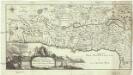
Carte de la Terre Promise
1 : 1600000 Izrael
Palestine
1 : 1000000 Colton, G.W.
Terra Sancta XXIII. Nova Tabula. [Karte], in: Claud. Ptolemaeus. Geographia lat. cum mappis [...], S. 431.
1 Karte aus Atlas Münster, Sebastian [und Ptolemaeus, Claudius]
Terre Sainte depuis la deuxieme croisade.
1 : 3300000 Houze, Antoine Philippe