Maps of British Columbia
British North America. Sheet III. Pacific Coast.
1 : 2407680 Fullarton, A. & Co.
British Columbia.
1 : 2500000 John Bartholomew and Son
British Columbia.
1 : 2408000 Rand McNally and Company
British Columbia.
1 : 2851000 Rand McNally and Company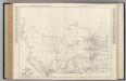
Alberta. British Columbia.
Rand McNally and Company
British Columbia. Historical Maps.
1 : 3787000 Hammond, C.S.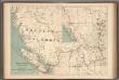
No.13, Telegraphs : British Columbia, Yukon and Alberta
1 : 2217600 Canada. Department of Interior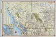
Shell British Columbia - Alberta.
1 : 2471040 Shell Oil Company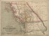
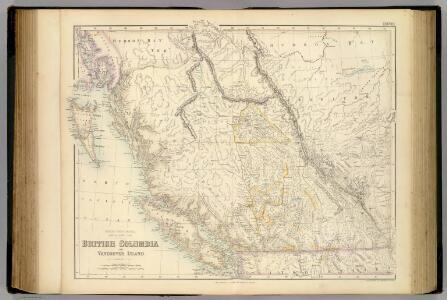
Philip’s Map of British Columbia and Vancouver Island
Philip's Map of British Columbia and Vancouver Island.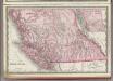
British Columbia.
1 : 2400000 Rand McNally and Company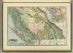
British Columbia.
1 : 2400000 Rand McNally and Company
Map Of The Grand Trunk Pacific Railway In British Columbia.
1 : 1250000 Grand Trunk Pacific Railway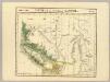
Partie, Nouvelle Hanovre. Amer. Sep. 31.
1 : 1641836 Vandermaelen, Philippe, 1795-1869
Rand McNally Official 1925 Auto Trails Map British Colombia.
1 : 1077120 Rand McNally and Company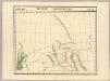
Nouveau Cornouailles. Amer. Sep. 24.
1 : 1641836 Vandermaelen, Philippe, 1795-1869
Cote NO, l'Amerique 4.
1 : 1500000 Vancouver, George, 1757-1798
The Coast of N.W. America.
1 : 915000 Vancouver, George, 1757-1798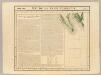
Ile de la Reine Charlotte. Amer. Sep. 30.
1 : 1641836 Vandermaelen, Philippe, 1795-1869
Facsimile: Vancouver's Chart of Coast of Northwest America.
1 : 1340000 Vancouver, George
Facsimile: British Columbia and Northwest Territory (portion).
1 : 2850000 Dawson Brothers
Alberta.
1 : 2438000 Hammond, C.S.
Origin of the population 1911: British Columbia and Alberta
1 : 2217600 Chalifour, J.E.
Cote NO, l'Amerique 3.
1 : 1500000 Vancouver, George, 1757-1798
The Coast of N.W. America.
1 : 1030000 Vancouver, George, 1757-1798
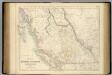
Map of the Gold Regions of the Frazer River and the Washington Territory on the Western Coast of America. By J. Wyld
Map of the Gold Regions of the Frazer River and the Washington Territory on the Western Coast of America. By J. Wyld. London
Facsimile: British Columbia and Vancouver Island (portion).
1 : 2400000 Arrowsmith, John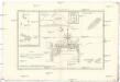
Isles de la Reine Charlotte
1 : 3220000 Ostrovy královny Charlotty (Britská Kolumbie) Bonne, Rigobert André
Facsimile: Russian Chart.
1 : 880000 Alaskan Boundary Tribunal
Facsimile: Cordova Bay to Cross Sound. Part of British Admiralty Chart. No. 2431.
1 : 530000 British Admiralty