Maps of Prince of Wales-Hyder

Facsimile: Russian Chart.
1 : 880000 Alaskan Boundary Tribunal
Facsimile: Cordova Bay to Cross Sound. Part of British Admiralty Chart. No. 2431.
1 : 530000 British Admiralty
Ketchikan
1 : 250000
Ketchikan
1 : 250000
Ketchikan
1 : 250000
Ketchikan
1 : 250000
Ketchikan
1 : 250000
Ketchikan
1 : 250000
Ketchikan
1 : 250000
Facsimile: Russian Map of Southern Half of the Koloshenski Archipelago.
1 : 510000 Hydrographic Department, Ministry of Marine
Craig
1 : 250000
Craig
1 : 250000
Craig
1 : 250000
Craig
1 : 250000
Craig
1 : 250000
Craig
1 : 250000
Craig
1 : 250000
Sheet No. 4. (Portland Canal, Behm Canal).
1 : 160000 Alaskan Boundary Tribunal
Sheet No. 6. (Clarence Strait, Kasaan Bay, Wales Island, Tlevak Strait).
1 : 160000 Alaskan Boundary Tribunal
Sheet No. 5. (Behm Canal, Revillagigedo Island, Clarence Strait, Nichol's Passage, Revillagigedo Channel, Cleveland Peninsula).
1 : 160000 Alaskan Boundary Tribunal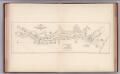
Facsimile: Portland Canal - Admiralty Survey.
1 : 206000 British Admiralty
Facsimile: Port Simpson to Nass Village - Admiralty Survey.
1 : 247000 British Admiralty
Facsimile: Observatory Inlet - Admiralty Survey.
1 : 223000 British Admiralty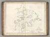
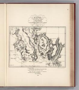
Entrance to the Port of Bucarelli.
1 : 120000 La Perouse, Jean-Francois de Galaup, comte de, 1741-1788
Sheet No. 3. (Dixon Entrance, Cordova Bay, Prince of Wales Island).
1 : 160000 Alaskan Boundary Tribunal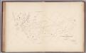
Facsimile: Northwest Shore of Portland Inlet - U.S. Coast Survey.
1 : 90000 Nichols, H.E.
Prince Rupert D-5
1 : 63360
Prince Rupert D-5
1 : 63360
Prince Rupert D-2
1 : 63360
Dixon Entrance D-2
1 : 63360
Dixon Entrance D-5
1 : 63360
Dixon Entrance D-5
1 : 63360