Maps of Arlit

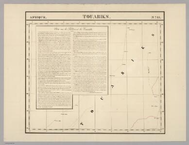
Touariks. Afrique 15.
1 : 1641836 Vandermaelen, Philippe, 1795-1869
Africa 1:2.000.000, Fezzan
Fezzan, Libya
Algérie
1 : 3500000 Alžírsko Gouvernement général de l'Algérie, Service cartographique
Algérie
1 : 3500000 Alžírsko Gouvernement général de l'Algérie, Service cartographique
Algérie
1 : 7000000 Alžírsko SCGGA
Spezial - karte von AfricaSektion Central-Sahara (2)
1 : 4000000 1 full d'1 mapa en 10 fulls i estoig Hermann Habenicht; Justus Perthes
Afrika
1 : 7500000 Afrika severozápadní Domann, Bruno Justus Perthes
Carte des fuseaux horaires de l'Afrique occidentale française
1 : 6000000
Spezial-Karte von Afrika
1 : 4000000 Blatt 2 Habenicht, Hermann Perthes
North-west Africa.
1 : 5000000 John Bartholomew and Son
Algérie, Tunisie et Sahara central, pour servir particulièrement à l'intelligence des évenements actuels et notamment à suivre les deux explorations du colonel Flatters
1 : 5000000 Barbier, Joseph-Victor 1840-1898 Nancy : Albert Barbier
Région saharienne française
1 : 4000000 Niox, Gustave-Léon 1840-1921 Paris : Ch. Delagrave
Lybia (Tripolitania y Cyenaica)
Libya (Tripolitania and Cyenaica), ADI (Maps) AM 180. [S.l.] : Air Ministry, United Kingdom, [19--]
An accurate map of west Barbary, including Suse & Tafilelt, forming the dominions of the present emperor of Marocco
Maroko Jackson, James Grey Neele, Samuel John G. & W. Nicoll
Carte de l'Afrique occidentale française. Zinder
1 : 2000000 France. Service géographique des colonies [Paris] : Service géographique des colonies
Haut-Sénégal et Niger. Partie occidentale du territoire militaire
1 : 1500000 Afrique occidentale française. Service géographique [Paris] : Gugelmann
Kidal. Edition provisoire (Afrique)
1 : 1000000 Afrique occidentale française. Service géographique Paris : Service géographique de l'Afrique Occidentale Française
Aegypten.
1 : 3000000 Radefeld, Carl Christian Franz, 1788-1874
Afrique occidentale française
1 : 2500000 Francouzská západní Afrika Service géographique de l'Afrique occid[enta]le franç[ai]se
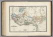
Barbarie.
1 : 17200000 Delamarche, Charles Francois; Lattre, Jean
Barbarie.
1 : 12300000 Malte-Brun, Conrad, 1775-1826
Sahara occidental et central
1 : 4000000 Afrika severozápadní Meunier, Alexandre imp. photo-métallo Millet
Northern Africa.
1 : 5300000 Pinkerton, John, 1758-1826
CHARTE von NORD-AFRICA
1 : 10090000 Afrika severní
Charte von Nord-Africa
1 : 10090000 Afrika severní
Cuba. Amer. Sep. 67.
1 : 1641836 Vandermaelen, Philippe, 1795-1869
Afrique Occidentale.
1 : 2700000 Montemont, A.
Routes de caravanes du Sahara Occidental
1 : 8000000 Soller, Charles; Société de géographie commerciale de Paris Paris : Société de Géographie Commerciale de Paris