Maps of Agadez
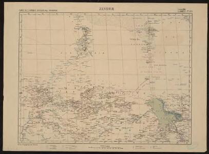
Carte de l'Afrique occidentale française. Zinder
1 : 2000000 France. Service géographique des colonies [Paris] : Service géographique des colonies
Lac Tchad. Afrique 22.
1 : 1641836 Vandermaelen, Philippe, 1795-1869
Neueste Karte von Sudan und Guinea
Grosser Hand-Atlas über alle Theile der Erde in 170 Karten Meyer, J. Verlag des Bibliographischen Instituts
West Africa II.
1 : 5600000 Society for the Diffusion of Useful Knowledge (Great Britain)
Timbouctou. Afrique 21.
1 : 1641836 Vandermaelen, Philippe, 1795-1869
[Ohne Titel]

Touariks. Afrique 15.
1 : 1641836 Vandermaelen, Philippe, 1795-1869
Kidal. Edition provisoire (Afrique)
1 : 1000000 Afrique occidentale française. Service géographique Paris : Service géographique de l'Afrique Occidentale Française
Carte des colonies de l'A.O.F. Dosso
1 : 500000 Afrique occidentale française. Service géographique Paris : Blondel la Rougery
Carte des colonies de l'A.O.F. Tahoua
1 : 500000 Afrique occidentale française. Service géographique Paris : Blondel la Rougery
Die Bissagos Inseln und die englischen Niederlassungen Bulama u. Riogrande auf der Westküste von Afrika
Bissagos (Guinea-Bissau) Homann, Johann Baptist Leo Africanus
[Ústí řeky Gambie]
Gambie, řeka Homann, Johann Baptist Leo Africanus
Sudan, Guinea.
1 : 7250000 Radefeld, Carl Christian Franz, 1788-1874
Spezial - karte von AfricaSektion Central-Sudân (5)
1 : 4000000 1 full d'1 mapa en 10 fulls i estoig Hermann Habenicht; Justus Perthes
Afrique occidentale française
1 : 2500000 Francouzská západní Afrika Service géographique de l'Afrique occid[enta]le franç[ai]se
Senegambie, Soudan, Guinee Septentrionale.
1 : 8250000 Picquet, C.
Westliches Mittel-Africa, Senegambien, Sudan, Ober-Guinea und einen Theil der Sahara umfassend oder die Stufenländer des mittlern Africa's und Nordrand von Hochafrica
1 : 6000000 entworfen und gezeichnet von C.F. Weiland gestochen von K.J. Mädel sen. Weimar : Geographisches Institut
Routes de caravanes du Sahara Occidental
1 : 8000000 Soller, Charles; Société de géographie commerciale de Paris Paris : Société de Géographie Commerciale de Paris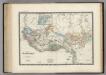
Senegambie, Soudan, Guinee.
1 : 8600000 Levasseur, E.
Westliches Mittel-Africa
1 : 6000000 Guinea Weiland, Karl Ferdinand Geograph. Instituts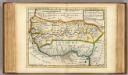
Negroland and Guinea.
1 : 15000000 Moll, Herman, d. 1732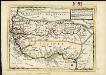
Negroland and Guinea, with the European settlements explaining what belongs to England, Holland, Denmark &c.
1 : 12500000
Senegambien
Afrique occidentale française
1 : 8000000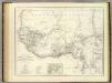
West. Mittel-Africa.
1 : 6000000 Weiland, C. F. (Carl Ferdinand), d. 1847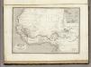
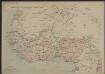
Afrique Occidentale.
1 : 2700000 Montemont, A.
[Kaart], uit: Carte Michelin Sahara / Michelin
1 : 4000000 titelvariant: Sahara Pneu Michelin, Paris Paris : Michelin
Africa Southern.
1 : 8000000 Hall, S. (Sidney)
Map of the Banso Area. Copied at the Kaiserl. Reg. St. Bamenda according to the Banso expedition map July 06. Dorsch.