Maps of Maharashtra

India 3.
1 : 2217600 Letts, Son & Co.
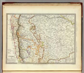
India III. Bombay Presidency.
1 : 2200000 Society for the Diffusion of Useful Knowledge (Great Britain)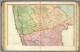
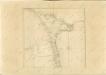
India peninsula N.
1 : 1300000 Faden, William, 1750?-1836
General Map of the Bombay Presidency

Bijapur Collectorate
Süd Mahratta
Atlas der evangelischen Missions-Gesellschaft zu Basel Locher; Gross, Rudolf Im Verlag des Comptoires der evangelischen Missions-Gesellschaft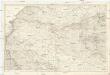
[India 1:250 000]
1 : 250000 Indie Survey of India Office
Plan of the Station and Town of Dharwar.
Huber, J.
Bombay and surrounding country
1 : 126720 Bombaj (Indie) Survey of India offices
Guide map of Ellora and Aurangabad caves
Survey of India offices
Bombay (Harbour) (1885)
India. West Coast. Bombay Harbour. Chiefly from surveys ... 1881-2. 1 sea mile[ = 50 mm] London : Admiralty
Bombay, No 47 B/13
India Office reference collection of maps Survey of India
Bombay
1 : 62000 Bombaj (Indie) Surveyor general of India
Plan von Bijapur.
Huber, J.
Secunderbad & Bolarum, 3 inch military map
India Office reference collection of maps Survey of India
Secundarabad & Bolarum
Secunderábád & Bolárum. Second edition. [Calcutta] : Survey of India Offices (P.L.O.)
Map of the Island of Bombay

India. West Coast(1935)
[India. West Coast. Port of Bombay. Surveyed ... 1892-3. Natural Scale, 1 : 12,100]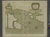
A new mapp of the Island of BOMBAY and SALLSET
from The sea-atlas : containing an hydrographical description of most of the sea-coasts of the known parts of the world.
Missions-Compound in Hubly und nächste Umgebung.
Huber, J.
Goa Indiae orientalis metropolis
Velha Góa (Indie) Hollar, Václav
Central division of Hindoostan
1 : 7000000 Cary, John, ca. 1754-1835 J. Cary
The Carnatic, Etc.
1 : 3380000 Sharpe, J.
Peninsula Indiæ citra Gangem, hoc est, orae celeberrimae Malabar & Coromandel cum adjacente insula non minus celebratissima Ceylon
1 Karte : Kupferdruck ; 53 x 47 cm L'Isle Homännische Erben
Composite: India peninsula.
1 : 1300000 Faden, William, 1750?-1836
Mysore State (Vishal Karnatak)

Ostindisches Missionsgebiet der evan.miss.gesellschaft in Basel

Mangalore und Aussenstationen
Breidenbach, M.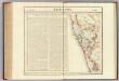
Bejapoor. Asie 102.
1 : 1641836 Vandermaelen, Philippe, 1795-1869