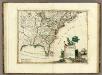
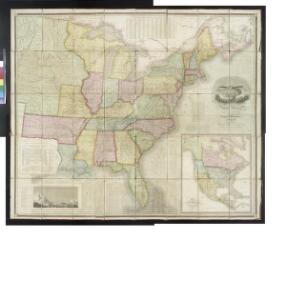
Maps of United States

Map of the United States of North America / compiled from the latest and most authentic information by David H. Vance ; engraved by J.H. Young.
from Whole
A map of Florida and ye Great Lakes of Canada / by Robt. Morden.
from Atlas terrestris / by Robt. Morden.
America Septentrionalis. A Map of the British Empire in America.
1 : 11000000 Popple, Henry
Amerikanisch-spanischer Kriegsschauplatz
1 : 7500000 Habenicht, Hermann Justus Perthes
A new map of ye north parts of America claimed by France : under ye names of Louisiana, Mississipi, Canada & New France with the adjoyning territories of England & Spain / By H. Moll, geographer.
from Charts and maps
Carte générale de l'Amérique séptentrionale: avec les posséssions Angloises dans cette partie du nouveau monde / dressée sur la carte de Pople [sic], publiée à Londres en 20 feuilles, pour servir à l'intelligence de la guerre présente.
from Whole Henry Popple,
A map of the British Empire in America: with the French, Spanish and Hollandish settlements adjacent thereto / by Henry Popple; I. Condet s.
from John H. Levine Collection Henry Popple; I. Condet s.,
Amerique septentrionale: suivant la carte de Pople faite à Londres en 20 feuilles.
from Charts and maps Par et chez le Sr. le Rouge ...: Paris; Lawson, Oscar A.; Le Rouge, Georges-Louis,
America Septentrionalis A Map of the British Empire in America.
1 : 11000000 Popple, Henry
Composite: British Empire in America.
1 : 2000000 Popple, Henry
A general map of North America : from the latest observations / J. Lodge sculp.
from The Constitutions of the several independent states of America; the Declaration of independence; the Articles of confederation between the said states; the treaties between His Most Christian Majesty and the United States of America. With an appendix, containing an authentic copy of the treaty concluded between Their High Mightinesses the States-General and the United States of America, and the provisional treaty. Pub. by order of Congress. Philadelphia printed. London reprinted, with an advertisement by J.L. de Lolme.
Map Of The United States And Mexico.
1 : 3540000 Stanford, Edward
A new map of North America with the West India Islands: divided according to the preliminary articles of peace, signed at Versailles, 20, Jan. 1783; wherein are particularly distinguished the United States and the several provinces, governments & ca. which compose the British dominions / laid down according to the latest surveys and corrected from the original materials of Goverr. Pownall, Membr. of Parliamt., 1783.
from Charts and maps Governor Pownall,
A Correct Map of the United States.
1 : 4850000 Lewis, Samuel

The United States of North America : with the British territories and those of Spain, according to the treaty of 1784 / engrav'd by Wm. Faden.
from John H. Levine Collection
Composite: North America.
1 : 5400000 Robert Laurie & James Whittle
Amerikanisch-Spanischer kriegsschauplatz
1 : 7500000
Composite: Amerique Septentrionale.
1 : 6300000 Anville, Jean Baptiste Bourguignon d, 1697-1782
United States.
1 : 1500000 Smith, J. Calvin
Composite: North America.
1 : 5400000 Jefferys, Thomas
Composite: A Map of the British Empire in America.
1 : 2000000 Popple, Henry
Regni Mexicani seu Novae Hispaniae, Ludovicianae, N. Angliae, Carolinae, Virginiae, Pensylvaniae, ... in America Septentrionali
from John H. Levine Collection
[Map of the United States, showing the proposed railroad routes from coast to coast, with table of distances, etc.]
from Whole s.n.: [N.Y.?],
Map of the United States, British & Central America : from state documents & unpublished materials
1 : 3540000
Map Of The United States Of America.
1 : 16526080 Colton, J. H.
Map of the United States of America, the British Provinces, Mexico, the West Indies and Central America, with part of New Granada and Venezuela
1 : 6400000 Colton, George Woolworth Colton, J. H. (Joseph Hutchins)
A new map of the north parts of America claimed by France under ye names of Louisiana, Mississipi, Canada and New France, with ye adjoyning territories of England and Spain ... / by H. Moll, geographer, 1720.
from Charts and maps Herman Moll,
A new map of the north parts of America claimed by France under ye names of Louisiana, Mississipi, Canada and New France, with ye adjoyning territories of England and Spain ... / by H. Moll, geographer, 1720.
from Charts and maps Herman Moll,