Maps of United States

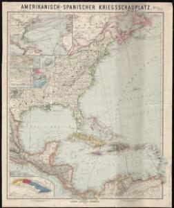
Amerikanisch-Spanischer kriegsschauplatz
1 : 7500000
A Correct Map of the United States.
1 : 4850000 Lewis, Samuel
A map of the British Empire in America: with the French, Spanish and Hollandish settlements adjacent thereto / by Henry Popple; I. Condet s.
from John H. Levine Collection Henry Popple; I. Condet s.,
Amerique septentrionale: suivant la carte de Pople faite à Londres en 20 feuilles.
from Charts and maps Par et chez le Sr. le Rouge ...: Paris; Lawson, Oscar A.; Le Rouge, Georges-Louis,
America Septentrionalis A Map of the British Empire in America.
1 : 11000000 Popple, Henry
Composite: British Empire in America.
1 : 2000000 Popple, Henry
Amerikanisch-spanischer Kriegsschauplatz
1 : 7500000 Habenicht, Hermann Justus Perthes
Composite: A Map of the British Empire in America.
1 : 2000000 Popple, Henry
Carte générale de l'Amérique séptentrionale: avec les posséssions Angloises dans cette partie du nouveau monde / dressée sur la carte de Pople [sic], publiée à Londres en 20 feuilles, pour servir à l'intelligence de la guerre présente.
from Whole Henry Popple,
America Septentrionalis. A Map of the British Empire in America.
1 : 11000000 Popple, Henry
Composite: North America, West India Islands.
1 : 5300000 Pownall, Thomas
A new map of North America with the West India Islands: divided according to the preliminary articles of peace, signed at Versailles, 20, Jan. 1783; wherein are particularly distinguished the United States and the several provinces, governments & ca. which compose the British dominions / laid down according to the latest surveys and corrected from the original materials of Goverr. Pownall, Membr. of Parliamt., 1783.
from Charts and maps Governor Pownall,
Composite: North America.
1 : 5400000 Robert Laurie & James Whittle
Regni Mexicani seu Novae Hispaniae, Floridae, Novae Angliae, Carolinae, Virginiae et Pensylvaniae necnon insularum archipelagi Mexicani in America Septentrionali
from Charts and maps
Composite: North America.
1 : 5400000 Jefferys, Thomas
Composite: Amerique Septentrionale.
1 : 6300000 Anville, Jean Baptiste Bourguignon d, 1697-1782
Map of the United States of America, the British provinces, Mexico, the West Indies and Central America, with part of New Granada and Venezuela / map drawn by Geo. W. Colton ; engraved by John M. Atwood ; border desig'd. & eng'd. by W. S. Barnard.
From Parts
A new map of the north parts of America claimed by France under ye names of Louisiana, Mississipi, Canada and New France, with ye adjoyning territories of England and Spain ... / ... laid down according to the newest and most exact observations by H. Mol
from The world described, or, A new and correct sett of maps : shewing the kingdoms and states in all the known parts of the earth, with the principal cities, and most considerable towns in the world ... / ... by Herman Moll, geographer ...

Regni Mexicani seu Novae Hispaniae, Ludovicianae, N. Angliae, Carolinae, Virginiae, Pensylvaniae, ... in America Septentrionali
from John H. Levine Collection
America septentrionalis
1 Karte : Kupferdruck ; 45 x 53 cm Janssonius excudit Ioannes Janssonius
America septentrionalis
1 Karte : Kupferdruck ; 45 x 53 cm Valck; Schenk penes Gerardum Valk et Petrum Schenk
Central America.
1 : 16600000 Sharpe, J.
Depths and temperatures observed in the western part of the North Atlantic Ocean
1 : 7000000 United States Coast Survey U.S. Coast Survey
Map of the United States of North America / compiled from the latest and most authentic information by David H. Vance ; engraved by J.H. Young.
from Whole
A map of Florida and ye Great Lakes of Canada / by Robt. Morden.
from Atlas terrestris / by Robt. Morden.
Map of the United States of America, the British Provinces, Mexico, the West Indies and Central America, with part of New Granada and Venezuela
1 : 6400000 Colton, George Woolworth Colton, J. H. (Joseph Hutchins)
Map Of The United States Of America.
1 : 16526080 Colton, J. H.
Mappa geographica regionem Mexicanam et Floridam terrasque adjacentes, ut et anteriores Americae insulas, cursus itidem et reditus navigantium versus flumen Missisipi et alias colonias ob oculos ponens
1 : 9300000 cura et sumptibus Tobiae Conradi Lotteri, Geographi Et Chalcographi Tob. Con. Lotter sculps. Augustae Vindel : [Tobias Conrad Lotter]