Maps of Carpathian Mountains

Ungarn u. seine Nebenländer vom Anfang des XIII Jahrhunderts bis zur Schlacht bei Mohacs 1526
1 : 3700000 Ungarn
Ungarn in seinen kirchlichen Verhältnissen vom Anfang des XIV Jahrh. bis zur Reformation
1 : 3700000 Ungarn Kirchengeschichte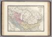
Dacie, Pannonie, Illyrie, Moesie Ancienne.
1 : 2886000 Levasseur, E.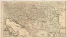
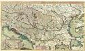
Regni Hungariae, et regionum, quae ei quondam fuere unitae, ut Transilvaniae, Valachiae, Moldaviae, Serviae, Romaniae, Bulgariae, Bessarabiae, Croatiae, Bosniae, Dalmatiae, Sclavoniae, Morlachiae, Ragusanae reipublicae maximaeq[ue] partis Danubii fluminis novissima delineatio
1 : 2100000 Besarábie (Moldavsko a Ukrajina) Wit, Frederick de ex officina Frederici de Wit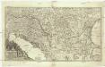
Augustissimi et invictissimi romanorum imperatoris haereditarium regnum Hungaria
1 : 2000000 Besarábie (Moldavsko a Ukrajina) Sedlmeyer, Ioannis Pauli Heckenauer, Jakob Wilhelm J. P. Sedlmeyer
Theatrum Belli Russo-Turcici
1 : 2100000 Mollova mapová sbírka Probst, Johann Michael
Ungarn und seine Nebenlande vom Regierungs-Antritte des Hauses Anjou bis zur Schlacht von Mohacs 1526.
1 : 3800000 Spruner von Merz, Karl
90-91. Danube Countries. The World Atlas.
1 : 2500000 USSR (Union of Soviet Socialist Republics).
Totius Regni Hungariae maximaeque partis Danubii fluminis, una cum adjacentibus et finitimis regionibus novissima delineatio / per Nicolaum Visscher
1 : 2000000 Annotatie: Origineel is Blad 130 in atlas factice; Annotatie geografische gegevens: Met 2 schaalstokken Nicolaes Jansz. Visscher jr. 1649-1702 [Amsterdam : per Nicolaum Visscher]
Österreich-Ungarn. Staaten
1 : 9000000 Österreich-Ungarn Politische Geografie
Ungarn nach dem Ersten Weltkrieg
Ungarn Weltkrieg <1914-1918>, Grenze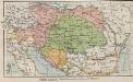
Österreich-Ungarn. Staaten
1 : 9000000 Österreich-Ungarn Verwaltungsgliederung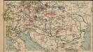
Österreich-Ungarn. Industrie und Verkehrswege
1 : 9000000 Österreich-Ungarn Industrie, Verkehrsnetz
Der Donauraum
1 : 1500000 Dunaj-oblast Justus Perthes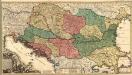
Novissima Tabula Regni Hungariae et Regionum quondam ei unitarum
1 : 2000000 Mollova mapová sbírka Ottens, Josua Keyser, Jacob Ottens, Josua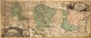
Danubius Fluviorum Europae Princeps
1 : 1600000 Mollova mapová sbírka Sandrart, Jakob von Sandrart, Jacob von
Karpaten-Länder
Donau-Karpaten-Gebiet
Österreich-Ungarn. Rumänien, Serbien, Montenegro, Bulgarien & Ost-Rumelien
Adolf Stieler's Handatlas über alle Theile der Erde und über das Weltgebäude Stieler, Adolf Justus Perthes
Composite: Austro-Hungarian Monarchy.
1 : 1642000 Johnston, W. & A.K.
Totius Regni Hungariae, Maximaeque Partis Danubii Fluminis, una cum adjacentibus et finitimis Regionibus Novissima Delineatio [Karte], in: Novus atlas absolutissimus, Bd. 2, S. 293.
1 Karte aus Atlas Janssonius Offizin
Prochaska ́s Neue Eisenbahnkarte von Österreich-Ungarn für 1898

Karte der politischen Justiz- und Militär- Verwaltungsbezirke im Kaiserthume Oesterreich
Evropa jihovýchodní Schnabel, Jiří Norbert Machek, A.
Österreich-Ungarn. Landwirtschaft und Fischerei
1 : 9000000 Österreich-Ungarn Landwirtschaft, Fischerei
Totius Regni Hungariae et adjacentium regionum tabula
1 : 2200000 Dunaj-oblast Visscher, Nicolaes Jansz.
Der Österreichische Kaiserstaat
Hand-Atlas über alle Theile der Erde und über das Weltgebäude Stieler, Adolf Justus Perthes
Karpatenländer, Flusz- & Gebirgskarte
1 : 6000000 Donau-Karpaten-Gebiet
Eisenbahn-Karte der oesterreichisch-ungarischen Monarchie
1 : 1228000 Budapešť (Maďarsko : oblast) Beer, Josef A. Hartleben
Theatrum Belli Russo-Turcici.
1 : 2100000 Mollova mapová sbírka Probst, Johann Michael Probst, Johann Michael
Österreich-Ungarn. Völker
1 : 9000000 Österreich-Ungarn Ethnische Gruppe