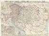
Maps of Carpathian Mountains

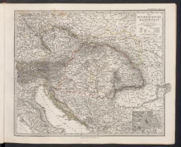
Der Österreichische Kaiserstaat
Hand-Atlas über alle Theile der Erde und über das Weltgebäude Stieler, Adolf Justus Perthes
Österreich-Ungarn. Rumänien, Serbien, Montenegro, Bulgarien & Ost-Rumelien
Adolf Stieler's Handatlas über alle Theile der Erde und über das Weltgebäude Stieler, Adolf Justus Perthes
Karte der wichtigsten Eisenbahnen Österreich-Ungarns und den angrenzenden Gebiete
1 : 6000000 Rakousko-Uhersko Rothaug, Johann Georg F. Tempsky
Österreich
Neuer Handatlas über alle Theile der Erde Kiepert, Heinrich Verlag von Dietrich Reimer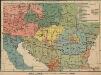
Österreich-Ungarn. Völker
1 : 9000000 Österreich-Ungarn Ethnische Gruppe
Osterreichisch. Ungarische Monarchie.
1 : 3700000 Vogel, C.
Die Donaustaaten
1 : 2500000 Dunaj-oblast Steinhauser, Anton Peucker, Karl Artaria
Die Donaustaaten
Oesterreich
Österreich-Ungarn
Artaria's Eisenbahnkarte
1 : 1500000 Evropa jihovýchodní Peucker, Karl Artaria
Artaria's Eisenbahn- u. Post-Communications-Karte v. Oesterreich-Ungarn
1 : 1745000 Rakousko-Uhersko Artaria
Die Donauländer
1 : 5000000 Österreich-Ungarn, Balkanhalbinsel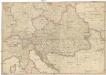
General Karte des Österreichischen Erb-Kaiserthums
1 : 2470000 Evropa jihovýchodní Mollo, Tranquillo T. Mollo
Uibersichts-Karte v. Oesterreich-Ungarn
1 : 2500000 Rakousko-Uhersko Steinhauser, Anton Artaria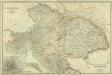
Composite: Austro-Hungarian Monarchy.
1 : 1642000 Johnston, W. & A.K.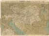
Prochaska ́s Neue Eisenbahnkarte von Österreich-Ungarn für 1898
Eisenbahn-Karte der oesterreichisch-ungarischen Monarchie
1 : 1228000 Budapešť (Maďarsko : oblast) Beer, Josef A. Hartleben
Karte der politischen Justiz- und Militär- Verwaltungsbezirke im Kaiserthume Oesterreich
Evropa jihovýchodní Schnabel, Jiří Norbert Machek, A.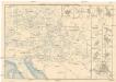
Eisenbahn-Routen-Karte für Österreich-Ungarn
Bratislava (Slovensko) Ritter, J. R. v. Waldheim
Eisenbahn-Routen-Karte für Österreich-Ungarn
Rakousko-Uhersko Ritter, J. R. v. Waldheim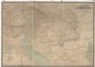
Hölzels Verkehrskarte von Österreich-Ungarn
1 : 800000 Rakousko-Uhersko Kallina, Leopold Hölzel, Eduard Ed. Hölzels geogr. Institut
Österreich-Ungarn, Staatenkarte
1 : 4500000 Österreich-Ungarn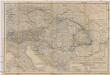
Oesterreichisch-ungarische Monarchie
1 : 2500000 Rakousko-Uhersko Geographisches Institut
Austrian Dominions.
1 : 3750000 Hughes, William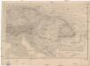
Kaiserthum Oesterreich
1 : 2500000 Rakousko-Uhersko Gräf, Carl Geographisches Institut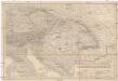
Kaiserthum Oesterreich
1 : 2500000 Rakousko-Uhersko Gräf, Carl Geographisches Institut
Kaiserthum Oesterreich
1 : 2500000 Evropa jihovýchodní Gräf, C. Geographisches Institut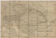
Kaiserthum Oesterreich
1 : 2500000 Evropa jihovýchodní Gräf, C. Geographisches Institut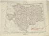
Übersichtblatt der Spezialkarte 1:75 000