Maps of Macedonia

H.8. Skoplje, uit: [Übersichtskarte von Europa 1:750.000]
1 : 750000 Wien : K.u.K. Militärgeographisches Institut
Karta Nove Srbije
1 : 1200000 Serbien Makedonien Bukarest / Friede <1913> Staatsgrenze Lazić, Ant.
Übersichtskarte der projectirten Eisenbahnlinie zwischen der Donau und Saloniki
1 : 1000000 Donau Eisenbahnnetz Hahn, Johann Georg von ; Kiepert, H.
Vilayet Prizren/Kosovo (1868-1913)
Kosovo Ejalet, Verwaltungsgliederung Zwick, J. ; Frantz, E.
Stellungen der Armeen vor und während der Schlacht an der Bregalnica (und unmittelbar nach derselben)
Makedonien Bregalnica-Gebiet Balkankrieg <1912-1913>
Izvod ot etnografskata karta na Mekenzi i Erbi
Makedonien Ethnische Gruppe
Demarkationslinie vor Beginn der Kriege gegen die Bulgaren
Südosteuropa Balkankrieg <1912-1913> Grenze
[Bălgarska zemja v Makedonija]
Makedonien Ethnische Gruppe Bulgaren
[Mazedonien]
Makedonien
Izvod ot etnografskata karta na Ležana
Makedonien Ethnische Gruppe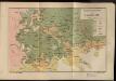
Etnografska karta na Makedonija
Makedonien Ethnische Gruppe
La Serbie de 1913
Serbien Geschichte
Karte der Flußgebiete des Drin und des Wardar
1 : 500000 Vardar-Gebiet Flusssystem Hahn, Johann Georg von
Atlas
Albanien
Národopisná mapka Macedonie
Makedonie Král z Dobré Vody, Vojtěch Kančov, Vasil
Carte ethnographique de la Macédoine, Point de vue bulgare
Makedonien Ethnische Gruppe Th. Weinreb del.
Carte ethnographique de la Macédoine, Point de vue serbe
Makedonien Ethnische Gruppe Th. Weinreb del.
[Mazedonien]
Makedonien
Ligne de partage d'après la carte annexée au traité d'alliance
Balkanhalbinsel Grenze Balkankrieg <1912-1913> Annexion
Ligne de partage d'après la carte annexée au Traité d'Alliance
Bulgarien Serbien Balkankrieg <1912-1913> Territorialer Anspruch Th. Weinreb del.
Novus Atlas
Albanien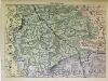
Süd-Serbien
1 : 800000 Serbien (Süd)
Übersichtskarte von Mittel - Europa

Atlas
Albanien
Charta tēs Ellados
Griechenland Albanien
Veles, Priština, Scutari
1 : 750000 Priština (Kosovo) Konrad, A. Erben, Fr. K. u. k. Militärgeographisches Institut
[Macedonien]
1 Karte : Kupferdruck ; 18 x 13 cm [Trattner]
Veles, Priština, Scutari
1 : 750000 Priština (Kosovo) Erben, Fr. K. u. k. Militärgeographisches Institut
Köprülü, Priština, Scutari
1 : 750000 Priština (Kosovo) Erben, Fr. K. u. k. militär-geographisches Institut
Köprülü, Priština, Scutari
1 : 750000 Priština (Kosovo) Erben, Fr. K. u. k. militär-geographisches Institut
![H.8. Skoplje, uit: [Übersichtskarte von Europa 1:750.000]](https://images-2.georeferencer.com/images/iiif/571998079586/full/,300/0/native.jpg)

