Maps of Thailand

[Overzichtskaart van den Oost-Indischen Archipel]. Bl. I
1 : 2500000 Annotatie: Overige bladen (II-VI) ontbreken [Batavia : Topographische Inrichting]
Farther India.
1 : 4000000 John Bartholomew & Co.
Nieuwe kaart van het eyland Sumatra
1 : 3000000 verb. door François Valentijn [S.l.] : J. van Braam et G. Onder de Linden exc.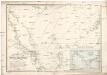
Reduzirte Karte vom Chinesischen Meere.
Jihočínské moře Berghaus, Heinrich Karl Wilhelm Horsburgh, James J. Perthes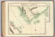
Partie de Camboge. Asie 110.
1 : 1641836 Vandermaelen, Philippe, 1795-1869
Geologische overzichtskaart van het schiereiland Malakka en omgeving = Geological map of British Malaya / J.B. Scrivenor
Landsdrukkerij Batavia [Weltevreden (Batavia) : Landsdrukkerij]
Sumatra North
Survey India Offices (H.L.O.) [S.l.] : Survey India Offices (H.L.O.)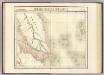
Presqu'ile de Malacca. Oceanique no. 12.
1 : 1641836 Vandermaelen, Philippe, 1795-1869
Kaart van Noord Sumatra : Gouvernement Atjeh en Onderhoorigheeden, Noordelijke gedeelten van de Res.n Tapanoeli en Sumatra's Oostkust, en de onafhankelijkeBatak Landen / [door J.W. Stemfoort en J.J. ten Siethoff ; gereproduceerd op last van het Departement van Koloniën, aan de Topographische Inrichting te 's-Gravenhage, onder leiding van den Directeur C.A. Eckstein]
Ministerie van Koloniën Den Haag s-Gravenhage : Departement van Koloniën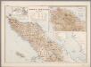
6. Noord Sumatra, uit: Atlas van Nederlandsch Oost-Indië / samengest. door Topographisch Bureau te Batavia van 1897-1904
Annotatie: Omgewerkte versie van: Atlas der Nederlandsche bezittingen in Oost-Indië / naar de nieuste bronnen samengest. door J.W. Stemfoort en J.J. ten Siethoff. - 's-Gravenhage : Topographische Inrichting, [ca. 1885] Topographisch Bureau, Batavia 's-Gravenhage : Topographische Inrichting
Indo-China and Siam 1:1,000,000, Geology (Sheet 3 - South)
Geology, Indo-China and Siam 1:1,000,000 , Series GSGS 4555A. Great Britain. Inter-service Topographical Dept. [S.l.] : Inter-Service Topographical Department
British Possessions In The Indian Seas.
Fullarton, A. & Co.
Carte routière de la Cochinchine et du Cambodge
1 : 1000000 Office local du tourisme au Cambodge Phnom-Penh : Société d'éditions Khmer
Schetskaart van het Rijk Atjeh en van de aangrenzende landstreken van Sumatra / Top[ographisch] Bureau ; lith. H.A.T. den Doop
Topographisch Bureau, Batavia [Batavia] : Top[ographisch] Bureau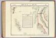
Isthme de Kraw. Asie 109.
1 : 1641836 Vandermaelen, Philippe, 1795-1869
Cultuurgebied Oostkust van Sumatra / uitgegeven door de A.V.R.O.S. ; herziening 1928-1929 door J.F.J. van Bijlevelt
Algemeene Vereeniging van Rubberplanters ter Oostkust van Sumatra (AVROS) [Medan] : A[lgemeene] V[ereeniging van] R[ubberplanters ter] O[ostkust van] S[umatra]
Rubber-estates on the east-coast of Sumatra
1 : 600000 [Verlag nicht ermittelbar]
Gouvernement Atjeh en Onderhoorigheden / bewerkt door het Encyclopaedisch Bureau, 1916
Encyclopedisch Bureau Batavia [Batavia] : Encyclopedisch Bureau
Overzichtskaart van Atjeh en Onderhoorigheden / Topographisch Bureau
Topographisch Bureau Batavia Batavia : Topographisch Bureau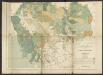
Carte forestière du Cambodge
1 : 1000000 Indochine. Inspection générale de l'agriculture, de l'élevage et des forêts [Hanoï ?] : Service géographique de l'Indochine
Automobielkaart van Noord-Sumatra / samengesteld en uitgegeven door de Koninklijke Vereeniging Java Motor Club
Koninklijke Vereeniging Java Motor Club Semarang Semarang : Koninklijke Vereeniging Java Motorclub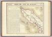
Partie, Sumatra. Oceanique no. 11.
1 : 1641836 Vandermaelen, Philippe, 1795-1869
North Sumatra : Tactical Pilotage Chart
[London] : Ministry of Defence United Kingdom
Medan / Survey of India
Survey of India [S.l.] : Survey of India
Singapore / Survey of India
Survey of India [S.l.] : Survey of India
Routekaart Medan - Pakanbaroe
[S.l. : s.n.
Kaart van het Gouvernement Oostkust van Sumatra : aangeboden door de Deli Spoorweg Maatschappij
Deli Spoorweg Maatschappij Medan [Medan] : Deli Spoorweg Maatschappij
Gouvernement Oostkust van Sumatra / Bewerkt door het Encyclopaedisch bureau 1917
Encyclopaedisch Bureau Batavia Bat[avia] : Top[ografische] Inr[ichting]
Overzichtskaart van den weg Medan-Padang / samengesteld door den Deli Automobiel Club
Deli Automobiel Club Medan [Medan] : Deli Automobiel Club
![[Overzichtskaart van den Oost-Indischen Archipel]. Bl. I](https://images-2.georeferencer.com/images/iiif/310103093611/full/,300/0/native.jpg)

