Maps of Pahang

Geologische overzichtskaart van het schiereiland Malakka en omgeving = Geological map of British Malaya / J.B. Scrivenor
Landsdrukkerij Batavia [Weltevreden (Batavia) : Landsdrukkerij]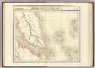
Presqu'ile de Malacca. Oceanique no. 12.
1 : 1641836 Vandermaelen, Philippe, 1795-1869
British Possessions In The Indian Seas.
Fullarton, A. & Co.
Singapore / Survey of India
Survey of India [S.l.] : Survey of India
[Malaka]
Topografische Dienst Batavia Batavia : Reproductiebedrijf Topografische Dienst
[P[oelau] Roepat]
Topografische Dienst Batavia Batavia : Reproductiebedrijf Topografische Dienst
Anambas Eilanden / Survey of India
Survey of India [S.l.] : Survey of India
Kaart van een gedeelte van Sumatra's Oostkust
Aardrijkskundig Genootschap Amsterdam Amsterdam : C.L. Brinkman
Pattani [Map of the Province of]
Map of the Province of Pattani. Scale, 1 : 320,000. Bangkok : Royal Survey Department
Gouv[ernemen]t Sumatra : Res[identie] Riouw / Topografische Dienst, Batavia
[S.l. : s.n.]
Bagan-siapiapi / published by War Office = uitgegeven door War Office ; revised and photolithographed by War Office
War Office Washington D.C. [Washington D.C.] : War Office
Port Dickson / prepared under the direction of the Chief of Engineers U.S. Army ; by the Army Map Service
Army map Service U.S. Army Washington D.C. [Washington D.C.] : Army Map Service
Schetskaart van Kota-Pinang

Poeak / published by War Office = uitgegeven door War Office ; revised and photolithographed by War Office
War Office Washington D.C. [Washington D.C.] : War Office
Terempah / samengesteld door den Topografischen Dienst (Kartogr[afische] Afd[eeling]) naar diverse gegevens in 1941
Topografische Dienst Batavia Batavia : Reproductiebedrijf Topografische Dienst
P[oelau] Djemadja / samengesteld door den Topografischen Dienst (Kartogr[afische] Afd[eeling]) naar diverse gegevens in 1941
Topografische Dienst Batavia Batavia : Reproductiebedrijf Topografische Dienst
Schetskaart van het Zelfbesturend Landschap Kota Pinang : behoorende tot de Afd[eeling] Asahan der Res[identie] O[ost] K[ust] van Sumatra
Encyclopaedisch Bureau Batavia [Batavia] : Encyclopaedisch Bureau
[Laboehanbilik] : opgenomen door den Topografischen Dienst in 1925-1926
Topografische Dienst Weltevreden (Batavia) Weltevreden (Batavia) : Reproductiebedrijf Topografische Dienst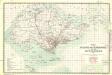
Singapore and its dependencies [Map of the isle] (1911)
Map of the island of Singapore and its dependencies, GSGS 2609. Great Britain. General Staff. Geographical Section. [London] : [GSGS, War Office]
[T[or] Si Kara-Kara] : opgenomen in 1904-1905 / Topographische Inrichting, Batavia 1908
Topographische Inrichting Batavia Batavia : Topographische Inrichting
[Kotapinang-Baroe] : opgenomen door den Topografischen Dienst in 1924-1926
Topografische Dienst Weltevreden (Batavia) Weltevreden (Batavia) : Reproductiebedrijf Topografische Dienst
[Batoepandjang] / opgenomen door den Topografischen Dienst in 1931-1932
Topografische Dienst Batavia Batavia : Reproductiebedrijf Topografische Dienst
[Poeak] / opgenomen door den Topografischen Dienst in 1932
Topografische Dienst Batavia Batavia : Reproductiebedrijf Topografische Dienst
[Langgapajoeng] : opgenomen door den Topografischen Dienst in 1924-1926
Topografische Dienst Weltevreden (Batavia) Weltevreden (Batavia) : Reproductiebedrijf Topografische Dienst
Binanga / prepared under the direction of the Chief of Engineers U.S. Army, 1943
Army Map Service U.S. Army Washington Washington D.C. : Survey Production Centre R.E.
[Oedjoeng Padang] : opgenomen in 1903-1905 / Topographische Inrichting, Batavia 1907
Topographische Inrichting Batavia Batavia : Topographische Inrichting
[Kebonbaroe] / opgenomen door den Topografischen Dienst in 1926-1927
Topografische Dienst Batavia Batavia : Reproductiebedrijf Topografische Dienst
[Langadai] / opgenomen door den Topografischen Dienst in 1926-1928
Topografische Dienst Batavia Batavia : Reproductiebedrijf Topografische Dienst
[Bagan-Siapiapi] / opgenomen door den Topografischen Dienst in 1926-1931
Topografische Dienst Batavia Batavia : Reproductiebedrijf Topografische Dienst


