Maps of Vologda

[IX], uit: Geognostische Karte des Oesterreichischen Kaiserstaates mit einem grossen Theile Deutschland's u. Italien / hauptsachlich nach ... Haidinger's geognostischer Karte dieses Staates bearb. von Josef Scheda
1 : 3000000 titelvariant: General-Karte von Europa in 25 Blättern; Annotatie: Bijlage bij: General-Karte von Europa in 25 Blättern. - 1:2.592.000. - 1845-1847 Scheda, Joseph Wien : K.K. Militär. Geografisch. Institut
Europäisches Russland
Hand-Atlas über alle Theile der Erde nach dem neuesten Zustande und über das Weltgebäude Stieler, Adolf bei Justus Perthes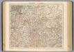
69-70. Russia centrale.
1 : 3000000 Touring club italiano
Vollstaendiger Kriegs-Schauplatz in Pohlen und Russland im Jahre 1812
1 : 2312000 Polsko im Kunst und Industrie Komptoir
[V]oll[st]and[i]ger Kriegs-Schauplatz in [P]o[h]len [und Rus]sland im Jahre [1]812
1 : 2312000 Polsko Kunst und Industrie Komptoir
Europäisches Russland
Hand-Atlas über alle Theile der Erde nach dem neuesten Zustande und über das Weltgebäude Stieler, Adolf bei Justus Perthes
Europäisches Russland
Stieler's Hand-Atlas Stieler, Adolf bei Justus Perthes
19-20. RSFSR (Russian Soviet Federated Socialist Republic) in Europe, Central. The World Atlas.
1 : 3000000 USSR (Union of Soviet Socialist Republics).
La Danimarca Svezia e Norvegia.
Dánsko Seutter, Matthäus Zatta, Antonio Zatta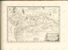

Plotnost' naselenīja ozernoj oblasti
Russland Russland (Nord) Bevölkerungsdichte Moračevskij, V.
Plemena ozernoj oblasti
Russland Russland (Nord) Ethnische Gruppe Stavrovskij, Ja.
Feuille 19 (E III), uit: Carte géologique internationale de l'Europe : la carte, votée au congrès géologique international de Bologne en 1881, est exécutée conformément aux décisions d'une commission internationale, avec le concours des gouvernements, sous le dir. de M.M. Beyrich et Hauchecorne
Annotatie: Blad 48 gamme des couleurs; blad 49: bladwijzer en titelblad Heinrich Ernst Beyrich 1815-1896; Wi. Hauchecorne Berlin : Reimer / (Berlin: Institut lithographique)
No.20. Karta Evropeyskaia Rossiia. Sheet 6
1 : 2000000 Shokalskago,Iu. M.
[Nordrussland ; Pferd]
Russland Russland (Nord) Landwirtschaft
Nedostajuščee količestvo prodovol'stvennago chlěba na dušu sel'skago naselenīja
Russland Russland (Nord) Ernährung Moračevskij, V.
Raspredělenie škol v ozernoj oblasti
Russland Russland (Nord) Schule Stavrovskij, Ja.
Rel'ef ozernoj oblasti
Russland Russland (Nord) Geografie Tillo, A. ; Šokal'skij, Ju.
[Nordrussland ; Pferd]
Russland Russland (Nord) Landwirtschaft
Počvy ozernoj oblasti
Russland Russland (Nord) Geografie Sibircev, K.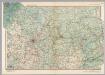
U.S.S.R. in Europe - Central. Pergamon World Atlas.
1 : 2500000 Polish Army Topography Service
Anfänge des Moskauer Reiches
1 : 8250000 Moskauer Reich
Raspredělenie lěsov i preděly rasprostranenīja někotorych porod derev'ev v ozernoj oblasti
Russland Russland (Nord) Geografie Bewaldung Il'in', N.
Geologičeskoe stroenīe ozernoj oblasti
Russland Russland (Nord) Geologie Geol. Komitet
Karta ozernoj oblasti
Russland Russland (Nord) Il'in', N.
[Nordrussland ; Vieh]
Russland Russland (Nord) Landwirtschaft
[Nordrussland ; Vieh]
Russland Russland (Nord) Landwirtschaft
Voenno-dorožnaja karta časti Rossii i pograničnych zemelʹ
1 : 1680000 Zentralrussland, Moskau Šubert [Generalmajor]
RVSSIÆ, | Vulgo MOSCOVIA dictæ, | Pars Occidentalis
Auctore Isaaco Maßa. [Amsterdam : Joan Blaeu]
![[IX], uit: Geognostische Karte des Oesterreichischen Kaiserstaates mit einem grossen Theile Deutschland's u. Italien / hauptsachlich nach ... Haidinger's geognostischer Karte dieses Staates bearb. von Josef Scheda](https://images-2.georeferencer.com/images/iiif/325035674257/full/,300/0/native.jpg)

