Maps of Polynesia

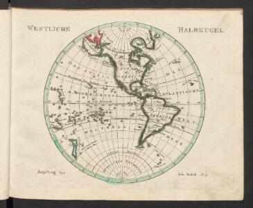
Westliche Halbkugel
Neuester Schul-Atlas Walch, Johann im Verlag bei Joh. Walch
Oestlicher Planiglob der Erde
1 : 17000000 Weimar : Verlag des Geographischen Instituts
Umriszhandkarte der Erde in Eckerts flächentreuer Projektion
1 : 90000000 Wagner, H. Verlag von H. Wagner u. E. Debes
Nova totius terrarum orbis tabula
1 : 80000000 auctore F. de Wit. t' Amsterdam : bij Frederick de Wit
General chart.
1 : 45000000 Roberts, Henry, Lieut.
Algemeene wereldkaart
1 : 75000000 C. van Baarsel en zoon del. et sculps. uitg. door de Maatschappij tot Nut van het Algemeen Te Leijden [etc.] : Du Mortier [etc.]
Beobachteten Werthe Der Declination.
1 : 130000000 Berghaus, Heinrich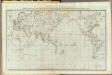
General chart Cook voyages.
1 : 45000000 Roberts, Henry, Lieut.
Kaart der oude waereld tot verstand van het XXI boek van den Geest der wetten
1 : 40000000 J.C. de Roeder delin. H. Klockhoff sculp. Te Amsterdam : bij Holtrop
Orbis Terrae Compendiosa Descriptio [Karte], in: Atlas, sive, Cosmographicae meditationes de fabrica mundi et fabricati figura, S. 62.
1 Karte aus Atlas Mercator, Gerhard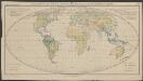
Verbreitung der wichtigsten Formationstypen der Erde
1 : 80000000 Schimper, Andreas Franz Wilhelm Gustav Fischer
Typus Orbis A Ptol. Descriptus [Karte], in: Claud. Ptolemaeus. Geographia lat. cum mappis [...], S. 251.
1 Karte aus Atlas Münster, Sebastian [und Ptolemaeus, Claudius]
Planisphère
1 : 57000000 Izarny-Gargas; France. Service géographique de l'armée [Paris] :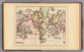
World Mercator proj.
1 : 97000000 Mitchell, Samuel Augustus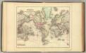
World Mercator proj.
1 : 97000000 Mitchell, Samuel Augustus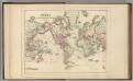
World Mercator proj.
1 : 97000000 Mitchell, Samuel Augustus Jr.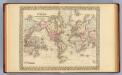
World Mercator proj.
1 : 100000000 Mitchell, Samuel Augustus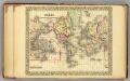
World.
1 : 95000000 Mitchell, Samuel Augustus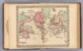
World Mercator proj.
1 : 100000000 Mitchell, Samuel Augustus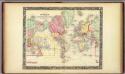
Map Of The World On The Mercator Projection.
1 : 100000000 Mitchell, Samuel Augustus
The world, on Mercator's projection
1 : 74000000 Burr, David H., 1803-1875 Published by J. Haven, 86 State St.
Allgemeine Ornitho- und Erpetologische Erdkarte.
1 : 130000000 Berghaus, Heinrich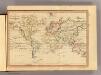
The World, Mercator's projection.
1 : 255000000 Fenner, Rest.
Routes par lesquelles les richesses metalliques.
1 : 160000000 Humboldt, Alexander von, 1769-1859
Chart of the world.
1 : 95000000 Bowen, Emanuel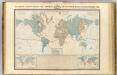
Systeme magnetique terrestre.
1 : 70000000 Garnier, F. A., 1803-1863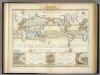
Windkarte der Erde.
1 : 100000000 Berghaus, Heinrich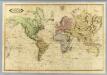
World.
1 : 51000000 Lizars, Daniel
Karte für die in den Jahren 1827-1831 Beobachteten Werthe der Declination
Erster Band, enthaltend in vier Abtheilungen die Erscheinungen der anorganischen Natur: 1. Meteorologie und Klimatographie. 2. Hydrologie und Hydrographie. 3. Geologie. 4. Tellurischer Magnetismus Humboldt, Alexander von Verlag von Justus Perthes