Maps of Polynesia
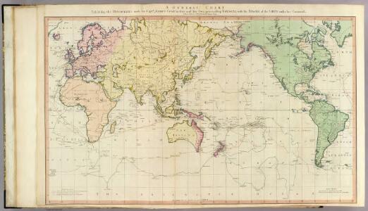
General chart.
1 : 45000000 Roberts, Henry, Lieut.
Algemeene wereldkaart
1 : 75000000 C. van Baarsel en zoon del. et sculps. uitg. door de Maatschappij tot Nut van het Algemeen Te Leijden [etc.] : Du Mortier [etc.]
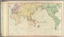
General chart Cook voyages.
1 : 45000000 Roberts, Henry, Lieut.
Orbis Terrae Compendiosa Descriptio [Karte], in: Atlas, sive, Cosmographicae meditationes de fabrica mundi et fabricati figura, S. 62.
1 Karte aus Atlas Mercator, Gerhard
Oestlicher Planiglob der Erde
1 : 17000000 Weimar : Verlag des Geographischen Instituts
Viaggio della R[a] Corvetta 'Vettor Pisani'
1 : 250500 Bruno e Salomone Stab. Lit. Bruno e Salomone
Östlicher Planiglob
Neuer Handatlas über alle Theile der Erde Kiepert, Heinrich Verlag von Dietrich Reimer
Karte für die in den Jahren 1827-1831 Beobachteten Werthe der Declination
Erster Band, enthaltend in vier Abtheilungen die Erscheinungen der anorganischen Natur: 1. Meteorologie und Klimatographie. 2. Hydrologie und Hydrographie. 3. Geologie. 4. Tellurischer Magnetismus Humboldt, Alexander von Verlag von Justus Perthes
Beobachteten Werthe Der Declination.
1 : 130000000 Berghaus, Heinrich
World, Mercator's projection.
1 : 82000000 Hall, S. (Sidney)
The World on Mercator's projection.
1 : 40000000 Pinkerton, John, 1758-1826
Orbis Terrae Compendiosa Descriptio [Karte], in: Gerardi Mercatoris Atlas, sive, Cosmographicae meditationes de fabrica mundi et fabricati figura, S. 58.
1 Karte aus Atlas Mercator, Gerhard Montanus, Petrus
Religious belief.
1 : 66000000 Johnston, Alexander Keith, 1804-1871
Mappemonde.
1 : 50000000 La Perouse, Jean-Francois de Galaup, comte de, 1741-1788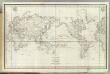
Mappemonde.
1 : 50000000 La Perouse, Jean-Francois de Galaup, comte de, 1741-1788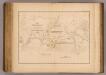
Currents, whaling grounds.
1 : 140000000 United States Exploring Expedition (1838-1842); Wilkes, Charles, 1798-1877
Planisphère
1 : 57000000 Izarny-Gargas; France. Service géographique de l'armée [Paris] :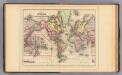
World Mercator proj.
1 : 97000000 Mitchell, Samuel Augustus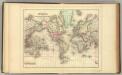
World Mercator proj.
1 : 97000000 Mitchell, Samuel Augustus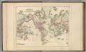
World Mercator proj.
1 : 97000000 Mitchell, Samuel Augustus Jr.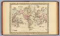
World Mercator proj.
1 : 100000000 Mitchell, Samuel Augustus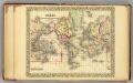
World.
1 : 95000000 Mitchell, Samuel Augustus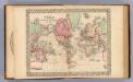
World Mercator proj.
1 : 100000000 Mitchell, Samuel Augustus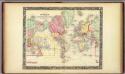
Map Of The World On The Mercator Projection.
1 : 100000000 Mitchell, Samuel Augustus
The world, on Mercator's projection
1 : 74000000 Burr, David H., 1803-1875 Published by J. Haven, 86 State St.
Allgemeine Ornitho- und Erpetologische Erdkarte.
1 : 130000000 Berghaus, Heinrich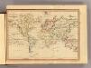
The World, Mercator's projection.
1 : 255000000 Fenner, Rest.
Routes par lesquelles les richesses metalliques.
1 : 160000000 Humboldt, Alexander von, 1769-1859
Chart of the world.
1 : 95000000 Bowen, Emanuel
Isothermal, winds; Religions Europe.
Andree, Richard; Times (London, England)