Maps of Malay Archipelago

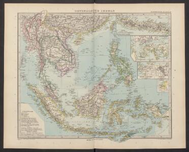
Ostindische Inseln
Adolf Stieler's Handatlas über alle Theile der Erde und über das Weltgebäude Stieler, Adolf Justus Perthes
Ostindische Inseln
1 : 12500000 Filipíny Berghaus, Herm. Eberhardt, H. Justus Perthes
Kaart van den Oost-Indischen Archipel
[Java und Madoera, geologische Detailkarten und Profile] Verbeek, R. D. M. Joh. C. Stemler Cz.
Hinterindien nebst den Hinterindischen Inseln
1 : 10000000 entworfen und gezeichnet im Jahre 1826 von C. F. Weiland, nach Crawfurd, Kolf und Krusenstern umgearb. und berichtigt 1832, und im Jahre 1838, abermals nach Raffles und Berghaus' Atlas von Asien theilweis umgearb. und berichtigt Weimar : Verlag des Geograph. Instituts
Hinter Indien.
1 : 10000000 Weiland, C. F. (Carl Ferdinand), d. 1847
East India Islands.
1 : 21500000 Arrowsmith, Aaron
East India Islands.
1 : 21500000 Arrowsmith, Aaron
95-96. Indocina, Siam, Arcipelago Malese.
1 : 10000000 Touring club italiano
Malesia ossia Arcipelago Indiano, ed India-Transgangetica.
1 : 11300000 Marzolla, Benedetto
Ostindien & China
Atlas der Hydrographie Berghaus, Hermann Justus Perthes
Niederländisch-Indien
1 : 13000000 Druck und Verlag von Carl Flemming. Glogau : Carl Flemming
Indiae Orientalis Nova Descriptio [Karte], in: Gerardi Mercatoris et I. Hondii Newer Atlas, oder, Grosses Weltbuch, Bd. 2, S. 362.
1 Karte aus Atlas Mercator, Gerhard und Hondius, Jodocus Jansson, Jan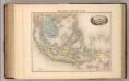
Indo-Chine et Archipel D'Asie.
1 : 14400000 Migeon, J.
Carte d'une partie de la Chine, les isles Philippines, de la Sonde, Moluques, de Papoesi etc. dressée sur les relations les plus nouvelles
1 : 9000000 I. Condet sc. A Amsterdam : par Covens et Mortier
Niederländisch-Indien / Druck und Verlag von Carl Flemming
Glogau : Carl Flemming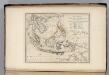
Islands of the East Indies.
1 : 23000000 Carey, Mathew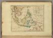
Islands of the East Indies.
1 : 23000000 Carey, Mathew
East India Isles.
1 : 11404800 Burr, David H., 1803-1875
Ost-Asien
Neuer Handatlas über alle Theile der Erde Kiepert, Heinrich Verlag von Dietrich Reimer
East India Isles.
1 : 15200000 Greenleaf, Jeremiah
East India Isles.
1 : 15200000 Greenleaf, Jeremiah
Indiae Orientalis Nova Descriptio [Karte], in: Novus atlas absolutissimus, Bd. 6, S. 150.
1 Karte aus Atlas Janssonius Offizin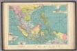
East Indian ports.
1 : 10000000 Philip, George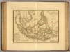
Grand Archipel d'Asie.
1 : 10200000 Picquet, C.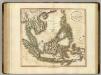
East India Isles.
1 : 8700000 Cary, John, ca. 1754-1835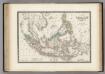
Malaisie.
1 : 1200000 Levasseur, E.
Ost-Asien / Neubearb. von Richard Kiepert und Paul Sprigade
1 : 12000000 Richard Kiepert 1846-1915; Paul Sprigade Berlin : Dietrich Reimer (Ernst Vohsen)
Die Ostindischen Inseln
Handatlas über alle Theile der Erde und über das Weltgebäude Stieler, Adolf Justus Perthes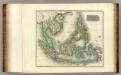
East India Isles.
1 : 8800000 Thomson, John