Maps of Malay Archipelago
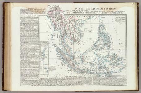
Malesia ossia Arcipelago Indiano, ed India-Transgangetica.
1 : 11300000 Marzolla, Benedetto
Hinter Indien.
1 : 10000000 Weiland, C. F. (Carl Ferdinand), d. 1847
Ostindien & China
Atlas der Hydrographie Berghaus, Hermann Justus Perthes
Hinterindien nebst den Hinterindischen Inseln
1 : 10000000 entworfen und gezeichnet im Jahre 1826 von C. F. Weiland, nach Crawfurd, Kolf und Krusenstern umgearb. und berichtigt 1832, und im Jahre 1838, abermals nach Raffles und Berghaus' Atlas von Asien theilweis umgearb. und berichtigt Weimar : Verlag des Geograph. Instituts
CARTE DES INDES ORIENTALES
1 : 10700000 Asie jihovýchodní Mayer, Tobias Apres de Mannevillette, Jean-Baptiste-Nicolas-Denis d' Heritiers de Homan[n]
Ostindien.
1 : 22000000 Reichard, C. G.
India
1 : 19000000 Asie jihovýchodní Spruner, Karl von Justus Perthes
Les Indes Orientales.
1 : 29000000 Lattre, Jean
Ostindien mit den Inseln
Schul-Atlas über alle Theile der Erde nach dem neuesten Zustande, und über das Weltgebäude Stieler, Adolf bei Justus Perthes
Ost-Asien
Neuer Handatlas über alle Theile der Erde Kiepert, Heinrich Verlag von Dietrich Reimer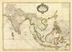
Composite: Indes.
1 : 10000000 Bonne, Rigobert, 1727-1794
Ostasiatischer-Raum
1 : 10000000 Asie východní Bibliographisches Institut
Indes Orientales.
1 : 16250000 Bonne, Rigobert, 1727-1794
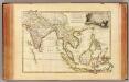
East India Isles.
1 : 15200000 Greenleaf, Jeremiah
East India Isles.
1 : 15200000 Greenleaf, Jeremiah
Ost-Indien
Handatlas über alle Theile der Erde und über das Weltgebäude Stieler, Adolf Justus Perthes
Ostindien
Allgemeiner Atlas [Walch, Johannes] im Verlag bei Johannes Walch
Ost-Indien mit den Inseln
Hand-Atlas über alle Theile der Erde nach dem neuesten Zustande und über das Weltgebäude Stieler, Adolf bei Justus Perthes
Ostindische Inseln
Adolf Stieler's Handatlas über alle Theile der Erde und über das Weltgebäude Stieler, Adolf Justus Perthes
Ostindien
Neuester Schul-Atlas Walch, Johann im Verlag bei Joh. Walch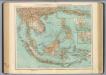
95-96. Indocina, Siam, Arcipelago Malese.
1 : 10000000 Touring club italiano
East India Isles.
1 : 11404800 Burr, David H., 1803-1875
Niederländisch-Indien
1 : 13000000 Druck und Verlag von Carl Flemming. Glogau : Carl Flemming
Ost-Indien mit den Inseln
Hand-Atlas über alle Theile der Erde nach dem neuesten Zustande und über das Weltgebäude Stieler, Adolf bei Justus Perthes
Niederländisch-Indien / Druck und Verlag von Carl Flemming
Glogau : Carl Flemming
Ostindische Inseln
1 : 12500000 Filipíny Berghaus, Herm. Eberhardt, H. Justus Perthes
Kaart van den Oost-Indischen Archipel
[Java und Madoera, geologische Detailkarten und Profile] Verbeek, R. D. M. Joh. C. Stemler Cz.
Ost Indien
Stieler's Hand-Atlas Stieler, Adolf bei Justus Perthes
East India Islands.
1 : 21500000 Arrowsmith, Aaron