Maps of Carpathian Mountains

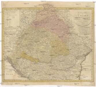
General Charte von Ungarn
1 : 2390000 Bukovina (Rumunsko a Ukrajina) Güssefeld, Franz L. Rausch, Johann Lorenz Jakob bey den Homannischen Erben

Etats orientaux de l'empereur a partir de la Baviere et de la Boheme
1 : 3170000 Evropa jihovýchodní Mentelle, Edme Tardieu, Pierre François
Hungaria.
from Abraham Ortelius his epitome of the theater of the worlde / nowe latlye ... renewed and augmented ... by Micheal Coignet, mathematitian of Antwarpe.

Der Donauraum
1 : 1500000 Dunaj-oblast Justus Perthes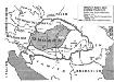
Ungarn nach dem Ersten Weltkrieg
Ungarn Weltkrieg <1914-1918>, Grenze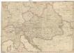
General Karte des Österreichischen Erb-Kaiserthums
1 : 2470000 Evropa jihovýchodní Mollo, Tranquillo T. Mollo
Die Donaustaaten
1 : 2500000 Dunaj-oblast Steinhauser, Anton Peucker, Karl Artaria
Die Donaustaaten

Karpaten-Länder
Donau-Karpaten-Gebiet
Österreich
Neuer Handatlas über alle Theile der Erde Kiepert, Heinrich Verlag von Dietrich Reimer
Karpatenländer, politische Übersicht
1 : 6000000 Donau-Karpaten-Gebiet
Artaria's Eisenbahnkarte
1 : 1500000 Evropa jihovýchodní Peucker, Karl Artaria
Ungarn und seine Nebenlande bis zum Aussterben Arpadischen Stammers 1301.
1 : 3800000 Spruner von Merz, Karl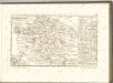

Galizien, Ungarn mit Sclavonien und Croatien, Siebenbürgen und Dalmatien; Moldau, Walachey]
Stieler's Hand-Atlas Stieler, Adolf bei Justus Perthes
Österreich-Ungarn. Rumänien, Serbien, Montenegro, Bulgarien & Ost-Rumelien
Adolf Stieler's Handatlas über alle Theile der Erde und über das Weltgebäude Stieler, Adolf Justus Perthes
Karte der wichtigsten Eisenbahnen Österreich-Ungarns und den angrenzenden Gebiete
1 : 6000000 Rakousko-Uhersko Rothaug, Johann Georg F. Tempsky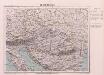
Oesterreich
Österreich-Ungarn
[Galizien, Ungarn Slavonien und Croatien, Siebenbürgen und Dalmatien, Moldau, Wallachey]
Hand-Atlas über alle Theile der Erde nach dem neuesten Zustande und über das Weltgebäude Stieler, Adolf bei Justus Perthes
Der Österreichische Kaiserstaat
Hand-Atlas über alle Theile der Erde und über das Weltgebäude Stieler, Adolf Justus Perthes
Karpatenländer, Flusz- & Gebirgskarte
1 : 6000000 Donau-Karpaten-Gebiet
Osterreichisch. Ungarische Monarchie.
1 : 3700000 Vogel, C.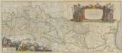
Danubius, Fluvius Europae Maximus, A Fontibus Ad Ostia. Cum omnibus Fluminibus, ab utroque latere, in illum defluentibus. [Karte], in: Theatrum orbis terrarum, sive, Atlas novus, Bd. 1, S. 310.
1 Karte aus Atlas Blaeu, Joan Blaeu, Willem Janszoon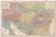
Völker und Sprachen Karte von Österreich und den Unter-Donau-Ländern
1 : 3000000 Rakousko-Uhersko Kiepert, Heinrich Dietrich Reimer
Völker und Sprachen Karte von Österreich und den Unter-Donau-Ländern
1 : 3000000 Evropa střední Kiepert, Heinrich D. Reimer
Völker und Sprachen Karte von Österreich und den Unter-Donau-Ländern
Rakousko-Uhersko Kiepert, Heinrich Riegel, Christoph Dietrich Reimer
Austrian Dominions.
1 : 3750000 Hughes, William