Maps of Carpathian Mountains
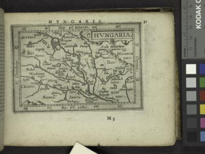
Hungaria.
from Abraham Ortelius his epitome of the theater of the worlde / nowe latlye ... renewed and augmented ... by Micheal Coignet, mathematitian of Antwarpe.
Artaria's Eisenbahn- u. Post-Communications-Karte v. Oesterreich-Ungarn
1 : 1745000 Rakousko-Uhersko Artaria
General Karte des Österreichischen Erb-Kaiserthums
1 : 2470000 Evropa jihovýchodní Mollo, Tranquillo T. Mollo
Oesterreich
Österreich-Ungarn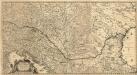
Totius Regni Hungariae
1 : 2200000 Mollova mapová sbírka Visscher, Nicolaes Jansz.
Osterreichisch. Ungarische Monarchie.
1 : 3700000 Vogel, C.
General Charte von Ungarn
1 : 2390000 Bukovina (Rumunsko a Ukrajina) Güssefeld, Franz L. Rausch, Johann Lorenz Jakob bey den Homannischen Erben
Hvngaria Magna In Regna et Prouincias diuisa
1 : 7400000 Mollova mapová sbírka
Die Donaustaaten
1 : 2500000 Dunaj-oblast Steinhauser, Anton Peucker, Karl Artaria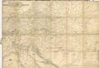
Post und Strassen Karte der oesterreichischen Monarchie nebst allen angrenzenden Landern herausgegeben von der k.k. Obersten-Holf-Post-Verwaltung im Jahre 1840


Die Donaustaaten

Der Donauraum
1 : 1500000 Dunaj-oblast Justus Perthes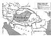
Ungarn nach dem Ersten Weltkrieg
Ungarn Weltkrieg <1914-1918>, Grenze
Österreich
Neuer Handatlas über alle Theile der Erde Kiepert, Heinrich Verlag von Dietrich Reimer
Karpaten-Länder
Donau-Karpaten-Gebiet
Neueste Postkarte der Saemtlichen K. k. teutsch und Ungarische Erblaender

Der Österreichische Kaiserstaat
Hand-Atlas über alle Theile der Erde und über das Weltgebäude Stieler, Adolf Justus Perthes
Bez titulu: Rakouské dějiny

Polsko, Československo, Maďarsko a Rumunsko

Artaria's Eisenbahnkarte
1 : 1500000 Evropa jihovýchodní Peucker, Karl Artaria
Karpatenländer, politische Übersicht
1 : 6000000 Donau-Karpaten-Gebiet
Der Oesterreichische Kaiser-Staat
Hand-Atlas über alle Theile der Erde nach dem neuesten Zustande und über das Weltgebäude Stieler, Adolf bei Justus Perthes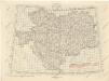
Übersichtblatt der Spezialkarte 1:75 000

Karpatenländer, Flusz- & Gebirgskarte
1 : 6000000 Donau-Karpaten-Gebiet
Österreich-Ungarn. Rumänien, Serbien, Montenegro, Bulgarien & Ost-Rumelien
Adolf Stieler's Handatlas über alle Theile der Erde und über das Weltgebäude Stieler, Adolf Justus Perthes
Le Royaume de Hongrie
1 : 2400000 Mollova mapová sbírka Valk, Gerhard Valck, Gerard
[Polen, Galizien, Ungarn, Kroatien u. Siebenbürgen; Moldau und Walachey]
Schul-Atlas über alle Theile der Erde nach dem neuesten Zustande, und über das Weltgebäude Stieler, Adolf Justus Perthes
Ungarn 1938-1944
Ungarn Weltkrieg <1939-1945>, Grenze