Maps of Hammersmith and Fulham

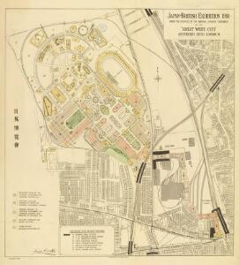
Japan-British Exhibition 1910 ... at the "Great White City," Shepherd’s Bush, London

The Imre Kiralfy new International Exhibition Grounds, London
London VI.66 - OS London Town Plan
1 : 1056 Topographic maps Ordnance Survey Ordnance Survey
London VI.76 - OS London Town Plan
1 : 1056 Topographic maps Ordnance Survey Ordnance Survey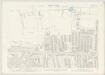
London VI.75 - OS London Town Plan
1 : 1056 Topographic maps Ordnance Survey Ordnance Survey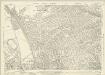
London (1915- Numbered sheets) IV.11 (includes: Hammersmith; Kensington) - 25 Inch Map
1 : 2500 Topographic maps Ordnance Survey Ordnance Survey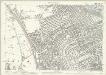
London (Edition of 1894-96) LIX (includes: Hammersmith; Kensington) - 25 Inch Map
1 : 2500 Topographic maps Ordnance Survey Ordnance Survey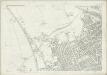
London (First Editions c1850s) XXXII (includes: Hammersmith; Kensington) - 25 Inch Map
1 : 2500 Topographic maps Ordnance Survey Ordnance Survey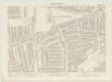
London VI.86 - OS London Town Plan
1 : 1056 Topographic maps Ordnance Survey Ordnance Survey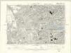
London VI.SE - OS Six-Inch Map
1 : 10560 Topographic maps Ordnance Survey Ordnance Survey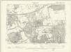
London VI.SW - OS Six-Inch Map
1 : 10560 Topographic maps Ordnance Survey Ordnance Survey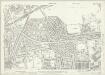
London (1915- Numbered sheets) IV.10 (includes: Acton; Hammersmith) - 25 Inch Map
1 : 2500 Topographic maps Ordnance Survey Ordnance Survey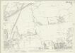
London (1915- Numbered sheets) IV.10 (includes: Acton; Hammersmith) - 25 Inch Map
1 : 2500 Topographic maps Ordnance Survey Ordnance Survey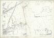
London (Edition of 1894-96) LVIII (includes: Acton; Hammersmith) - 25 Inch Map
1 : 2500 Topographic maps Ordnance Survey Ordnance Survey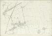
London (First Editions c1850s) XXXI (includes: Acton; Hammersmith) - 25 Inch Map
1 : 2500 Topographic maps Ordnance Survey Ordnance Survey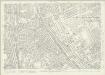
London (1915- Numbered sheets) IV.15 (includes: Fulham; Hammersmith; Kensington) - 25 Inch Map
1 : 2500 Topographic maps Ordnance Survey Ordnance Survey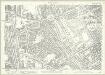
London (Edition of 1894-96) LXXIII (includes: Fulham; Hammersmith; Kensington) - 25 Inch Map
1 : 2500 Topographic maps Ordnance Survey Ordnance Survey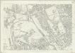
London (First Editions c1850s) XLI (includes: Fulham; Hammersmith; Kensington) - 25 Inch Map
1 : 2500 Topographic maps Ordnance Survey Ordnance Survey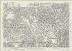
London (1915- Numbered sheets) IV.14 (includes: Acton; Chiswick St Nicholas; Hammersmith) - 25 Inch Map
1 : 2500 Topographic maps Ordnance Survey Ordnance Survey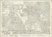
London (1915- Numbered sheets) IV.14 (includes: Acton; Chiswick St Nicholas; Hammersmith) - 25 Inch Map
1 : 2500 Topographic maps Ordnance Survey Ordnance Survey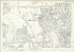
London (Edition of 1894-96) LXXII (includes: Acton; Chiswick St Nicholas; Hammersmith) - 25 Inch Map
1 : 2500 Topographic maps Ordnance Survey Ordnance Survey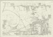
London (First Editions c1850s) XL (includes: Acton; Chiswick St Nicholas; Hammersmith) - 25 Inch Map
1 : 2500 Topographic maps Ordnance Survey Ordnance Survey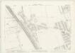
London VI.56 - OS London Town Plan
1 : 1056 Topographic maps Ordnance Survey Ordnance Survey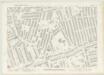
London VI.85 - OS London Town Plan
1 : 1056 Topographic maps Ordnance Survey Ordnance Survey
A PLAN of the ROADS Under the DIRECTION and CARE of this TRUST and divers Roads Adjacent.
1 : 16351 The title of this road map of Kensington and Chelsea appears in a panel above the plan, with the compass star at top right and scale bar at bottom left. The roads within the Kensington and Hyde Park Trust are indicated by a shadowed line; the king's private roads by a double line; the common roads by a double dotted line; and the footpaths by a single dotted line. Turnpikes and junctions are numbered for reference with distances given in a table down the left side of the plate. Roberts, R.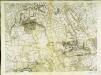
An exact survey of the city's of London Westminster , XI
1 Blatt : 53 x 71 cm John Rocque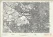
London Sheet J - OS Six-Inch Map
1 : 10560 Topographic maps Ordnance Survey Ordnance Survey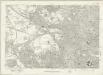
London Sheet J - OS Six-Inch Map
1 : 10560 Topographic maps Ordnance Survey Ordnance Survey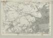
Middlesex XVI - OS Six-Inch Map
1 : 10560 Topographic maps Ordnance Survey Ordnance Survey